|
"The Canyon Trip Promised to Matthew Huggins" |
|---|
|
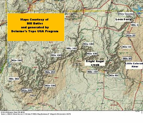
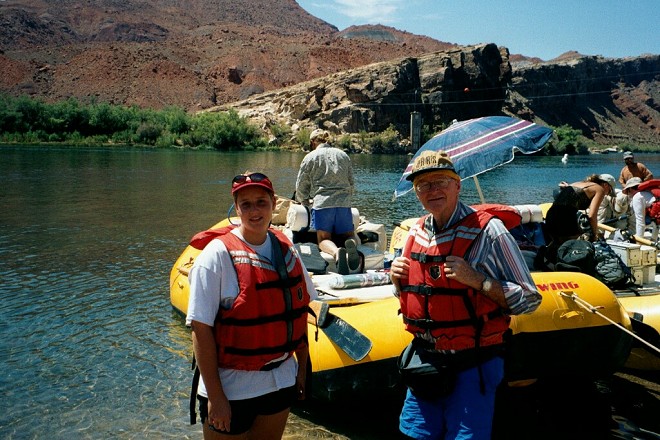
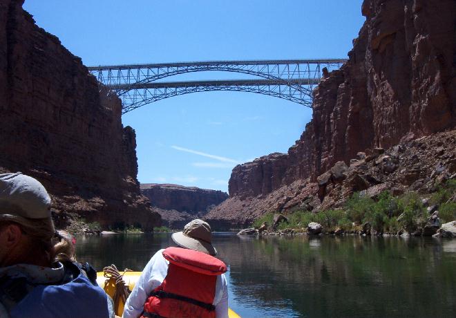
DAY 1. SUNDAY, AUGUST 11, 2002Rising early, we carried our bags down to the lobby of the Radisson Woodland Hotel of Flagstaff, our meeting place arranged by OARS. Rob Pitagora, our trip leader had briefed us in a conference room the night before, and distributed our waterproof bags and ammo boxes. After breakfast Bill Huggins, Jennifer Huggins, Phil Roberts, Larry Roberts (Phil's son), Kevin Roberts (Phil's grandson), Gary Truitt and his son Steve boarded a van that was driven by Rob for the trip to Lees Ferry. Bill, Phil and I had met Rob back in September of 1993 when he was one of the skippers on an OARS trip we took from Bright Angel Creek to Whitmore Wash. He had been an excellent and knowledgeable skipper on that run. We were reassured to learn that he was our leader for the present trip. As we crossed the Navajo Bridge on Rt. 89 on our way to Lees Ferry I looked down at the Colorado, always a thrilling view. The blueness and the clearness of the water were amazing. I have never before been able to see the rocks on the bottom. It was beautiful to see, and in sharp contrast to the muddy conditions when we went down river with Dories 5 years ago. The reason for the unusual clarity of the Colorado is the fact that the Southwest is experiencing its worst drought since 1933. Actually many areas are suffering more than they did during the famous "Dust Bowl" years.
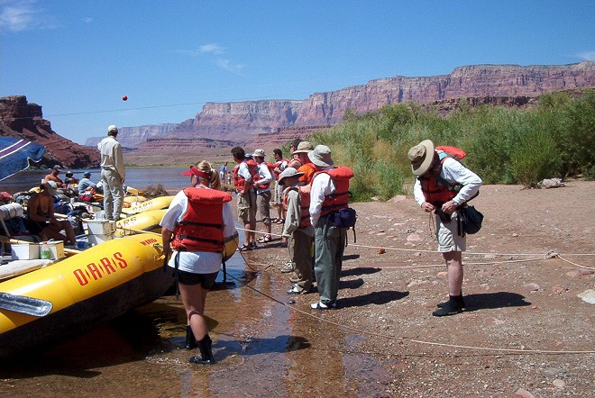
Ever since an agreement hammered out under President Hoover in 1922, and finally modified to the satisfaction of the state of Arizona in 1944, by law 8.23 million acre feet a year must be allowed to pass through Lees Ferry to supply the needs of the states of the Lower Colorado Basin, Arizona, Nevada and California. Since the completion of the Glen Canyon dam, 15 miles upstream from Lees Ferry, this same amount of water must be released from Lake Powell, and this volume of release is required by federal law no matter what amount of water flows into Lake Powel from the various streams and rivers above. Because of the present drought, almost no water has been flowing into Lake Powell for the past few years. Naturally with the markedly decreased flow, very little sediment is being washed in, so unusually clear water is now passing through the gates and turbines of Glenn Canyon Dam. The beautifully clear, blue water of the Colorado at Lees Ferry is a result of one of the worst droughts in history, and may be the foreboding of severe hardships to come. The controversial federal law was based on the average flow of 25 years prior to 1922. We now know that 10 of those years were 10 of the wettest years recorded in the Southwest. During the years included in the study the average flow was 16.8 million acre-feet per year, while the real average is about 13.9 million acre-feet a year. With lower basin populations of the 30's and 40's this made no difference, but now in the 21st century with populations of many millions more than were dreamed of back when the first agreements were reached it is becoming a big problem. For example in the late 50's Las Vegas had the same population as Albany, Georgia, which was a little over 50,000. Now Greater Albany has a population of around 100,000 while Las Vegas is over a million, and currently Las Vegas, a dry desert community, has the largest per capita water consumption in the entire United States. The people of Las Vegas rely mainly on Lake Meade above Hoover Dam, and Lake Meade relies mainly on Lake Powell. Both lakes are presently at very low levels. On the bright side, whether all of this is good or bad, is the fact that the controversial law which requires a minimum of 8.23 million acre feet a year to pass Lees Ferry has made it possible for rafts to continue to ride the Colorado through the Grand Canyon. When we arrived, our trip could still be done, and done while rafting through some of the prettiest water that I have ever seen. If not for the law the flow would have been so low that exposed rocks, and shallow bars would have made passage of the rafts impossible. Also we had the additional benefit of no rain to chill us, even though August is the "Monsoon Season" for the Canyon. Arriving at the Lees Ferry boat ramp at close to 9:00 am, we were thoroughly briefed by Rob, assisted in being properly fitted with our life vests by all of the boatmen, and so we were ready to board by 10:00 am.
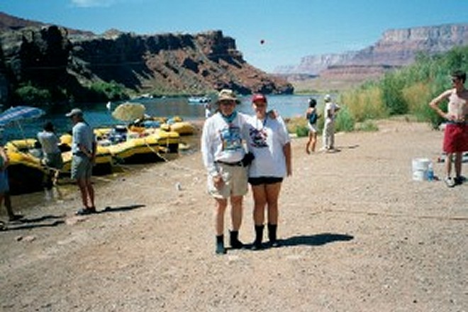
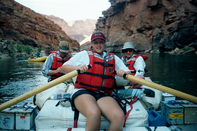
The first days run on these river trips never ceases to fascinate me. I am entranced by the seemingly miraculous appearance of the rock formations that make up the walls of the Canyon. First we pass the dugways, the primitive roads constructed in the late 1800's to enable wagons to be pulled up to the top of the steep bank on the south side of the river. Primitive as they were they were a big improvement over the rough rock ledges of Lees Backbone, which is clearly seen in the picture of me, and Jennifer in front of Scotty Steven's boat. At Lees Ferry we are in the Moenkopi formation of the Triassic Period, the oldest level of the Mesozoic Era, about 225 million years ago. As we approach the first minor turbulence in the water, the Paria Riffle, we pass through the first appearance of the Kaibab Limestone of the Middle Permian Period of the Mesozoic Era, which is about 250 million years old. Down stream this limestone layer takes on a grayish white color, and is called the bathtub ring of the canyon. Up here at the Paria River entrance it has a reddish color. Just below the Paria Riffle, we notice sections of the Lower Dugway on the south bank, and around mile 2 the 260 million year old Toroweap Limestone Formation appears. Down near the Grand Canyon Village this layer is almost the same color as the Kaibab Formation above it, except that it is slightly more yellow. Here, near Lees Ferry, as with all of the formations, it has a redder hue. Farther downstream, just above 4 Mile Wash on the left, and the two Navajo Bridges above us we see the appearance of the Coconino Sandstone layer. This layer is a 270 million year old petrified beach, which is a fairly hard rock, and forms one of the first cliff barriers to those who like to climb down into the canyon. At Grand Canyon village, this layer is almost white, and is easily seen high up near the rim everywhere you look. Here at 4 Mile Wash and the bridges it is a pale red, and is just noticeable down at water level. Can you see why I am fascinated? We are taking a trip through ancient geological history. It must be what Colin Fletcher felt, when he wrote his popular book, "The Man Who Walked Through Time."
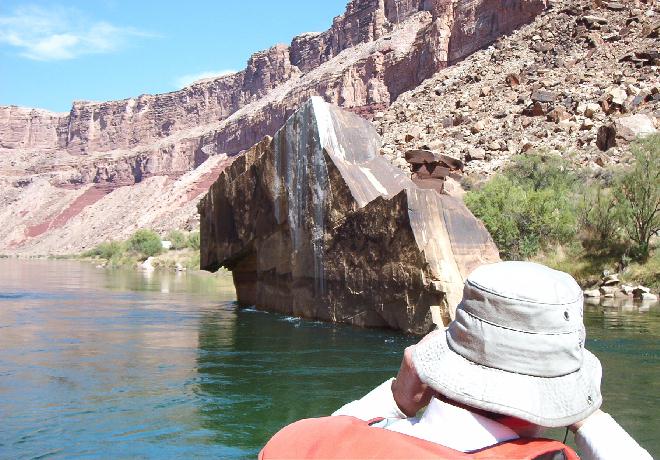
The original two lane bridge, built in 1928 with a deck only 18 feet wide and not structurally sound enough to handle modern traffic, was replaced with the new much stronger one just south of it in 1995. The new bridge, has a deck over 45 feet wide, and is able to support much heavier traffic on 4 lanes. The bridges were given the name Navajo as a compromise. In 1928 the Mormon Church objected to John D. Lee's name being attached to it , because he was still blamed as the main, if not the only, culprit in the Mountain Meadows Massacre and he was still excommunicated. With the 1950 publication of Juanita Brooks book, "The Mountain Meadows Massacre," which brought to light many hidden items, the Mormons (along with everyone else who learned the true facts) realized that Lee had been made a scapegoat, and was only one of many players in the tragedy. As a direct result of her book plus pressure from Lee's family, Lee, who had been excommunicated in 1870, was reinstated in 1961. Nevertheless, in 1928 Lee was looked upon as evil incarnate, and the Mormon higherarchy did not want his name honored in any way. They suggested honoring Jacob Hamblin, the famous "Buckskin Prophet" and Navajo Chief Hastele, who had long been a friend of the Mormons. All parties finally agreed on the name "Navajo Bridge." As we glide past 4 Mile Wash, and I look up at the rim hundreds of feet above, I find it hard to believe that Haldane ("Buzz") Holmstrom climbed out of the canyon here. He was on his way as the first, and probably only, solo runner of the entire Canyon from Green River, Wyoming to Boulder Dam. This guy was a service station attendant, who cut down a Port Orford Cedar Tree, sawed it into boards, and built his 15-foot boat himself. Then he hauled it in his own vehicle to Green River, and launched it in October 1937. He had run out of supplies by the time he got to 4 Mile Wash, so he climbed out of the Canyon, hitchhiked to Flagstaff, picked up more food, hitchhiked back, climbed back down to his boat, and took off again. There was an official exploration party ahead of him, which party had turned him down when he had applied to be a part of it. In spite of his late start, and in spite of having been delayed by his side trip to Flagstaff, Buzz overtook them, and beat them to Boulder Dam. The soft, very red Hermit Shale (Early Permian. 280 million yrs. old) begins in the cliffs around 6 Mile Wash, and at mile 8 we come to Badger Creek Rapid. This is the first real test for Jennifer, who has been worrying a little about how she will react to running through strong rapids. She loved it! Jacob Hamblin, the famous Mormon "Buckskin Prophet" shot a badger at the mouth of this creek during one of his trips, and gave the place it's name. Two miles down we pass 10 Mile Rock, a huge rock that was thrown out into the river eons ago. We think of what powerful forces must have caused such a huge boulder to be thrown or washed out that far.
On down at Mile 11 we ran Soap Creek Rapid. Jacob Hamblin cleaned and tried to cook a stew with the meat of the badger that he had shot earlier, but he was apparently not a very good cook, and the stew looked and tasted more like soap. Laughing at his culinary skill he named the place Soap Creek. Shooting the rapids here proved to be another significant run with waves high enough to give us all a good soaking. Jennifer loved this one too. Around 12:30 pm Rob had us all pull over to the beach at Salt Water Wash where we had lunch of cut fruit, sandwiches and coffee, tea, soft drinks or water. We were now in the 300 million year old Supai Formation of the Pennsylvanian Period. The Supai is a 6 to 7 hundred foot thick layer of red shales intermixed with some limestone, and capped with sandstone. Water washing over this red layer, as well as over the Hermit shale immediately above it is responsible for the red color of the dolomite and limestone of the huge Redwall cliffs that are so obvious throughout the Canyon. In the afternoon, during stretches of calm water, Scotty allowed Jennifer to row our boat.
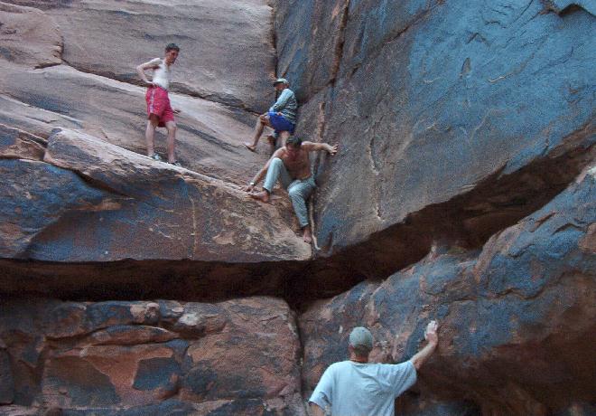
We made easy progress throughout the afternoon, and glided on down past Hot Na Na Wash, where we had camped on previous trips, to set up camp at 18 Mile Wash. While some of the crew members organized the kitchen and began cooking, Rob and Scotty entertained us by their rock climbing skills.
The cooks were excellent. For dinner we had chicken cordon blue, rice with gravy, broccoli and mixed vegetables. We had a choice of V-8 juice, coke, tea, water and a variety fruit juices for our beverage, and I have forgotten what we had for desert: however, I can guarantee it was good. All of the meals we were served were outstanding. I don't see how they do it.
Night fell, the stars were brilliant, and the sounds of distant rapids were soothing. I slept soundly, as I always do when in the Canyon. |
|
|
|---|
|
|---|