|
"The Canyon Trip Promised to Matthew Huggins" |
|---|
|
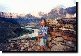
Monday, August 11, 1997Climbing stiffly out of my wet tent at 5:30 a.m. I was greatly relieved to see that it was no longer raining. There were even a few patches of blue sky that could be seen through the drifting clouds. On our way from Nankoweap down to the Little Colorado we passed through Kwagunt Rapids, named by Powell for a Paiute that claimed to own the adjacent canyon, and Malgosa Rapids, named for a Spanish soldier under Coranado's command. Malgosa, (BGN spelling - or misspelling) is named for Pablo de Melgosa of Burgos who, back in the late summer of 1540, was sent by Coronado's Lieutenant, Garcia Lopez de Cardenas, to find a way from the south canyon rim down to the river. Cardenas sent three men, Melgosa, Juan Galeros and a third soldier, whose name was not recorded in existing records. These guys were chosen because they were the lightest, and the most agile of the troops. They made it about a third of the way down, far enough to let Cardenas know that it was a very deep canyon with a pretty big river in it, a lot larger than the 6 foot or so stream that the troops believed. Since the guides the Spaniards were using were Hopis, and since the Hopis regularly climbed down their trail along the Little Colorado to their sacred salt mines, it is thought that the Hopis gave these men a bum steer, to keep them away from their sacred grounds. Today the Park Service helps keep unauthorized trespassers out of there. Both of these rapids were easy, and we quickly were down past 60 Mile Rapid, where the Tapeats Sandstone first emerges, and on to the confluence of the Little Colorado. On our other trips we had stopped for a swim in the blue, blue waters of this river, and to explore the old, stone cabin that the miner Ben Beamer had made in the 1890s. He had modified an Anasazi building that he had discovered up above high water on the south bank, and had fixed up a sturdy little home. When we arrived we discovered that the Little Colorado was high, swift and even muddier than the Colorado. Swimming would not only be no fun, but also it would be pretty dangerous. We went on downriver. Drifting down around Cape solitude, (called Cape Desolation by the Kolb brothers) down past the Hopi salt mines with their snow white salt streaking the red canyon walls, we came to our lunch stop at Crash Canyon which is immediately beyond the salt streaks, and on the right hand side of the Colorado. One of our nation's worst aircraft disasters is responsible for this name. At noon on a clear June 30th in 1956, a United Airlines DC-7 and a TransWorld Airlines Constellation, both headed east from Los Angeles were on almost, but not quite parallel courses. They collided over the Grand Canyon, and their debris crashed into Temple and Chuar Buttes, killing all 128 people on board. The victims were removed by helicopter, and many of them are now buried in the cemetery at the Grand Canyon village, where there is a monument in memory of them. Others are buried in Flagstaff. In addition to the bodies the Park Service removed all of the remains of the two planes, they say to prevent curious hikers from endangering themselves by searching for macabre artifacts. One good thing came of this tragedy. It resulted in the creation of the Federal Aviation Administration in 1958. Agile as a monkey, and strong as a horse, Roger climbed the nearby cliffs to hang the nylon shelters that the crew slept under to dry in the noonday sun. This guy had previously described skiing down the North Kaibab Trail from the trailhead 2.5 miles down to the Supai Tunnel one December. Negotiating those switchbacks was not a problem, he said. After watching him climb some of the side trails, and watching him hang the tents on that cliff, I can believe that for him slaloming around the sharp turns up there in the top of roaring Springs Canyon it is not a problem. I wouldn't recommend it for anyone else. Factor used an ingenious set up to demonstrate plate tectonics, and how faults develop as continents shift. He concealed a of a couple of planks under the sand, and then by slowly moving them he was able to graphically demonstrate the geological history of the Grand Canyon. It was a very interesting lecture. We were now entering the widest area of the eastern canyon. The relatively soft layers of the so-called Grand Canyon Supergroup, particularly the massive layers of the orange colored Dox Sandstone have eroded a broad area here in the big bend of the river, and it is this area, so suitable for primitive farming, that has a tremendous number of ancient Indian ruins. We headed more and more easterly through relatively long stretches of calm water, warming and drying in the pleasant sunshine. Char and Tanner rapids were a pleasant relief when the sun got too hot, and so our trip down to Unkar Delta where we camped was a lot of fun. It also gave us time to observe the rock formations of the Dox Sandstone and the Galeros Lavas that had spilled over it in some areas, and to discuss them with Coyote, who was our skipper for the afternoon. All of the guides on this trip were interesting to talk to, and seemed interested in talking to us. Since they were all very well informed on the canyon history and geology it was a lot of fun, and we learned a lot. The well know Mormon trader and pioneer miner, Seth B. Tanner, developed copper mines along the river, and to work them in 1884 - 85 he improved an old Indian trail down what became known as Tanner Canyon. This trail went up the river, crossing it above the mouth of the Little Colorado and continued on to the north side of the canyon at Saddle Mountain. Later this trail became known as the Horsethief Trail, because it was said that a gang of rustlers was stealing horses from ranches to the north, taking them down across the Colorado on this trail, and selling them in the south. Later they would reverse the process with many of the same horses. During the prohibition years this trail was used to transport illegal whiskey. There are a lot of wild tales about this route. We arrived at the pretty beach at the Unkar Delta early in the afternoon well rested, and in plenty of time to set up my tent to have it dry out before I had to sleep in it. I didn't know it at the time, but now as I review Nancy Brian's book, "River to Rim" I see that a mile and a half upstream and around the bend from our campsite, where Cardenas Creek flows in, was the spot where a hiker in 1975 found the bones of Bert Loper. They had washed ashore here, a little over 46 miles downstream from where he had died. He had either drowned or died of a heart attack in 24.5 Mile Rapid. His boat was found at Berts Canyon at mile 41.3, and his bones had been found at Cardenas Creek at mile 71. The Colorado really moves things along. Before dinner another hike was organized by Factor. This one took us up to Hilltop Ruins, an Anasazi building on the crest of a hill that overlooks the river from Cardenas Creek in the north to Unkar Rapids in the south. The structure was first discovered by Robert Brewster Stanton in 1890, and it is sometimes called Stanton's Fort. It reminds me a lot of a smaller version of Desert View, and I suspect that it was at one time a watch tower.
This simple hike is what did me in. I started out very leisurely walking along with Clyde and his daughter Dianne Allen. Clyde decided that he would not take the hike all the way up to the ruins, so I went on ahead. Not really walking briskly, but still walking purposefully - trying to get close to, if not catch up with, the main group - I was enjoying myself. Also since it was such an easy hike, more like a walk really, I was enjoying the scenery as I strode along. Big mistake. Don't ever do that in the canyon. Always watch where you are stepping when in the canyon, no matter how easy the hike seems. When I was within about a hundred yards of the ruins there were a couple of stone steps to walk up in order to reach a sort of saddle. Carelessly I didn't make the extra effort to lift my right foot up, which effort I had been making all the way through the canyon because my stiff right knee was not bending properly. That carelessness made me catch my toe just below the top of the step. And THAT made be fall forward. But, - I couldn't bring my left foot forward fast enough to catch myself, because it was a step down and behind me, so I fell. And I fell with my right foot caught on that (expletive deleted) stone step. That made me land on my flexed right leg, - the leg that wouldn't flex. But it did. And it flexed completely - and with exquisite pain. I made it the rest of the way to the ruins without any problem, but then I had a whole mile of downhill walking to get back to camp. And that nearly killed me. All through supper, and all through the evening all I could think about was that day after tomorrow I was going to have to hike out the Bright Angel Trail to the South Rim. Nine whole miles. At least it would be uphill, I kept telling myself. There was one more problem. Matthew had been wearing his sandals without socks all day. That seemed to be the fashion with most of the river guides. They, however, have been doing this a long, long time - and their feet are toughened to the abrasive action of the sand under the sandal straps. Matthew's feet were not. Surreptitiously, as guys his age - or any age for that matter - do, he quietly called Bill and me to his tent, and showed us the sores on his feet. While Bill gently cleaned the areas I got out my antiseptic ointment (that some genius had developed with the local anesthetic lidocaine added). With the application of this, and then with covering the areas with large band aids plus mole skin, we were able to completely get rid of the pain. From then on there was no problem in getting Matthew to wear his socks. They concealed the bandages on his feet. Displaying bandages apparently would be more humiliating to a young man than displaying socks. I remember times like that in my own life. We learn from our mistakes, and I'm still learning. It seems that I'm a slow learner. |
|
|
|---|
|
|---|