Go to GRAND CANYON Explorer home page

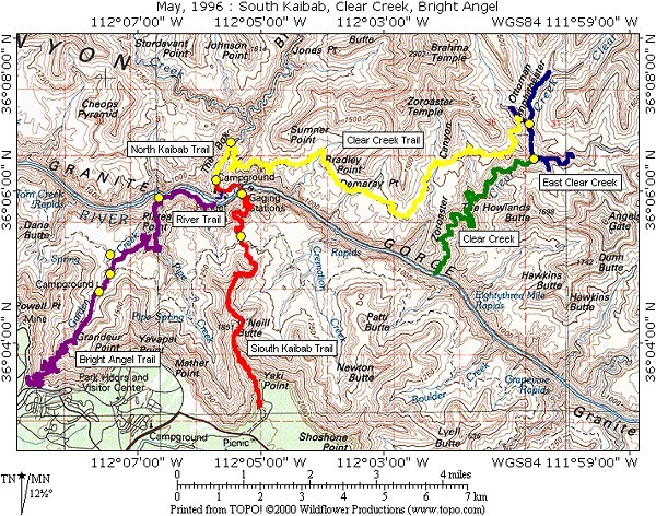
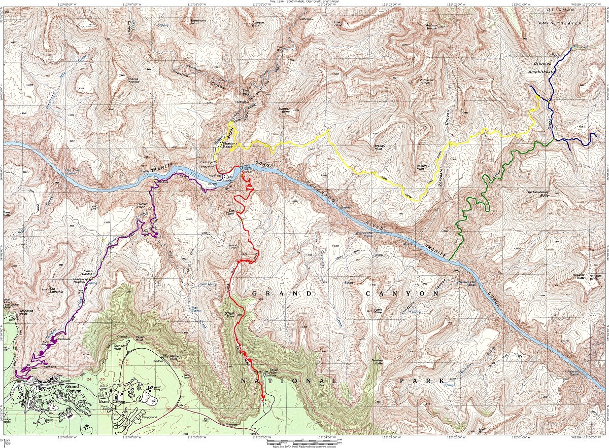
Trip Report - May, 1996 - South Kaibab, Clear Creek, Bright Angel

This trip report uses the new approach that I started using with the December, 1994 trip report in which photos that I have taken along the trail have been included with the text. The first page gives you an index to the various days of the trip. The report for each individual day contains thumbnail images of the photos embedded in the text. To view the full size image you should click on thumbnail image. Most of the smaller JPEG images are 600 x 400 but I have also included a pointer to a much larger 1200 x 800 JPEG image that is accessible from the smaller image.

This trip was pretty much a complete success. We did originally plan to do a day hike over to Cheyava Falls but I more or less gave up on that idea a few weeks before we actually started the hike, the reason for this was because there was no water to feed the falls this year. Cheyava is an Native American word that means "intermittent" and the falls typically only run for a short period in the spring when the snow pack on the north rim is melting. The north rim normally receives over 300 inches of snow in a good season but this year they only got 14 inches of snow and the place is dry as a sun-baked bone.

The original day hike to Cheyava Falls was replaced with a some other shorter day hikes:

  • 1) a hike up Clear Creek to Obi Canyon to visit some Anasazi ruins;
  • 2) another short hike up to a high, dry falls just north of the Clear Creek camping area;
  • 3) another longer hike up the East Clear Creek drainage, which I did solo.

Happy Trails


Trip map
View larger trail map camera Photo map
Day 1 - Yaki Point to Bright Angel Campground and Phantom Ranch
Day 2 - Bright Angel Campground to Clear Creek
Day 3 - Day hike down Clear Creek to Colorado River
Day 4 - Other day hikes
Day 5 - Clear Creek to Bright Angel Campground
Day 6 - Bright Angel Campground to Bright Angel trailhead

Hopi House, Grand Canyon Village, south rim

Lost Orphan Mine from Powell Point, Hermit Road, south rim

Dana Butte, Tower of Set from Powell Point, Hermit Road, south rim

Early morning haze looking east from Powell Point, Hermit Road, south rim

The Battleship, inner gorge, Zoroaster Temple and view east from Hopi Point, Hermit Road, south rim

The Alligator and view west from Hopi Point, Hermit Road, south rim

Cope Butte, the inner gorge and Hermit Rapids from Mohave Point, Hermit Road, south rim

Inner gorge, Granite Rapids and Tower of Set from Pima Point, Hermit Road, south rim

Close-up of Granite Rapids from from Pima Point, Hermit Road, south rim

Mather Point, Hermit Road, south rim

Duck-on-a-rock, Desert View Drive, south rim

Colorado River and the Watchtower from Desert View, Desert View Drive, south rim

Top section of Bright Angel Trail from Grandeur Point, Rim Trail, south rim

Horseshoe Mesa from Grandview Point, Desert View Drive, south rim

Close-up of Horseshoe Mesa from Grandview Point, Desert View Drive, south rim

Duck-on-a-rock, Desert View Drive, south rim

Cedar Ridge and O'Neill Butte from the South Kaibab Trail

[ Grand Canyon Home | South Rim trails | North Rim trails | Trip reports ]
Copyright © Bob Ribokas, 1994-2024, all rights reserved. This publication and its text and photos may not be copied for commercial use without the express written permission of Bob Ribokas.