|
Trip Report - December, 1994 - Tanner, Beamer and Escalante trails |
|---|
I am trying a different approach with this trip report so that I can include some photos in it that I have taken along the trail. Rather than have the whole report be one document, the first page now simply gives you an index to the various days of the trip. The report for each individual day contains thumbnail images of the photos embedded in the text. To view the full size image you should click on thumbnail image. The small images are 600 x 400 and each has a link to a larger image that is 1200 x 800.
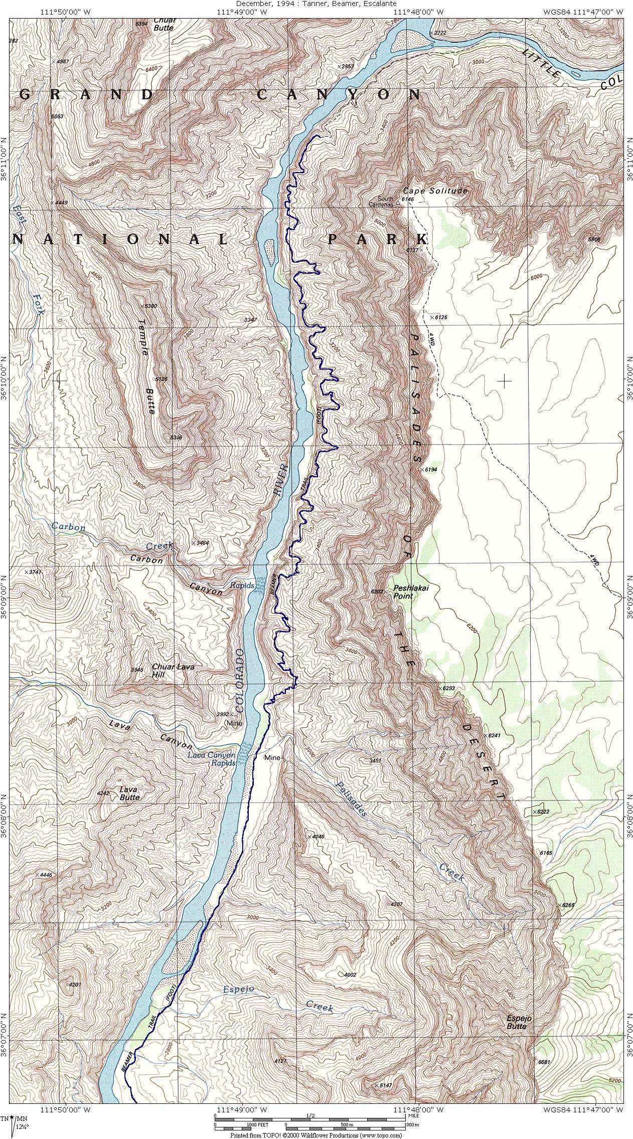
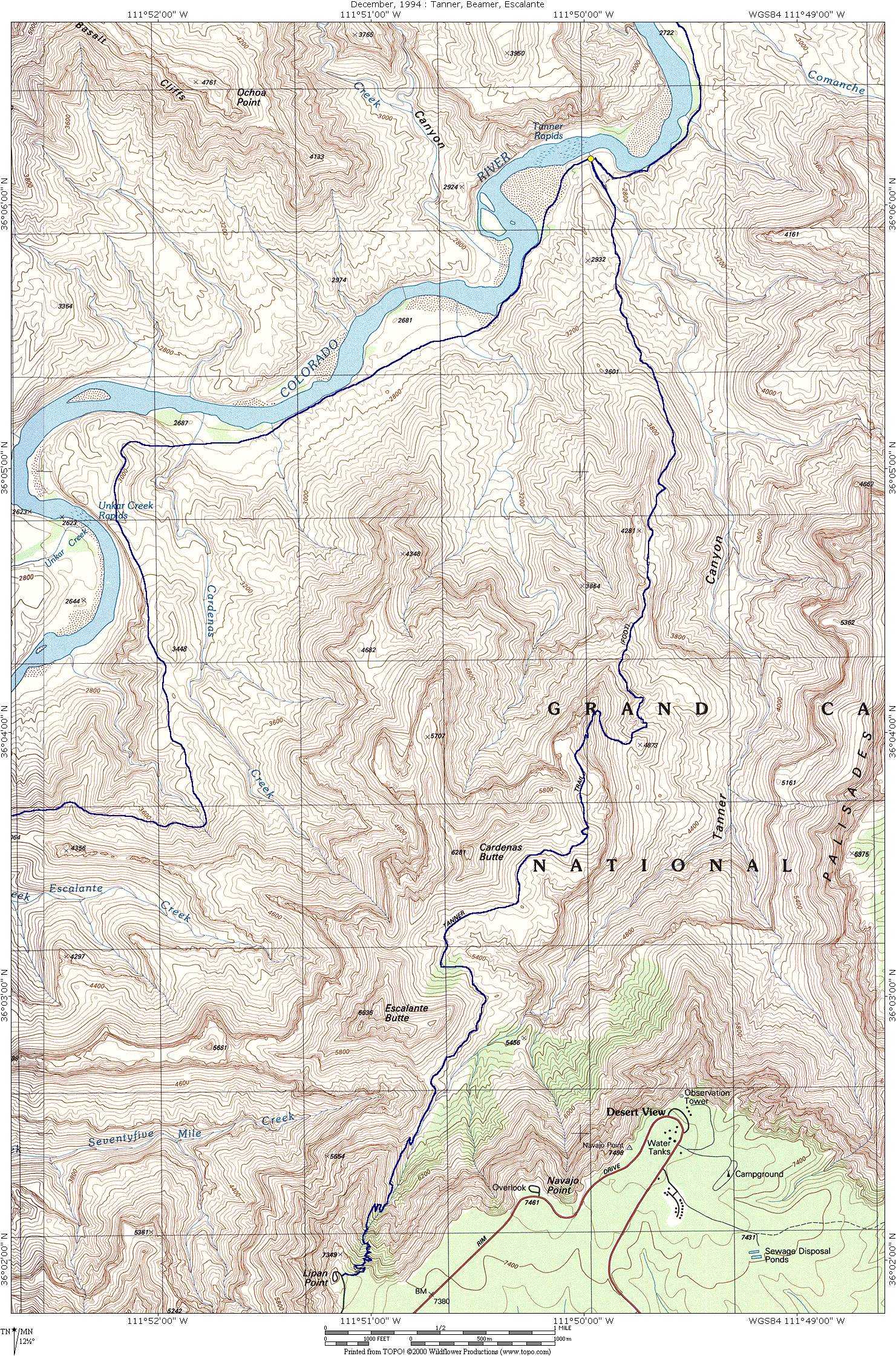
This trip was a not a complete success. I did not encounter any major problems with route finding nor did I experience any injuries aside from one blister that really wasn't too bad. The main problem was not having enough time on my second day to get from my camp at Tanner Rapids to the confluence of the Colorado and Little Colorado Rivers, and then back to camp. This was about a 20 mile roundtrip hike and there simply was not enough time to do it all in daylight during the winter months. I suppose I could have started out maybe a half hour earlier and/or I could have taken a flashlight and hiked part of the trail back in the dark, but I did neither of these and as a result did not make it all the way. This was somewhat disappointing. The northern section of the Beamer Trail is longer than it looks on the topo map. It crosses a lot of side drainages, some fairly large, that are not very obvious from the map.
On my third day I had some troubles finding the Anasazi ruin out near the Unkar Creek overlook on the Escalante Route. I climbed all over the cliffs and rocks around the Unkar Creek overlook itself, thinking that the ruins would be up there somewhere. I then found the remains of what I thought were old human trails, which I gather now are actual game trails, and followed them until they vanished into oblivion. I had given up on finding the ruin and had started heading back to camp when I came across a fork in the trail that I had not noticed on my way out. The right fork (when heading east) goes to the ruin.
On my last day which was really supposed to be my second to last day, I decided to abort the trip a day early. It had rained and snowed quite a bit the night before and as a result I had been hiking most of the day through rain and mud. When I got the spot that I had planned to camp at that night it was all mud. I knew that I was up high enough so that it would freeze that night and did not want to deal with trying to get my tent loose from this stuff in the morning.
Happy Trails
| |
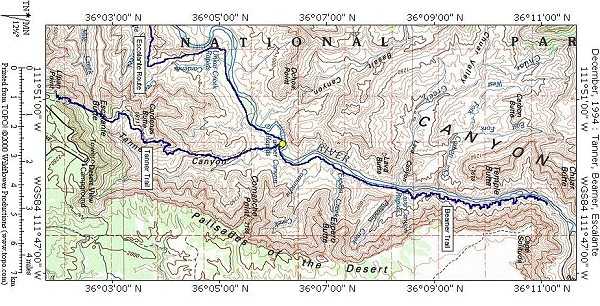
| View larger trail map, northern potion |
|
|
|
|
|
|---|
|
|---|