|
GRAND CANYON RIM TO RIM HIKE, SEPT 13-21, 2003, By Bill Huggins |
|---|
WEDNESDAY, SEPTEMBER 17
DAY THREE ON THE TRAIL
Al got us up before breakfast as usual. It was dark thirty. After our oatmeal breakfast and packing up, Phil and I hit the trail for Indian Gardens in the dark and by flashlight while Al lingered behind to police the campsite and give us a head start since Al is a faster hiker. We got to the silver bridge across the Colorado River about the time we could see without flashlight.
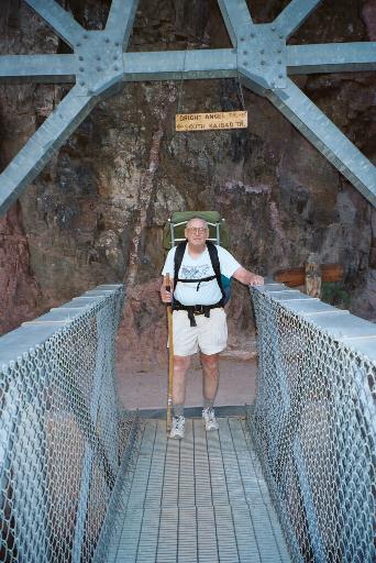
Bill, standing at North end of the Silver Bridge. The sign above his head directs the way to the Bright Angel Trail to the right, and the South Kaibab Trail to the left.
It was not long until Al caught up with us. The hike to the Gardens is a more difficult hike as it starts our ascent toward the South Rim. Whereas it is only 4.7 miles to the campgrounds, it ascends about 1400 feet, the most grueling part being the Devil's Corkscrew. It's a good warm up for what lies ahead the next day. We completed the river trail, arrived at Pipe Springs and stopped briefly at the rest house to explore. No potable water, but we didn't need any. Mostly in the shade hiking. After negotiating the Corkscrew and hiking through the Tapeats Narrows, we began looking forward to Indian Gardens. I told Phil and Al when the huge Cottonwood tree appeared on the right side of the trail we would be there.
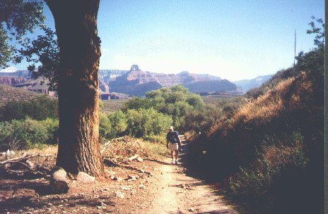
A28 Big Cottonwood Tree.jpg Bill approaches the big cottonwood tree on the Bright Angel Trail shortly before arriving at Indian Gardens. Actually this shot was from a previous trip we had taken, but the same tree is still there.
I had forgotten how many Cottonwood trees there were as you approached the campgrounds. Eventually we came to "the" tree and arrived at Cottonwood Campground early afternoon. Next to find a good campsite. I had forgotten how far up the trail the actual campgrounds were. I thought we would never get there, but the reward was a great campsite. One that was spacious, shady, had a shelter built over the site, water and relief facility within a short walking distance. This was the best campsite of the entire hike. We claimed the site with our backpacks, packed away our food in the metal boxes provided, and decided we would have plenty of time for a hike out to Plateau Point, a distance of 1.5 miles. I had gone there in 1985 on the back of a mule, but had never hiked it. Al had, but Phil had not so we started out. Plateau Point is on the Tonto Platform and is the most visibly feature seen from the South Rim. The trail is easily seen from above. It looks flat. It is not.
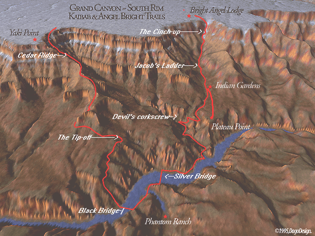
Diagram of the trails from Phantom Ranch to the South Rim.
Although we had no backpacks to weight us down, after three days of hiking it felt to me like it was uphill both ways. We arrived at the trails end and were rewarded by a spectacular view of the Colorado River. There is a protective railing which we respected as we had read in Ghigliery and Myers book "Over the Edge: Death in the Grand Canyon." of the many people who had met their death by falling or being blown over into the canyon.
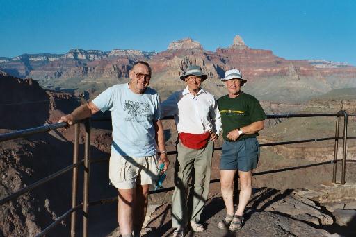
Bill Huggins at left, Phil Roberts and Al Roberts stand at the railing at Plateau Point.
There were some young people who had climbed over the railing. We felt compelled to issue a warning, but it did little good. We backtracked over the trail arriving back at our campsite just before dark. Al prepared the stove for our evening delights, and soon we were enjoying our meal. After cleanup, out came the sleeping bags and down we went. Al spread his bag well away from ours while muttering something about snoring.
|
|
|---|
|
|---|