 |
|---|
|
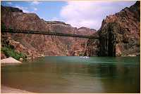
River Trail At Bridges
|
|
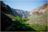
Indian Gardens
|
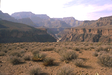
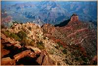
Tonto Trail
The Tonto Trail is the longest of the Canyon's trails, winding it's way along the Tonto Platform, some 90 miles from Hance Rapids and the Red Canyon Trail in the east to Elves Chasm and the South Bass Trail in the west.
|

Horseshoe Mesa
|
|
Cedar Ridge
|
|
beamer trail || boucher rapids || boucher trail || bright angel campground || bright angel trail || bryce canyon np || cameron, arizona || cape royal || cedar ridge || chevaya falls || clear creek || clear creek trail || cliff spring trail || cottonwood campground || desert view || devil's corkscrew || dripping springs trail || east entance || escalante route || flagstaff, arizona || fredonia, arizona || glen canyon dam || grand canyon village || grandeur point || grandview point || grandview trail || granite rapds || hance rapids || hermit camp || hermit rapids || hermit trail || hermit's rest || hopi point || horseshoe mesa || indian gardens || jacob lake || kaibab lodge || kanab, utah || ken patrick trail || lee's ferry || lipan point || marble canyon || maricopa & powell points || mather point || mohave point || monument point || nankoweap trail || north entrance || north kaibab trail || north rim || obi canyon ruins || old bright angel trail || page, arizona || phantom ranch || pima point || plateau point || point imperial || red canyon trail || ribbon falls || river trail at bridges || river trail at river resthouse || south entrance || south kaibab trail || tanner rapids || tanner trail || tonto trail || tusayan ruins & museum || tusayan, arizona || unkar creek || visitor center || walhalla plateau || widforss trail || williams, arizona || yaki point || yavapai point || zion np
Shortcuts:
side bars ||
bottom ||
none
|
Copyright © Bob Ribokas, 1994-2000, all rights reserved. This publication and its text and photos may not be copied for commercial use
without the express written permission of Bob Ribokas.
|
|---|
|
|---|