|
Day Hikes For First Timers |
|---|
In this top section of the trail you will pass through the two tunnels (actually more like arches) that have been blasted through the cliffs of the Kaibab formation. There are some petroglyphs to the left and above you after you pass through the first tunnel. As you hike from the first tunnel to the second tunnel you will leave the Kaibab formataion and pass through the Toroweap formation. Shortly after you exit the second tunnel you will be hiking through the Coconino formation. The Mile-and-a-Half Resthouse has an emergency phone (you can call a park ranger only) and water during the spring, summer and fall months. No water is available here during the winter months. Composting toilets are available a little further down the trail, just beyond the resthouse.
In this middle section of the upper Bright Angel you will pass Two-Mile Corner where there are some more petroglyphs, about 200 yards above and to the left of the corner. You will pass through the Coconino formation, the Hermit formation, and enter the Supai formation. The Three-Mile Resthouse also has an emergency phone and water during the spring, summer and fall months. Water is also not available here during the winter months.
In the lower section of the upper Bright Angel you will exit the Supai formation and descend through the Redwall Limestone along the Bright Angel Fault. Below the Redwall limestone you will pass through the Muav formation and come out on top of the Bright Angel Shale. Indian Gardens has a ranger station, campground, composting toilets and water is available all year.
| Please note that this day hike should not be attempted by any but those in excellent physical condition. A 9-mile day hike is a long day hike, especially when you have to come down and then go back up more than 3,000 vertical feet. The Park Service does not recommend a day hike beyond the Three-Mile Resthouse. |
| Please note that this day hike should not be attempted by any but those in excellent physical condition. A 12-mile day hike is an extremely long day hike, especially when you have to come down and then go back up more than 3,000 vertical feet. |
In the upper section of the South Kaibab Trail you will pass through the Kaibab, Toroweap and Coconino formations and end up in the Hermit Shale when you reach Cedar Ridge. There is a composting toilet at Cedar Ridge but there is no water.
In the upper middle section of the South Kaibab Trail you will pass through the Hermit Shale and the Supai Formation. From the end of O'Neill Butte you will get a glimpse of the Inner Gorge and the Colorado River below. No water is available along the trail and you should bring at least a gallon (4 liters) of water with you if you plan to do this day hike. You may be able to get by with less water in the winter months but you should not attempt this with less than 2 quarts (2 liters).
| Please note that this day hike should not be attempted by any but those in excellent physical condition. A 7-mile day hike is a moderate day hike, especially when you have to come down and then go back up more than 2,000 vertical feet. The Park Service does not recommend a day hike beyond Cedar Ridge. |
In this lower middle section of the trail you will pass through the Redwall Limestone and Muav formations and come out on top of the Bright Angel Trail. No water is available along the trail and you should bring at least a gallon (4 liters) of water with you if you plan to do this day hike. An emergency phone (for contacting park rangers only) and a composting toilet is available at The Tipoff.
| Please note that this day hike should not be attempted by any but those in excellent physical condition. A day hike of almost 9-miles is a long day hike, especially when you have to come down and then go back up more than 3,000 vertical feet. The Park Service does not recommend a day hike beyond Cedar Ridge. |
The hike down to Horseshoe Mesa will take you down through the Kaibab, Toroweap, Coconino, Hermit and Supai formations. The Grandview trail is very scenic, hence the name, but it is also very steep and very exposed in some sections. There is no water available along the trail and I recommend that you bring at least a gallon (4 liters) with you. Composting toilets are available at the Horseshoe Mesa campground.
There are a number of old mine entrances and some mining artifacts left on the mesa top. You should not enter the mine shafts as the timbers in the mines are very old and they could give out and cause the shafts to collapse at any time.
If you hike out to the end of the western arm of the mesa you will be able to see the Colorado River, the Inner Gorge and the Tonto Platform. This will add another 2 miles (3.2 kilometers) each way or 4 miles (6.4 kilometers) round-trip to the distance listed. There is virtually no elevation change involved in doing this but the trail becomes increasingly difficult to follow the closer you get to the end of the western arm.
The hike down to Santa Maria Spring will take you down through the Kaibab, Toroweap, Coconino and Hermit formations. The Hermit Trail is not a maintained trail and has some very rough and rocky sections where the footing is quite hazardous and extreme caution should be used. There is no water available along the trail until you reach Santa Maria Spring. This water should be purified or treated with iodine, it should not be consumed untreated.
About two-thirds of the way down through the Coconino sandstone you will notice some slabs of this formation off to the left of the trail. These slabs contain some very well preserved fossil reptile tracks.
This hike will use most of the Hermit Trail mentioned in the above section. The junction for the Dripping Spring Trail is well marked and located about 1/4 mile (0.4 kilometer) before you reach Santa Maria Spring. This trail contours just above the southern edge of the Hermit drainage and has some very exposed sections. The are some little ups and downs but virtually no elevation change along the Dripping Springs segment of the hike. There is water available at Dripping Springs but it also should not be consumed without first purifying or otherwise treating it.
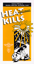 Hike Smart, Hike Safe, Heat Kills
|
|
|
|---|
|
|---|