|
|
|---|
|
Terry Leroux, Jeff Kernz, Mike Hamann, and Victor Kean 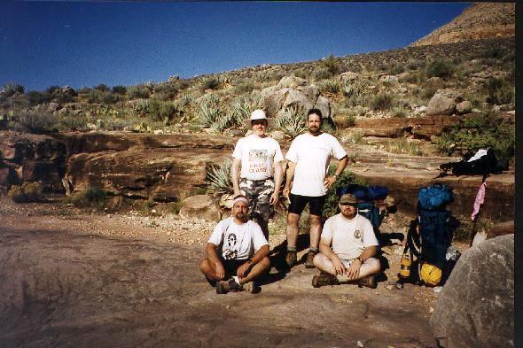 Left to right Jeff, Vic, Terry and Mike Ken Patrick, Old Bright Angel, North Kaibab, Clear Creek, Bright Angel, Tonto, Hermit Day 1 Day 2 Day 3 Day 4 Day 5 Day 6 Day 7 Day 8 Day 9 Day 1. Ken Patrick Trail to Old Bright Angel Trailhead. 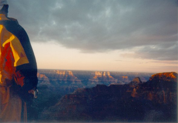 Dawn at Bright Angel Point Dawn at Bright Angel Point
I checked in at the ranger station asking about trail conditions on the Old Bright Angel and camping on the Walhalla Plateau. Like on the south rim back country office, I was warned that the trail was unmaintained and would require a lot of bushwhacking. Our permit required us to camp east of the lake for some reason. On the south rim the back country office originally thought we could camp anywhere in the use area. When I showed them the restriction on the permit, they were unsure why the restriction was placed on there, and quietly noted that there would not be any backcountry rangers in the area checking permits. The hike along the Ken Patrick was very pleasant; a shaded, wooded walk the entire way. The only exceptions were the times the trail plunged downhill just so we would be required to climb back up. For the most part, it was a very enjoyable hike. Having a short, easy hike on the first day was a good way of easing into our nine day trip When we got to the Old BA trailhead, we dropped our gear and did a little scouting down the trail. The top part of the trail a short way after the trail head is very steep, and scouting out this part of the trail without packs was definitely worthwhile. It allowed us to confidently go the first mile or so without being sidetracked by game trails or hunting for the trail through the brush. We set a time limit for scouting the trail, and stuck to it. We found out later that if I had gone on just a few minutes longer, I would have found a flat outcrop suitable for camping-- about a mile down the trail. Still keeping to a time limit has saved us trouble and is worth doing. We all headed back up to the trailhead and started looking for a good place to set up camp and start dinner. We finished cleaning up dinner at dusk and talked a bit before settling in for the night. That night it got pretty cool. (Jeff's opinion was that it got downright cold.) We were used to being in the Canyon at the beginning of August rather than at the end of September and camping near the bottom of the Canyon rather than the north rim. Day 2. Old Bright Angel to Cottonwood. 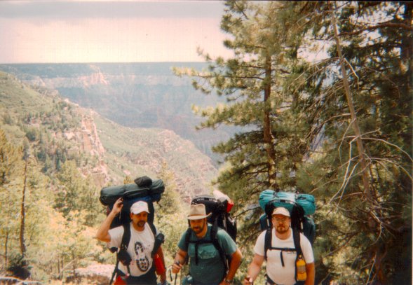 Jeff, Terry and Mike at Old Bright Angel Trailhead Jeff, Terry and Mike at Old Bright Angel Trailhead
The next morning we got up and packed our gear getting ready to hit the trail. It was a bit cool which turned out to be very handy as wearing long pants and a jacket made walking through the brush much more comfortable. We quickly made it down to a large log fall across the trail that had been just about the extent of our scouting the other day. Just past the downed tree, we passed an outcropping just below the trail that looked as if it would have been just large and flat enough for our tents. We continued on using Bob's trail description of the Old BA to help guide us. We occasionally had to drop packs and scout around looking for cairns to identify the trail. This was quite a bit different from being on a maintained trail, but interesting. I enjoyed being on a trail you had to hunt down. 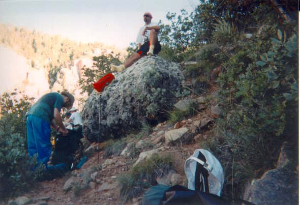 Near the top of the Old Bright Angel Trail Near the top of the Old Bright Angel Trail
Our only real trail finding problem occured when we were following the creek bed. Bob's trail description indicated we should exit on the west side of the drainage, but after dropping our packs and searching for approximately 20 minutes I found some signs of animal trails, but nothing that looks like the Old BA. No cairns and no way to continue west. Jeff was scouting on the east side and eventually found cairns and the trial heading out that way. After half a mile or so the problem we had became clear. The wash we were traveling down was not the creek bed Bob described. The wash is exited on the east and a half mile later you come to the dry creekbed that is exited on the west. Once you enter into the creekbed, it is obviously much larger than the wash up above and we immediately realized we had mistaken the wash for the creekbed. 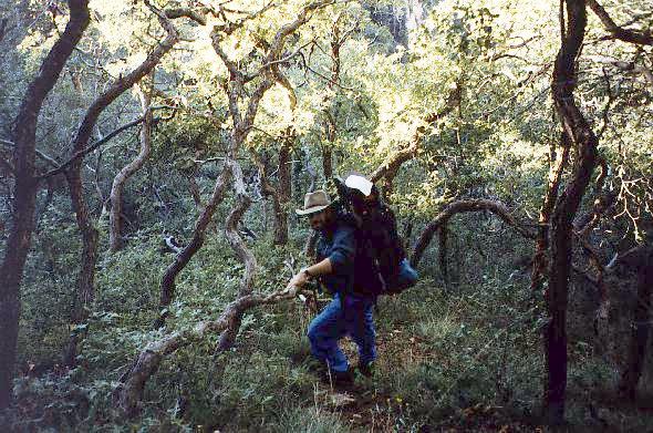 A little bushwacking along the Bright Angel A little bushwacking along the Bright Angel
As we exited out the west side of the canyon, the day was heating up. We had lost our shade from the tree cover higher up, and were starting to get tired and thirsty. But our topos seemed to indicate that we should shortly be finished with most of the descent, and that it should be comparatively level in a mile or so. It was fortunate that Fern Spring was just ahead of us; we were getting hot and running low on water. We stopped to get water, sit in the shade, and wait out the noon day sun. 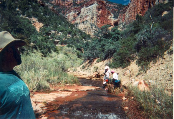 Resting at Fern Creek Resting at Fern Creek
Fern creek was very pleasant and would almost make a great water slide, except that it's a bit steep and long to risk trying it. After a good rest here, Mike and Jeff headed out, while Victor and I waited for it to get a little cooler. We followed them about 20 minutes later. After hiking a ways out from Fern Creek, we were soon to discover that the upper portion with all its bushwhacking was in fact the easy part of the trail. There are several major washouts along the trail from Fern Springs to the North Kaibab Trail junction at Manzanita Creek. The other interesting occurrence was that we started running into rattlesnakes. There are several rock climbs where we had to hunt for the trail once we had crossed the washed out area. Victor and I had caught up with Mike and Jeff because of all the scrambling and hunting they had to do. The trail then actually gets even worse. There are several crossings over loose debris where the trail has been obliterated that tend to slide out from under you. (Jeff found this out the hard way. His knees took the brunt of a fall that nearly sent him for a swim thirty feet below.) The other difficulty we ran into was at the crossing of Bright Angel Creek. The directions we had said that there was an obvious crossing of the creek, but where the cairns led to the creek, we could not find an obvious crossing. Eventually I waded in to the creek up to my knees and ferried the packs across. The soaking did eventually lead to some blisters that day, but they weren't too bad and didn't bother me later. We knew we were getting close to the finish when we passed the pumphouse and finally saw the bridge that the North Kaibab trail follows over the creek. After encouraging our third Western Rattlesnake to move off the trail enough to pass by, we finally made it to the Kaibab Trail. There we congratulated ourselves for getting through the trail. I think this confused the couple that were behind us on the South Kiabab bridge, but the idea of an easy maintained trail was a welcome sight at this point. We headed into Cottonwood and set up camp and got some well deserved rest! 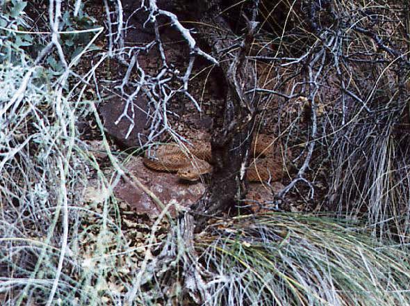 Rattlesnake along Old Bright Angel Rattlesnake along Old Bright Angel
Day 3. North Kaibab to Bright Angel Campground. 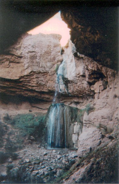 Ribbon falls Ribbon falls
The next day was an easy one. Jeff and I wanted to get a reasonably early start so we could get a good site at Bright Angel Camp. Mike and Vic wanted to take a more leisurely time, so left some time after us. We headed over to Ribbon Falls, avoiding what we had come to refer to as "asinine hill". The last time we were here, we ended up climbing over it both to and from the North Rim--and missed the falls both ways! We apparently arrived at Bright Angel Campground the same morning Bob Ribokas was heading out from his trip to Clear Creek. Unfortunately after reading his trip report he apparently headed out 4-6 hours before we got there. 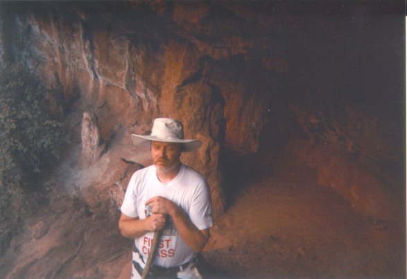 Victor resting at Ribbon Falls Victor resting at Ribbon Falls
We made good time to Bright Angel Campground, dropped our gear and headed to Phantom Ranch and to wait for Mike and Vic. When they arrived we got our lemonade, sent out some T-shirts and relaxed for a while. While there, we checked on dinner, as we had only two reservations, and we managed to get two more so we could all eat in the dining hall that night. After dinner, I went to the ranger program, which was a question and answer period followed by a talk on the California condors that had been released. Basically this was a pleasant and relaxing day for us to lay about after the previous day's gruelling hike. Day 4. Clear Creek Trail 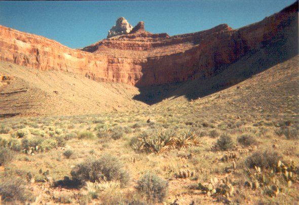 Zoroaster Temple between Bradley and Demaray Points Zoroaster Temple between Bradley and Demaray Points
We got a later start than I had hoped. I wanted to get started between 5:30 and 6:00, and we actually started closer to 7:00. Clear Creek Trail goes directly to the Tonto Plateau at the begining of the trail. This makes for a lot of climbing at the start, but approximately two miles later the trail levels out on the plateau and then you can move pretty fast. We were wondering about the warning on our permit and echoed by a sign at the trailhead, that there is no camping within first 2 miles of the trail. Where would one camp? We saw no suitable spots for camping anywhere until we reached the plateau. (Perhaps they are concerned about people sleeping in the middle of the trail?) The Tonto Plateau on the north side of the river provided a different perspective to look out over the inner Canyon. There is a very scenic overlook directly above Phantom Ranch near the start of the trail. Once you reach the Plateau, you have a unique view of the lower half of the South Kaibab trail and all along the trail you new stretches of the Colorado River become visible. Most of the hike from Sumner Butte to Demaray Point was fairly easy and reasonably flat. After a while though, we began to wonder just how far it was to Clear Creek. It was starting to get a little hot and we needed a break. We dropped our packs in a wash in Zoroaster Canyon were we found some shade . After about a 20 minute rest, we headed on, only to find the next major side canyon was not the start of the descent into Clear Creek. We continued along the trail and decided to grab the next shady overhang and wait until the sun set enough that we were in shadows during the descent. It turned out that the "next shady overhang" overlooked the last section of trail leading into Clear Creek. The trail was in full, blazing sunshine. Our wait turned out to be a couple of hours. Finally, when it looked like there would be some shade from Zoroaster Temple, we started our descent into Clear Creek.  Jeff gets a little bored waiting for it to cool Jeff gets a little bored waiting for it to cool
While the descent is a bit rough and the shale path is fairly narrow, it was a definite improvement over some of shale crossings we madeon the Old Bright Angel. Several of them have no path across them and the shale tended to slide away underfoot as we crossed them. The other major advantage is that a fall will deposit you rather abruptly at the bottom of the creek, but wouldn't drop you off a sheer cliff face which made the second day's crossing so entertaining. 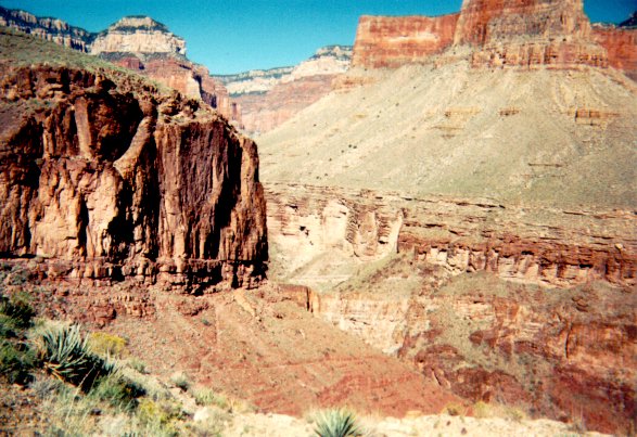 Nearing the end of Clear Creek Trail Nearing the end of Clear Creek Trail
We got down to the creek and campsites, and found that we had the place to ourselves that day. The first thing we did was to refill our water from the creek. We looked around and selected a site under a large tree to set up our camp, then headed down the creek to wash up a bit and rinse out some of our clothes. We then got ready for dinner. Mike's efforts before the trip insured that the meals were much better than we had prepared on some of our earlier trips, and of course everyone was more than willing to donate some food from their pack toward the effort in hopes of lightening their load a little for the rest of the trip. Day 5. Clear Creek. This day we had planned on spending the day exploring the Clear Creek area. Jeff and I had hoped to head up near the saddle of Brahma and Deva Temples. The hike along the Clear Creek Trail had taken longer than we had planned. Instead we decided that we would explore in the morning and early afternoon - saving serious expeditions for another trip. We would cook an early dinner and then hike up to the Tonto Plateau and camp the night there. This would make for an easy hike back to Phantom spread out over two days. 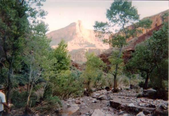 Clear Creek with Howlands Butte in the background Clear Creek with Howlands Butte in the background
Late that morning a couple arrived from Phantom. We chatted with them for a while and told them we were planning to hike up to the plateau to make the trip back easier. They debated whether they wanted to hike back up to the plateau, and eventually decided to stay down near the creek. Since we had decided against long forays away from camp that day, I revised my plans and wandered downstream. The trail downstream and the cairns marking it are missing in a lot of areas. As most of the growth along the creek had been flattened, I didn't look for the trail; it was fairly easy to head down through the brush, crossing the creek when necessary and walking through the creek when nothing easier appeared on the shore. I wandered about as far south as the drainage that comes in from the west side of Howlands Butte. The trip back turned out not to be quite as easy as the growth was now laid down pointing at me, forcing me out to the side more. I did find cairns marking the trail here and there, although they were fairly easily lost, and usually about that time, wading into Clear Creek proved to be the easiest trail back. It was also cooler walking in the creek. 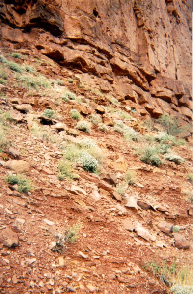 I'm barely visible hiking out of Clear Creek I'm barely visible hiking out of Clear Creek
When I got back the others were getting ready for dinner. We pumped some more water for dinner and the trip out, then sat down to eat. After cleaning up, we started packing our gear and prepared to hike up to the Tonto Plateau. We headed up as soon as it looked like we would have some shade. While I have noticed Bob Ribokas is not overly thrilled with the descent into Clear Creek, I'd have to note that it makes a pretty unrelenting climb out. The trail does nothing but climb until it gets up to the plateau, which is even a steeper ascent than the climb at the other end of the trail. After making it to the plateau, we took a break and discussed how far to hike that afternoon. We decided to forego the first campsite that is just a short way down the trail and instead try for a campsite underneath an overhang we saw on the way in about 2 miles from the trailhead.  Clear Creek trail heading back up to the Tonto Plateau Clear Creek trail heading back up to the Tonto Plateau
The hike over the Tonto went pretty fast as the four of us move much faster on level trails than ascending or descending, but we were running out of light and nowhere near our chosen spot yet. At what would be our last rest stop we broke out flashlights. We got a bit concerned as following the trail on the Tonto Plateau is easy enough during the day, but at night you can easily wander off the trail and not realize you are wandering through the scrub. It's easy enough to hike across the Tonto even without a trail, but if we lost the trail, we would have a tough time finding a suitable campsite. Just when it became too dark to navigate with confidence (even with flashlights), we came across a clearing just off the trail that turned out to be an excellent campsite. 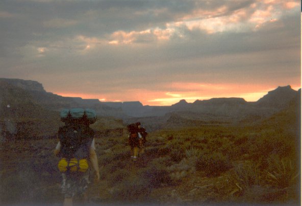 Dusk closing in on us on the Clear Creek Trail Dusk closing in on us on the Clear Creek Trail
Day 6. Clear Creek to Bright Angel Camp This morning we would have an easy hike from the Tonto Plateau to Bright Angel camp. We figured that it was only 3 miles or so to the trailhead, so we made a leisurely hike of it and spent time enjoying the various vistas that presented themselves along the way. We highly recommend a dayhike up to the plateau on the Clear Creek Trail from Phantom Ranch. On the way back we picked up a couple of lost items, a watch dropped in the middle of the trail and a water bottle someone had apparently cached and forgotten. We spotted the bottle when we were hiking in. Since we didn't meet anybody at Clear Creek to whom the bottle might belong to , we figured it was abandoned or lost, so we dropped both items off at the Phantom Ranch ranger station. 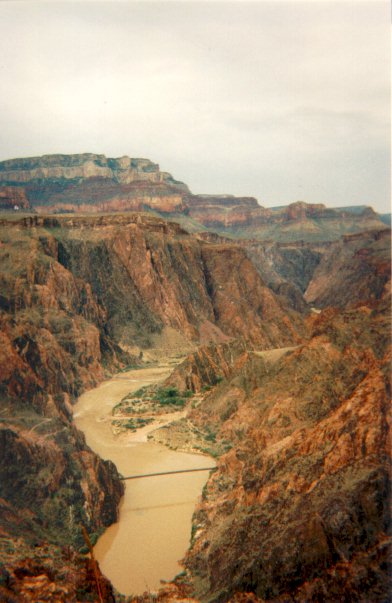 Black and Silver Bridges from above Phantom Ranch Black and Silver Bridges from above Phantom Ranch
Jeff and I arrived at Phantom Ranch just as a light rain started. After we set up our tent and got our packs covered from the weather, we headed back to the cantina. There we learned about the dire weather predictions for rain from the next hurricane remnants to head through Arizona. After seeing the forecast we were glad we weren't camping at Clear Creek, we would have hated to get flooded out of there. We were a bit concerned about the other two groups we had met out at Clear Creek on our second day, but a little later in the day, both of them showed up at Phantom. The one couple couldn't get a permit for Bright Angel Campground, but fortunately the weather forecast had stopped a number of hikers from heading down to Phantom and they managed to get dorm space. 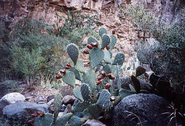 Cactus in bloom Cactus in bloom
Bright Angel campground was the emptiest I've ever seen it. For most of the day it, three-quarters of the campsites were empty, and I think well over half of the sites were not used that night. We managed to pick up more dinners at the dining hall for this night, saving us cooking duties out in the drizzling rain. After dinner I again headed out to the ranger program to see if I could find out more about the weather situation. We were supposed to hike out along the Tonto West trail eventually heading out Hermit Trail, but we were concerned that the weather conditions might be such that we would be better off hiking up and out the Bright Angel Trail tomorrow. The ranger said that the rain had been holding off (it was originally supposed to rain heavily the evening we got into Clear Creek) and she suggested that we continue to check on the reports, but it seemed that the rain shouldn't be to bad and that we could follow our planned route. During the discussion period, one of the Phantom Ranch guests got a bit concerned about the possibility of dangerous wildlife. I suggested that the Old Bright Angel would be a good place to see rattlesnakes as we had come across three Western Rattlers during hike down. I also noted that although getting bitten would not be fun, our encouters them had been more interesting than threatening. Mr. Snake always obligingly rattled his tail, and the sound always brought us up short. We would then look for Mr. Snake and the work our way around him keeping a safe distance. For some reason our troubled hiker was deathly concerned about scorpions, especially when he asked the ranger about their abundance in the Canyon. The ranger tried to assure him that although the sting from a scorpion was often painful, no one stung by a scorpion had ever needed to be evacuated from the Canyon because of the sting since she had been at Phantom Ranch. Strangely enough, this was the first time in six trips that I had ever seen a scorpion. One of the small straw colored scorpions was in the men's restroom that night. After the ranger talk, I spent some time talking with the ranger about the weather conditions (it drizzled all evening long) and asked her about some ideas for other hikes. Day 7. Bright Angel and Tonto Trail to Horn Creek. 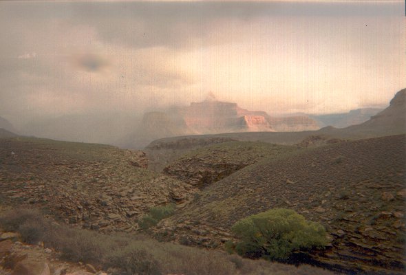 Low clouds threatening rain over Zoroaster Temple Low clouds threatening rain over Zoroaster Temple
Jeff got up around 3:30 this morning as he had to hike out to catch a plane so he could get back to work. There was still a drizzling rain as Jeff packed up and headed out the Bright Angel trail. The rest of us got up a few hours later and started packing our wet gear up. Mike's tent had decided to allow a small stream through it, so he and Vic were a bit more waterlogged than expected from the light rain. While the sky was very overcast we kept looking at Bright Angel Creek, but it didn't seem to be running any higher than normal. The light rain hadn't caused an noticeable changes overnight, but just before we headed out, the creek suddenly changed from clear to muddy. 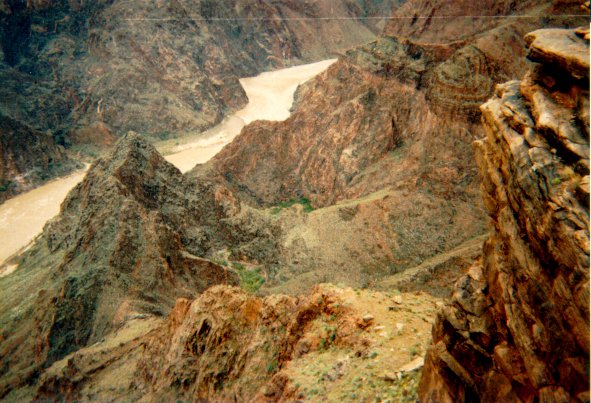 The Colorado River from Plateau Point The Colorado River from Plateau Point
The hike up the Bright Angel Trail went smoothly. The rain had packed the sand on the river trail making that much easier to hike. By the time we reached the Devil's Corkscrew, we had caught up with several other campers hiking out from Bright Angel Camp. We passed some of them as they rested and then were passed by them in turn as we took breaks on the way to Indian Gardens. We all got up to Indian Gardens early in the day, and there we stopped for a rest and to determine if we would continue on to Horn Creek. I went over to the ranger station to see if they had any updates on the weather situation. Their reports proved to be of little help. All they could say was that it might rain presenting a serious threat of flash floods -- or it might clear up some. It was very overcast at this point, the clouds descending well below the rim of the Canyon. We decided that we would hang around Indian Gardens to see how weather conditions looked in a few hours. Vic decided that he wanted to go out and see Plateau Point, and I went along, as I hadn't been out there for years. It was a pleasant walk out to the point; the overcast sky kept the trip cool. We spent some time trying to spot parts of the Clear Creek trail over on the north side of the plateau, but most of it was too faint to to make out from this point. The clouds had started to break up by the time we headed back to Indian Gardens. It looked as if the weather would clear up enough to go on. We prepared dinner at Indian Gardens, so we could use the water available there. This would save us carrying extra water to Horn Creek, since there is no drinkable water at that site. 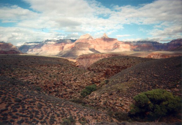 Zoroaster Temple, clouds clearing Zoroaster Temple, clouds clearing
We filled up our water bottles and started out for the Tonto Trail. The Park Service makes very sure you are aware of the radioactive contamination at Horn Creek. My permit had warnings, the Tonto Trail sign had warnings, and finally the Horn Creek campsite had warnings about the water. The hike to Horn was fairly flat and easy. Our only concern was finding the campsite as we entered Horn Creek. The campsite sits nestled under a large tree right next to the creek, and when coming in from the east its entrance is well hidden by the growth around it. This is a bit disconcerting when you are searching for it, but it makes for a very pleasant, well shaded campsite. After setting up camp, Mike and Vic explored downstream while I headed upstream towards the mining area. There is a support and a crossbeam near the back of Horn Creek on the left side, and I was working my way up the canyon to get a better view. Unfortunately I ran out of time about 80 to 100 feet below it, but did get close enough to discover the 4 lines running from it up to the rim. Apparently this was used as a cable car to send material to and from the rim. I headed back to camp only to discover that it took me about a third the time to come back down as it had taken me to go up. Perhaps I could have made it up there and back before dark after all. Oh well, better to stick to self imposed time limits than to get into trouble because it was "just a little further". Day 8. Tonto Trail to Hermit Camp. Today was to be our longest hike, approximately 11 miles from Horn Creek to Hermit Camp. This second to last day hiking would have a similarity to our second day hiking, as we would run across three more rattlesnakes, (total for the trip 5 Western Rattlesnake, 1 Diamondback). The sky had cleared up and the sun was even warming up the Canyon. We were still having difficulty convincing Vic that the dessert gets very hot in the Canyon. With a cold first night on the north rim, surprisingly cool weather the next few days, and finally getting rained on for a day, we were having unusual weather compared to the heat we normally experience. We started out early enoughto have shade from Dana Butte for the hike out to Salt Creek, although we started to get some sun on the way to Cedar Springs. The views from the West Tonto Trail are very different from the Corridor. The most noticeable change was that the Cheops Pyramid actually looks like a pyramid from this area. We hiked into Monument Creek and hid out under an overhang to sit out the noon sun. While waiting, we rinsed out our spare clothes and spread them out to dry. We then broke out the Thermarests set up for some serious relaxing in the shade. Lazing around Monument Creek would have been a bit nicer if it weren't for the steady stream of aircraft flying over the Dragon Corridor ([Victor] "and the steady stream of flies flying over me"). When the tours get going, they fly in a continuous line across this area, generally with 2 to 4 aircraft always within sight and hearing range. 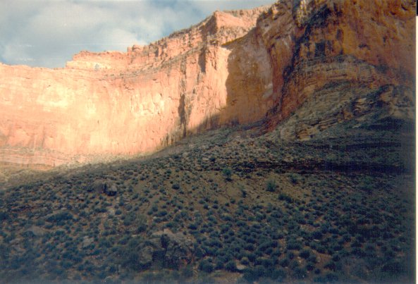 The Inferno from Tonto Trail The Inferno from Tonto Trail
After resting up until the afternoon, we filled up on water and headed off to Hermit Camp. Passing out by the Monument, we noted this would have been a very nice place to camp and do some exploring. The hike along the Tonto Trail was pretty uneventful until we got to the Hermit Trail intersection. We were a bit confused as the sign lists three trails: Tonto Trail continuing west, the portion we came in from the east and the Hermit Trail. The confusing part was that while the sign lists three trails, four trails intersect there. The Tonto heading east and west were easy to identify, it was determining whether the southwest or the southeast trail was the Hermit trail. After looking at our maps, we finally decided the one heading southeast was Hermit Trail and the one heading due south was some unmarked trail. As we continued on into Hermit Creek, Mike and Vic wanted to take a break at the eastern arm of the drainage, while I wanted to look ahead to see how far away the camp was. Descending down into Hermit Camp I wondered who decided 3.5 feet was a good size for a step. After descending into Hermit camp, I determined that Mike and Vic would have to see for themselves how far it was from the eastern arm to the camp. I wasn't climbing back up those steps this evening to tell them how much further the campsite was. 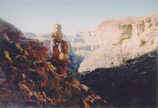 The Monument, Monument Creek The Monument, Monument Creek
Hermit Camp was very full that night -- some hikers headed back up the Tonto trail to camp rather than crowd in at the campsite. We found one of the last few empty sites and set up camp. After setting up the tents we then went down to the creek to fill up water, wash up a little and get ready for dinner. Vic decided at this point to test our patience by taking apart the water filter when he was having trouble getting it to work to his satisfaction. As soon as he unscrewed the filter, a piece flew out and disappeared into the creek. Mike and I grumbled about what to do about water. We actually had enough fuel to boil all the water we'd need for the rest of the trip. Mike decided to try some of the iodine he'd brought down as a backup and discovered that it does a wonderful job discoloring Platypus bags. Somehow Victor eventually found the missing piece and we were able to get the filter working again. We learned an important lesson: If someone asks you whether your water filter can be disassembled, say NO! 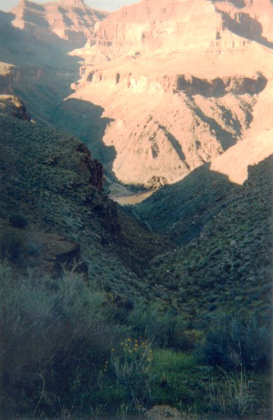 Ninety-four mile creek from Tonto Trail Ninety-four mile creek from Tonto Trail
Day 9. Hermit Trail to Hermit's Rest. This was our last day in the Canyon. The biggest annoyance for me was the fact that none of my clothes dried out overnight. We hiked out of Hermit's Camp early and spent a little time wandering around the foundation and remains of the original Hermit Camp. We left early enough that we had plenty of shade climbing up the Cathedral Stairs and clear out to Lookout Point. We took a rather long rest break at Lookout Point to enjoy the view and also to look for the survey control point to determine how the accuracy of Vic's GPS. We couldn't locate the control point and eventually headed on. A little further down the trail we managed to lose Hermit's Trail for a few minutes while crossing a large washout. We climbed across the washout to what appeared to be the trail on the other side, but the trail on the other side turned into a sheer drop, leaving nowhere to go. As we were looking around for the trail, we spotted a hiker coming down the trail from the top of the washout. The trail switched back in the middle of the washout and continued up it. We had mistakenly assumed that the trail went across it. We greeted the hiker coming down and then had to point him back across the wash -- he had assumed the dead end we were searching was where the trail headed down. 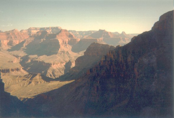 Cope Butte from Hermit Trail near Lookout Point Cope Butte from Hermit Trail near Lookout Point
When we reached Santa Maria Spring, we decided that the shady benches at the spring would be a good place to get some rest before we pushed on to the top of the trail. As we were relaxing there, we met another hiker coming up the trail. He and two friends were completing a Boucher-Tonto-Hermit trip. About the time the second of the trio arrived we were rested enough to head on up. We spread out some on this part of the climb, Mike needing to rest his legs a bit before going up some of the steps. I headed out in front a ways but was soon caught by Victor who was doing a remarkable job. Victor did very well hiking, especially considering this was his first hike in the Canyon and very little was over the easier corridor trails. We discovered that Vic's only problem was that he couldn't lead very well on the trail. He tended not to watch ahead for where the trail went, and so when we crossed washouts, Vic would invariably head up or down the washout missing the trail. As we neared the top of Hermit Trail, the first hiker we had met at Santa Maria Springs passed us by. He was moving very fast up the trail. Apparently we were all curious about his speed as both Mike and I tried to keep pace with him but were quickly left behind. He didn't move that much faster than us, but he never slowed down and he never needed a rest break. 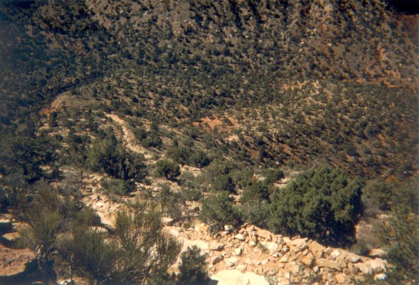 Looking back down Hermit Trail from near the trailhead Looking back down Hermit Trail from near the trailhead
Vic and I finally reached the top and dropped our gear for a rest at the intersection with the West Rim Trail. After catching my breath, I headed up to the Hermit Trail Head and talked briefly with the Boucher hiker that had passed us before heading back to wait for Mike. The second hiker came out and we directed him to his buddy at the trailhead. Mike arrived and dropped his pack in the shade as we decided a little sunscreen would be in order before we headed on to Hermit's Rest. We were loading up our gear to head out when the third hiker finally appeared. He looked extremely tired and worn, making us feel better because we weren't feeling nearly as tired and haggard as he looked. We pointed out the way to the trailhead where his two buddies had gone and we took the rim trail to Hermit's Rest. The snack bar at Hermit's Rest was our re-introduction to civilization after nine days of hiking. The Gatorade did not sound appetizing after drinking it throughout the hike, but the ice cream turned out to be an ideal choice. While we were eating the ice cream, the first two Boucher hikers showed up at Hermit's Rest. They were still waiting for their third man (who we had sent up to meet them at the Hermit Trailhead). After I finished my ice cream, I headed out to the rest rooms and on the way back spotted their missing companion. He was sitting near the bell in front of Hermit's Rest. I told him that his buddies were resting in the shade near the concession area, but he said that he was too tired to move and that they could look for him. We left Hermit's Rest on a shuttle with all three of the other hikers, who finally managed to reunite. During the ride back we insisted that any unusual aroma the other passengers might notice was certainly coming from the other group, not ours. Exiting the bus, we headed in to the Bright Angel Lodge for a well deserved lunch to cap off our week and a half hiking trip through the Canyon. *** Text and Images Copyright © Terry Leroux, 1997. *** |
|
|
|---|
|
|---|