|
Trip Report - October, 2023 - Tanner and Beamer Trails to the Little Colorado River |
|---|
|
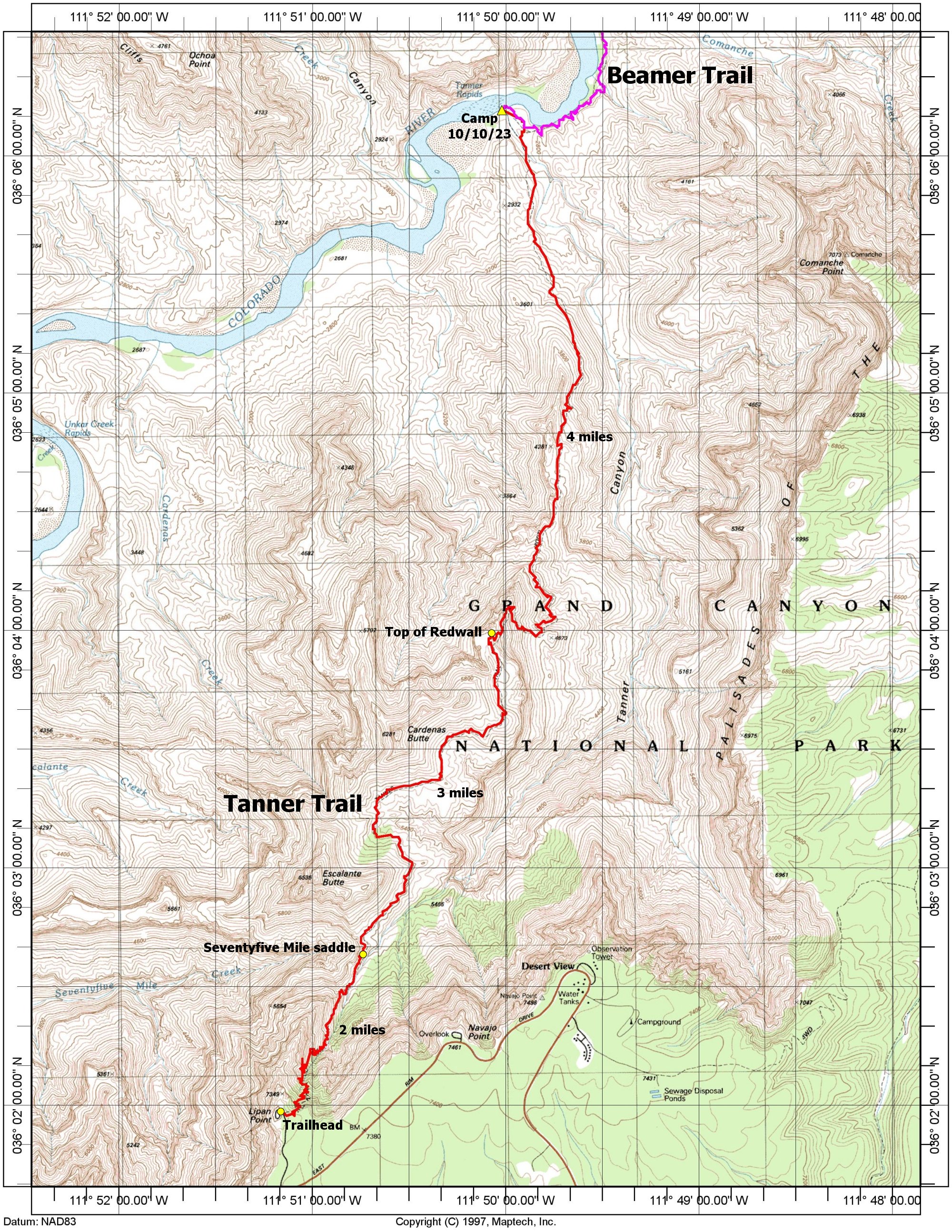
This trip didn't work out so well. It started off very nice and the first three days were perfect, with beautiful weather, fantastic scenery, clear nights and just about everything I could ask for. But towards the middle of the last day, during what was supposed to be the first day of a two-day hike back to the rim, I ran into some problems going up the Redwall.
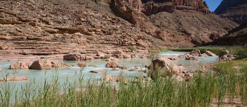
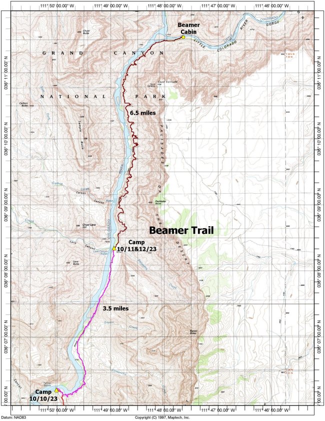
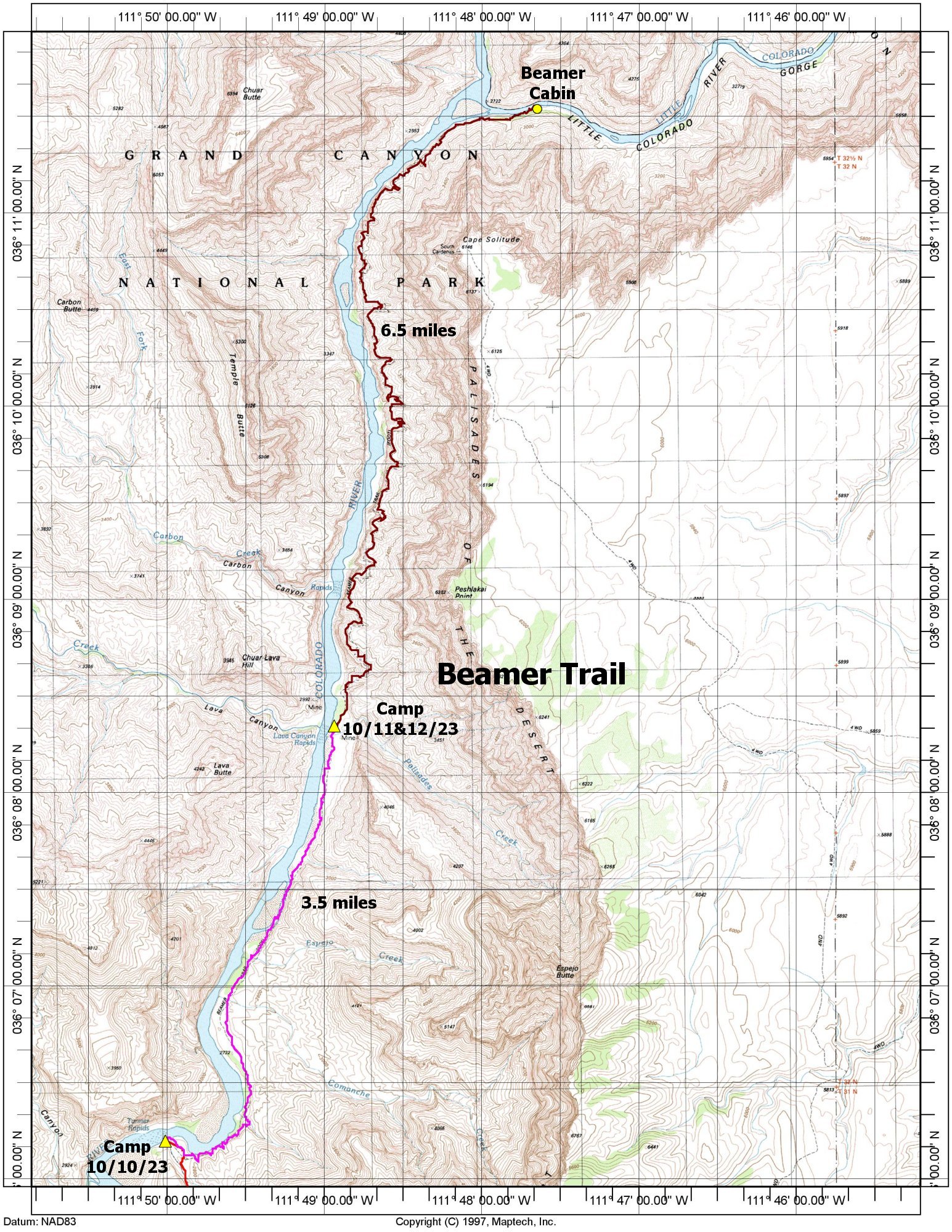
The first incident occurred in the lower section when I slipped on something and ended up doing a hard face-plant to some rocks on the side of the trail. I ended up with a long gash and a few bumps on my forehead and there was blood all over the rocks. This bothered me when it first happened but I cleaned the wound and it stopped bleeding in no time. I was worried about possibly having a concussion but I felt fine afterwards and was back on the trail again after a short rest. The second incident occurred in the upper section of the Redwall when I was making a turn on a switchback and felt something go "pop" in my right hip. I kept moving and the next step on the right leg was pure agony. I stopped briefly but then tried to move forward slowly. It was no use, every step on the right leg was painful and I was convinced I had dislocated the hip. I found a rock to sit down on at the side of the trail and took the backpack off. I sat there in total disbelief of the situation for several minutes trying to figure out what to do. I tried walking around without the backpack but that was not much better. How was I going to get out of here? I knew I was in the upper sections of the Redwall and I thought I could see the top but I had no idea how much more trail was required to get there. The plan had been to get to the top of the Redwall for lunch and a long rest and then continue on to the Seventyfive-mile saddle where I had two quarts of water cached for dinner and the hike out. I had enough water with me to get through the rest of the day and the night but then I was out and I did not relish the thought of spending the night where I was. After the first incident lower down, when I saw all the blood and the gash in my forehead, I was wondering if I would need a rescue but that turned out to not be the case once I cleaned the wound and the bleeding stopped. But now I really felt I was in need of rescue and the SOS button on my Garmin GPS was the only option left. I bought the Garmin primarily because it allowed me to send text messages via satellite when I was in an area where there was no cell coverage and I had already used that feature several times during this trip to keep my wife up to date on my progress. This next progress report was not a good one but I had to send her something before I triggered the SOS. I had never used the SOS before and it was just there as a bit of last minute insurance. I didn't want to use it and it took some time before I could actually make myself use it. But I was pretty much convinced that I had no choice. So I triggered the SOS. After several exchanges with Garmin support I was transferred to Grand Canyon Search and Rescue. After several more exchanges I was asked if I could make it to the top of the Redwall where they might be able to get a helicopter in to get me out. I grabbed a couple of snacks from my backpack and took my camera (no way was I leaving that behind), grabbed my hiking poles and began hobbling up the trail. I was surprised actually at how close I was to the top of the Redwall and I was up there in about 15 minutes. If it had not been for the accident I probably would have made it with the backpack in 5 or 10 minutes. I signaled the GC SAR team that I had made it to the top and they send a helicopter for me. And the rest is in the final day of this report. I was constantly reminded when hiking down the Redwall on the first day, of the trip by some lines in the official trail description of the Tanner Trail that read: "The Redwall descent is nasty—steep and loose. A thin coating of gravel makes some slipping and sliding inevitable and a serious fall is a real possibility, so take your time." I took my time in many places along the trail on the way down because there really is no choice. The steep and loose trail, along with the gravity trying to pull you down faster than you want to go, is a real concern. I was hoping it would be a lot easier going up. I was wrong. Trip highlights
|
| ||||||
| ||||||
|
|
|---|
|
|---|
