|
A Day Hike in New Hampshire's White Mountains |
|---|
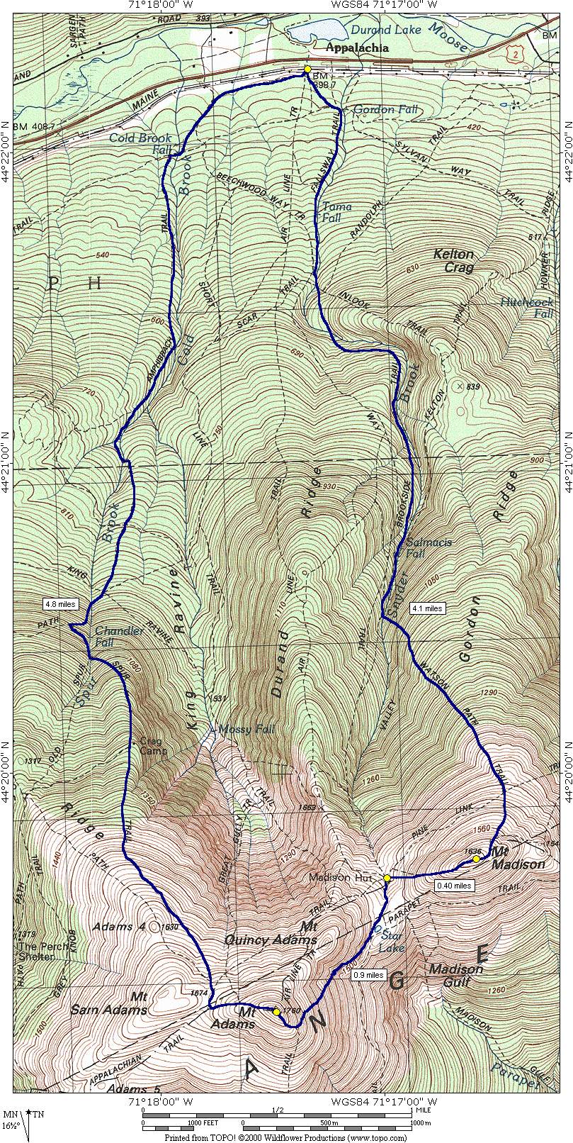
This day hike involved going along the Valley Way Trail to the Brookside Trail to the Watson Path to the summit of Mount Madison. From the summit of Mount Madison I followed the Appalachian Trail to the Madison Hut and the Star Lake Trail to the summit of Mount Adams. From the summit of Mount Adams I descended via the Appalachian Trail to Thunderstorm Junction and then followed the Spur Trail to the Amphibrach Trail back to the Appalachia parking area.
|
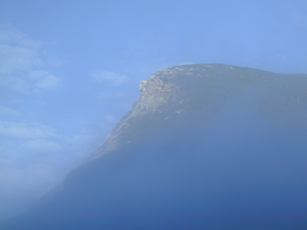
The first photo here has nothing do to with the hike but I couldn't resist taking it as I passed through Franconia Notch on my way up to Appalachia. There were clouds drifting in and out of the notch as I was driving through and they lifted just long enough to provide a very dramatic view of the Old Man of the Mountains as I was passing by.
|
The starting point for this hike was the Appalachia parking area off of U. S. Route 2 about 1/2 mile west of Randolph and 3 miles east of Bowman.
To reach the trailhead for the Valley Way Trail proceed south from the parking area, across the abandoned Boston & Maine railbed and beneath the power lines. There is a hikes register located here and you should sign in, especially if you are hiking solo, to let the rangers let you know that you are there.
Just beyond the trail register the trail forks and this is where the Valley Way Trail starts. Keep to the left for the Valley Way Trail which at the start is also called the Fallsway Trail. The profusion of trails in the area had me concerned when I was studying the topo map and attempting to pick the route that I would take to the summit of Mount Madison, and I was concerned that I would be able to find and stay on the trails that I wanted. This concern turned out to be pointless as all of the trails were well marked for the most part and the only real concern was on the summit of Mount Adams when I was trying to figure out where the descent route that I wanted was located. The problem here was that the sign had come loose from the post and it was just resting against the base.
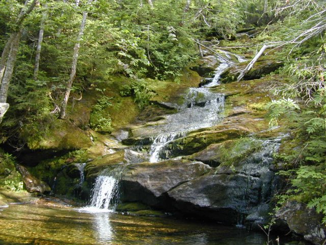
One of the nicest things about this hike was all of the flowing water and the accompanying waterfalls along the way. It is sort of sad that none of this water is fit to drink without being filtered or treated but that's pretty much the case for surface water anywhere these days. Had I been smarter I would have brought my water filter with me but I knew I could replenish my limited supply at Madison Hut and so I did not want to carry the additional weight. I had to ration my water towards the end of the hike and at that point I would have been very happy to have the filter with me so that I could pump a quart or two from the creek.
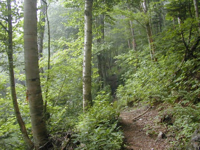
After a little more than one mile on the Valley Way Trail there is a sign marking the start of the Brookside Trail which again forks to the left and very shortly thereafter crosses Snyder Brook. After a little more than 1/4 mile it again crosses the brook back to the other side and remains there until it reaches the junction of the Watson Path. The junction with the Watson Path is a little more confusing as there is a sign pointing where the trail should be but there is no obvious sign of a trail whatsoever. If you look closely at the other side of Snyder Brook, however, you will see a little white diamond nailed to a tree with the word "TRAIL" written on it.
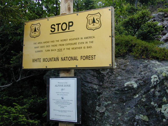
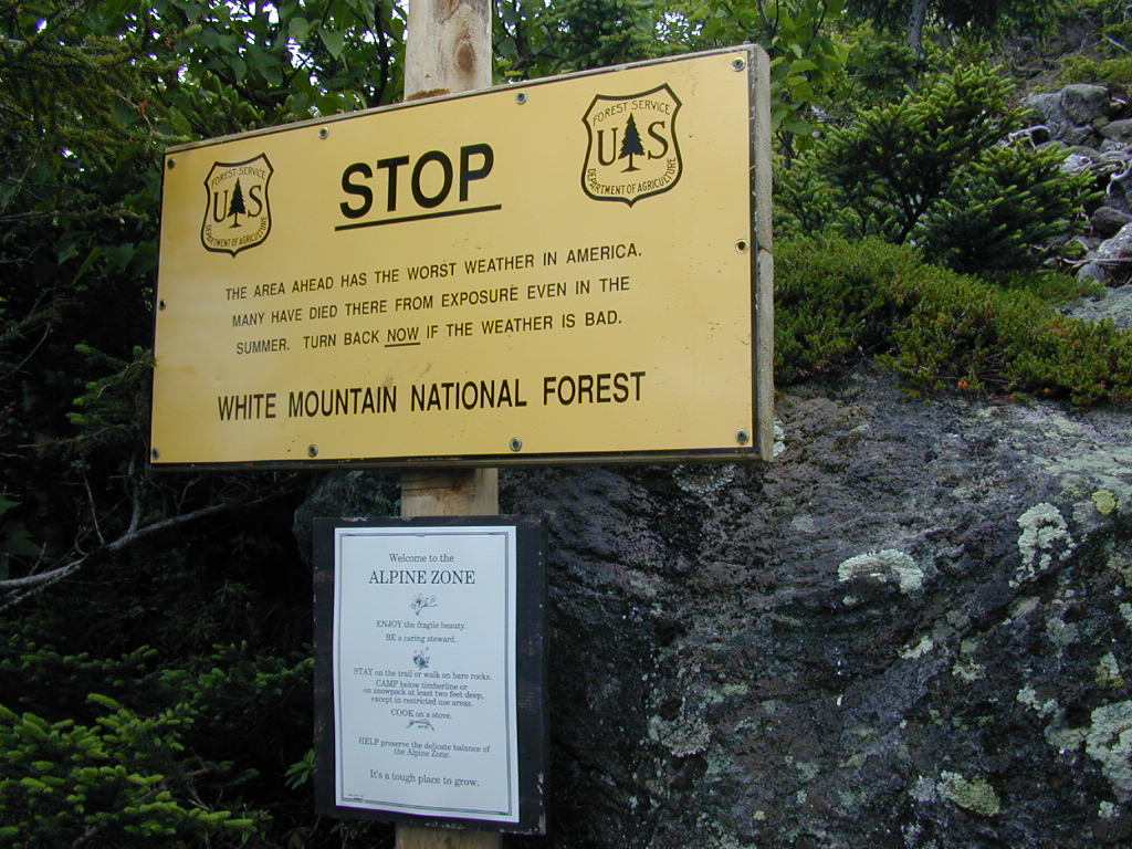
The Watson Path is one of the more challenging routes in the White Mountains as it is very steep, very rocky and very exposed once it breaks out above the treeline. This is definitely not someplace you want to be with a storm in progress or even brewing. The original route was constructed over one hundred years ago, in 1882, by L. M. Watson and lead from Ravine House, next to Durand Lake in Appalachia, to the summit of Mount Madison. The lower portions of the original route have now been taken over by other trails and/or reclaimed by Mother Nature and only the upper portion remains the original route. It took me just about an hour to travel from the point at which the Watson Trail splits off from the Brookside Trail to the point where it emerges above the treeline. I stopped numerous times along this stretch to catch my breath and rest.
|
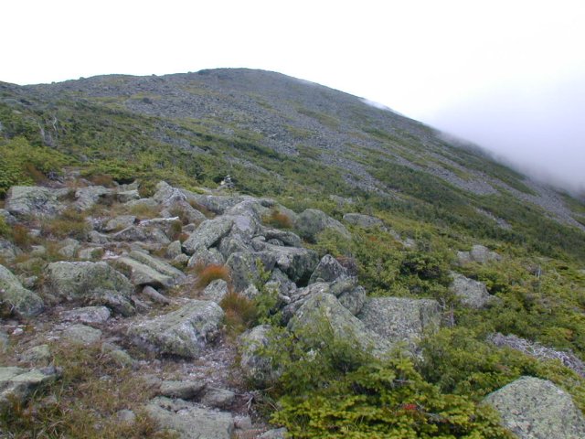
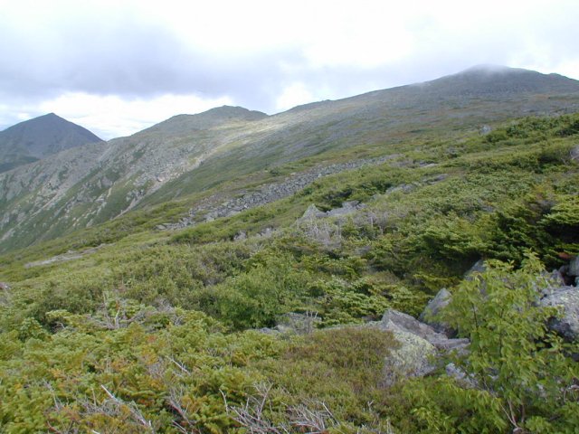
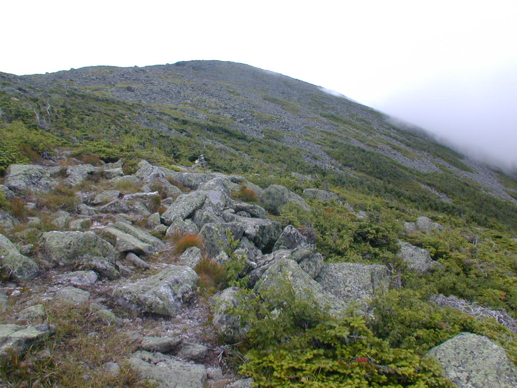
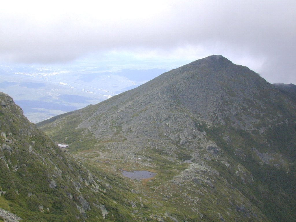
Once above the treeline the trail levels out somewhat for a short distance and then begins to climb more gradually towards the summit of Mount Madison. It is still steep but not nearly as much as the portion that travels through the forest below the treeline. I found the large chunks of granite above the treeline much easier to negotiate than those on the cone of Mount Washington during the hike that I did there in the prior week. The cairns on the other hand are not as large as those on Mount Washington and not as easy to pick out against the rocky terrain. I did not take any decent photos from the top of Mount Madison basically because there was really nothing there to see. When I arrived on the top it was socked in with clouds and any views that might have been had were totally obscured.
|
As I descended towards Madison Hut via the Appalachian Trail (which is also called the Osgood Trail at this point) the clouds began to break up again and some good views of Star Lake, Mount Adams and Madison Hut were to be had. I lucked out in that it started to drizzle just as I reached Madison Hut so, after refilling my water bottles, I decided to stay inside and eat my lunch. While I was eating the rain increased somewhat but by the time I finished my lunch and left it was back to a light drizzle. I had a rain jacket with me but there didn't seem to be anough rain to bother with it and it actually felt good anyway.
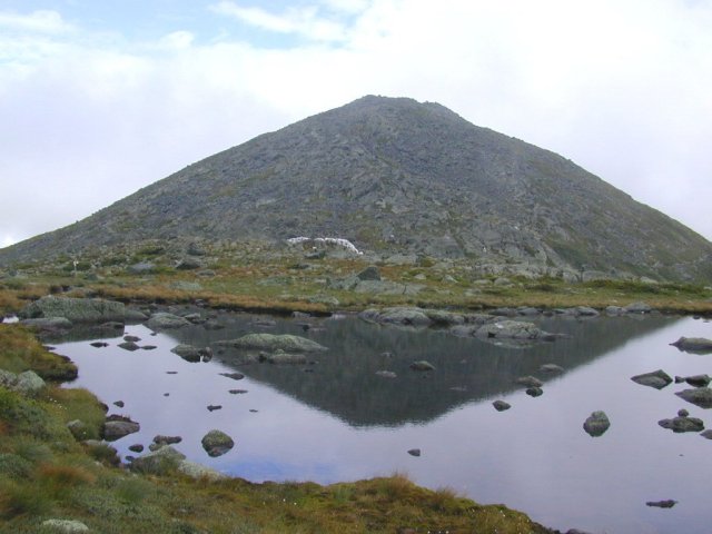
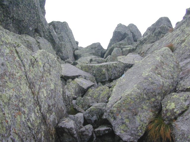
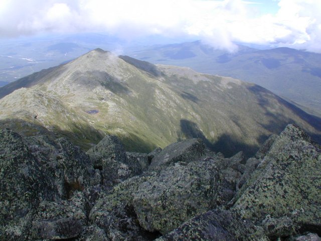
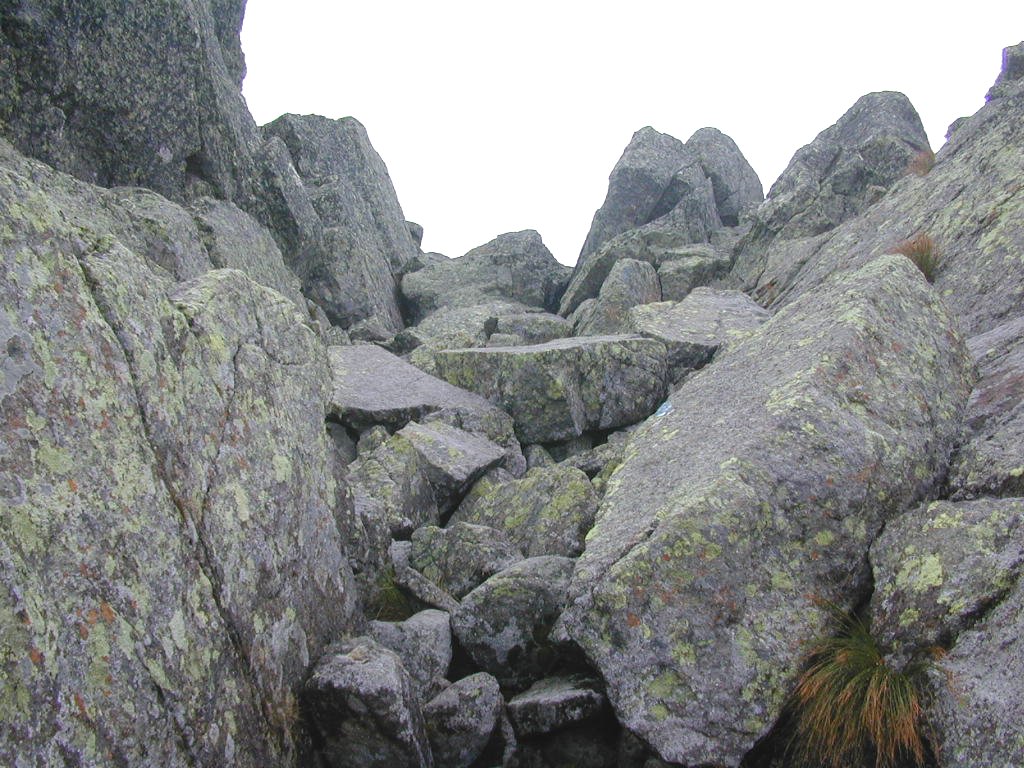
I took a wrong turn leaving the hut and ended up on the Star Lake Trail instead of the Air Line Trail, which I originally intended to take to the summit of Mount Adams. I didn't realize this until I was almost at Star Lake and a quick check of my topo map confirmed that it would take longer to go back than to continue along my present route, which also, fortuitously, led to the summit of Mount Adams. I also got a close-up look at Star Lake and a beautiful photo of Mount Madison reflected in its waters which I otherwise would not have seen so it all worked out for the best. The views of the Great Gulf Wilderness and Jefferson Ravine were also very nice (when the clouds parted enough for me to see them) and I would not have seen these from the Air Line Trail. The lower portion of the Star Lake Trail beyond Star Lake climb upwards at a very reasonable rate until you reach approximately the half-way point between Star Lake and the summit of Mount Adams. It then gets more like the top of Mount Washington and you find yourself constantly hunting out the easiest route among the massive granite blocks. The final stretch to the top is up a huge granite chute or ravine that is very impressive. The most difficult part of this climb was the fact that the rain had made the lichen, which covers most of the granite, very slippery and it quickly became obvious that my footing was not to be trusted.
|
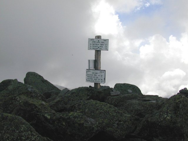
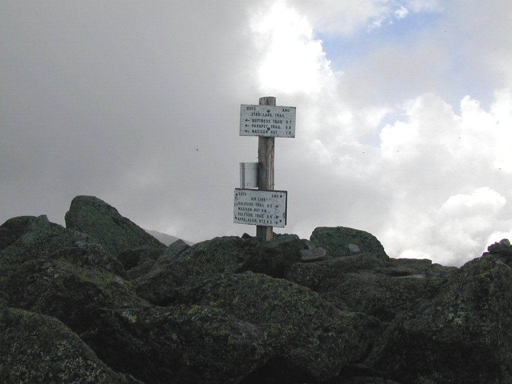
The views from the top of Mount Adams were considerably better than those from the top of Mount Madison. There were still lots of clouds about but the top was by no means socked in completely. The huge concentration of flying insects on top were the biggest problem and after taking some photos I was eager to find the route down. This proved more difficult than I originally expected as the route that I planned to take down, the Spur Trail, did not appear to reach the summit. I could see the ridge below me and in the distance along which it had to descend but could not figure out which trail from the summit would get me there. Another problem was that one of the signs on the summit pole had some loose and was resting amoung the rocks at its base. Once I looked at this and matched Lowes Path up my topo I had my route down.
|
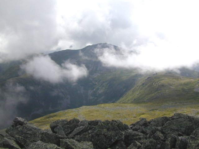
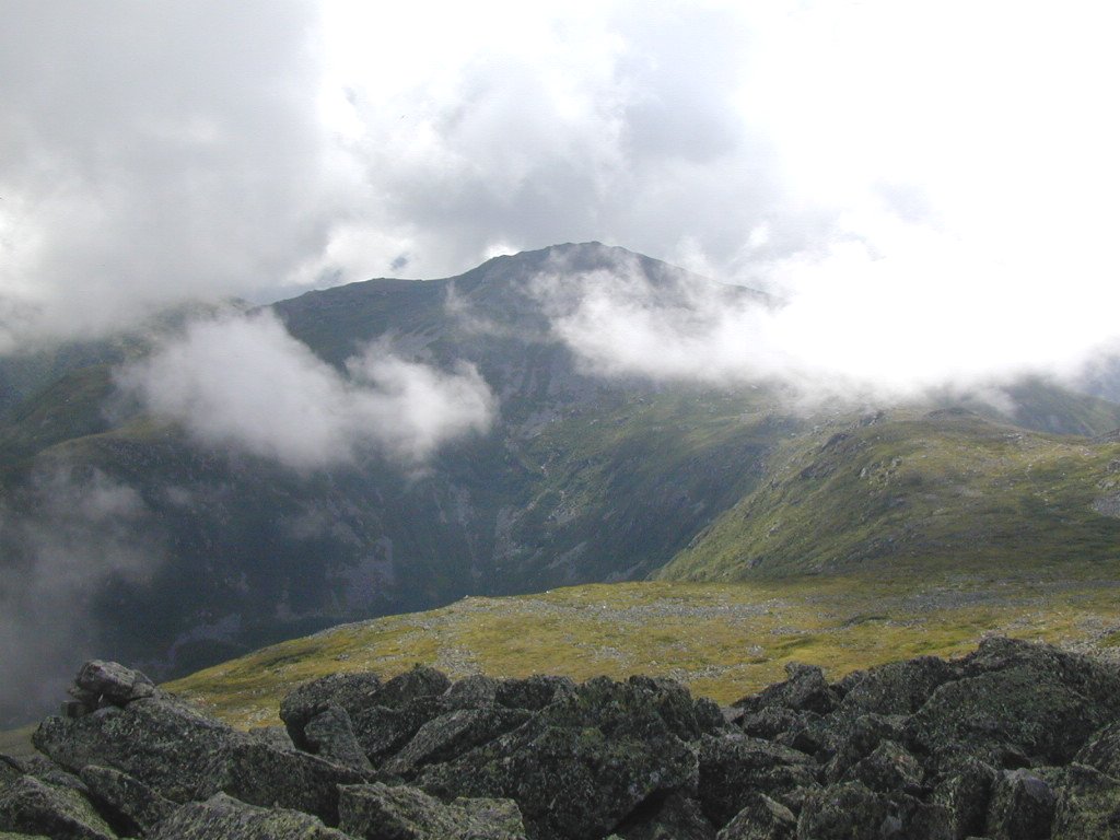
On the way down I enjoyed some magnificent views of Mount Jefferson as well as Jefferson Ravine and wished that I had more time to explore the summit areas. I was running somewhat behind schedule at this point and was becoming concerned that I would finish the hike before it got dark so I needed to pick up the pace somewhat. My only hope was that the descent would not be as demanding as the ascent up Mount Madison had been.
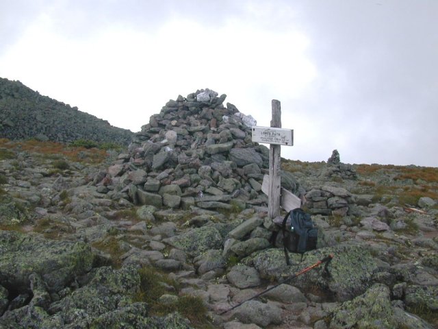
At Thunderstorm Junction I finally picked up the Spur Trail which would lead me off of the mountain and that made me very happy. I don't really know where Thunderstorm Junction gets its name but there is a huge 10 foot cairn of rocks there and given the unsettled weather in the area I had no intention of sticking around long enough to find out.
|
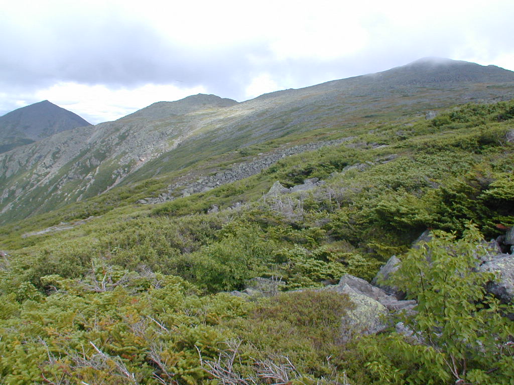
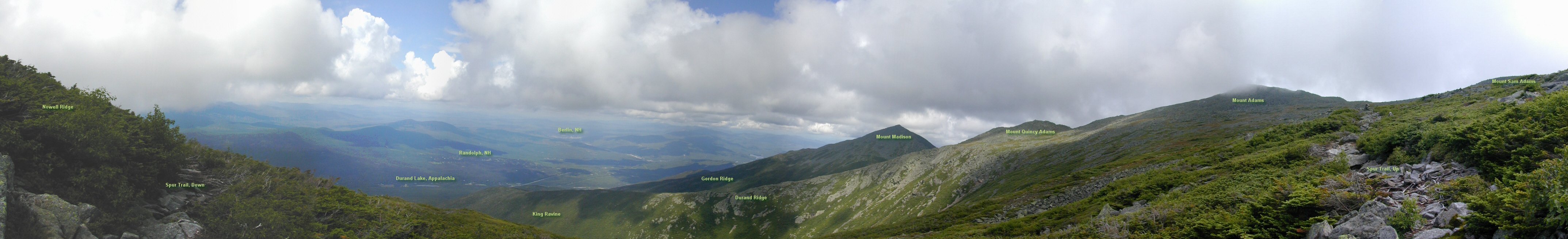
Once on the Spur Trail it descended very gradually along the northeast side of Nowell Ridge. The views were again magnificent and I stopped to take a series of photos which have been stitched together into the panorama below. It's a bit on the large side but well worth looking at itf you are planning to attempt this hike.
|
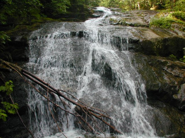
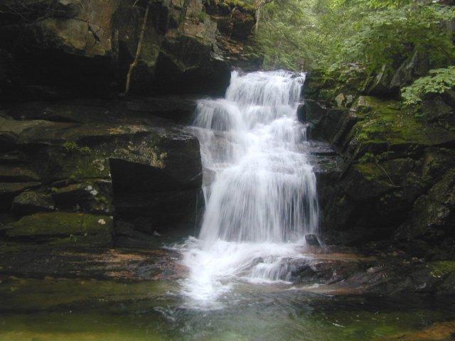
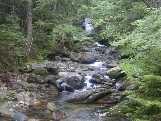
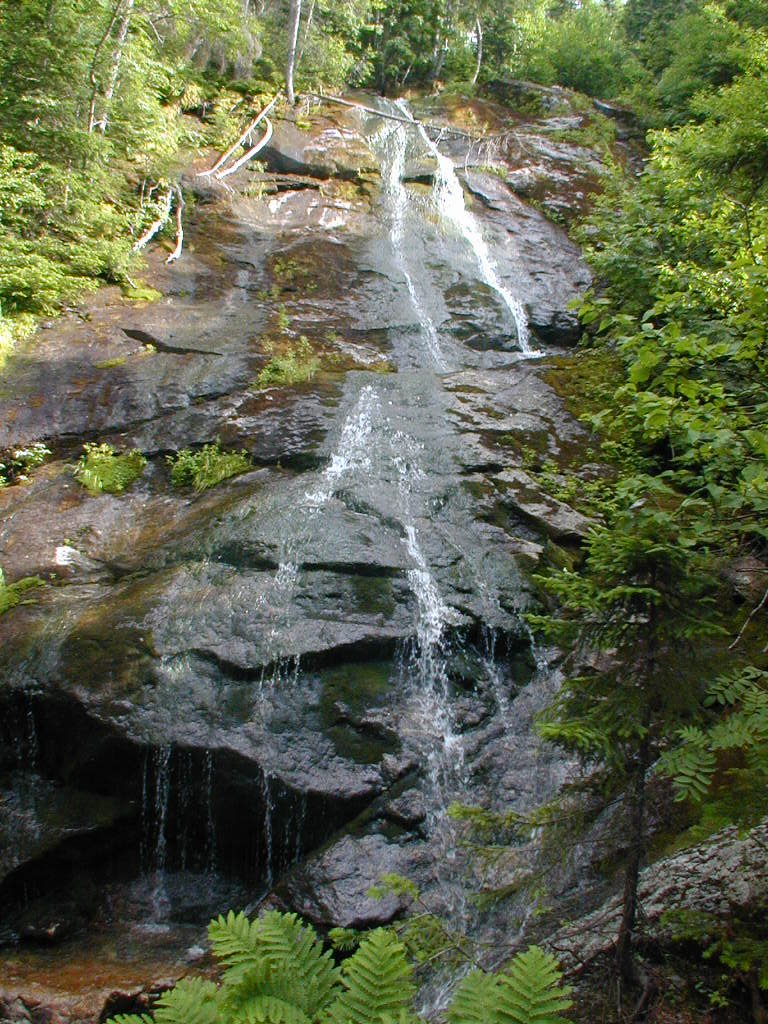
Shortly before the Spur Trail descends below the treeline it becomes considerably more steep and I was very happy to have my hiking pole with me. I extended it to its full reach to aid as much as possible in the steep descent. The steep descent continues for most of the distance along the northern arm of Nowell Ridge but is moderated here and there by some less steep and even a couple of flat sections, as can be found near Crag Camp. It starts to become much less steep as you approach Chandler Fall and shortly beyond there becomes even more reasonable. The descent still seems to take forever but I thing this is mostly psychological as once you get below the treeline there is really nothing to look at and the trail just drags on. Once the trail settled into following the brook I found it to be much more interesting as there was the water to listen to as well as the occasional waterfall to enjoy. I felt good when I finally reached Chandler Fall and could place my location on the topo map again. To reach Chandler Fall there is a short side trail which leads to its base. I could not resist even though at this point I was running about one and a half hours behind my original time estimate and was hoping that the condition of the trail would improve shortly.
|
Luckily the condition of the trail improves greatly a short distance below Chandler Fall and the descent becomes very moderate. At times it did not feel like I was descending at all and for a while I became concerned that I had somehow veered off unsuspectingly onto some other trail. None of the trails in the area appeared "level" though and this tended to confuse me even more. I was on the correct trail, however, and I still don't understand why it didn't "feel" like the topo "looked". I guess I should count my blessings as even though I didn't pick up any lost time, at least I didn't loose any more.
About a mile below Chandler Fall the Spur Trail ends and you find yourself on the Amphibrach Trail. The condition of this is about the same as the lower portion of the Spur Trail and it descends at a very gradual rate along Cold Brook towards Cold Brook Fall. Once you reach Cold Brook Fall (again via a short side trail) you are less than a mile from the trailhead.
I ended up finishing the hike about one and a half hours after I thought I would, at 6:30 pm instead of 5 pm. I started around 8 am which gives a total round-trip time of about 10 1/2 hours.
|
|
|
|---|
|
|---|


