|
A Day Hike in New Hampshire's White Mountains |
|---|
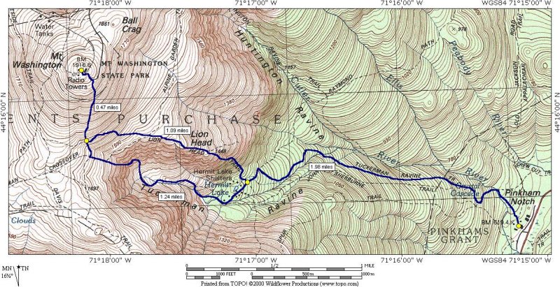
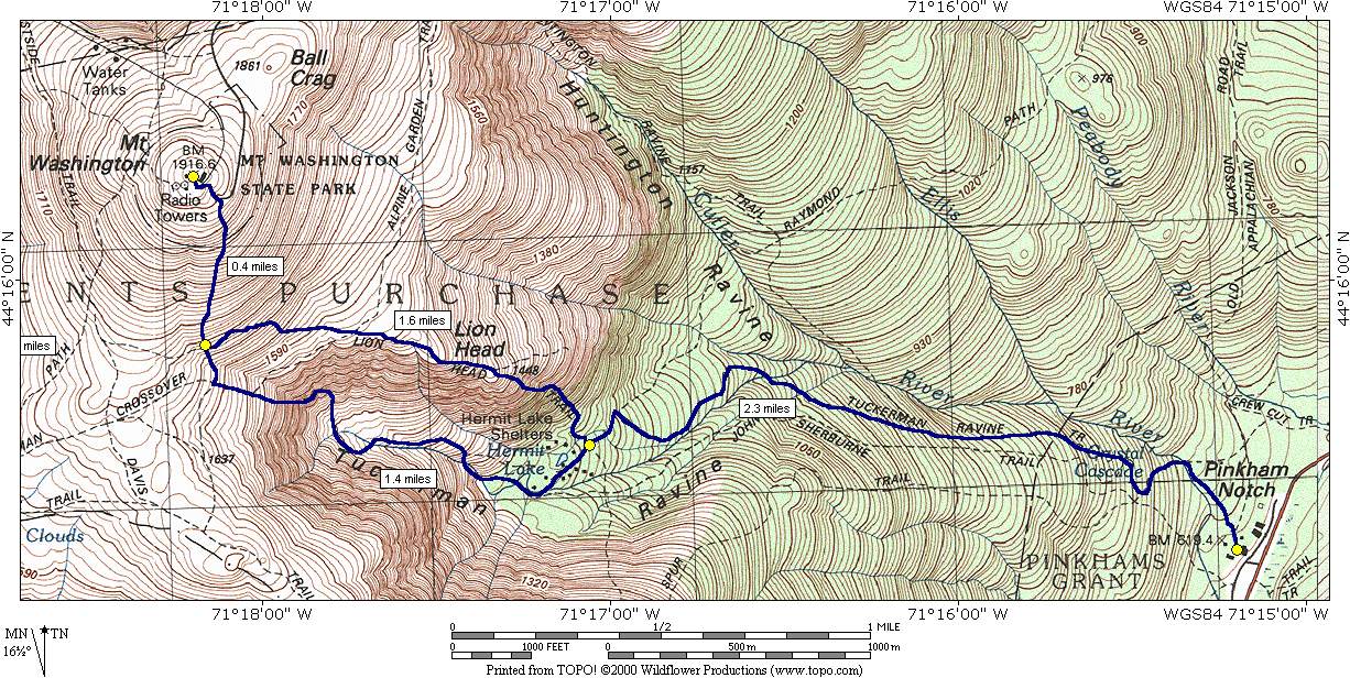
This day hike involved going along the Tuckerman Ravine Trail to the summit of Mount Washington, returning via the Lion Head Trail and the Tuckerman Ravine Trail:
|
The starting point for this hike was the Pinkham Notch AMC (Appalacian Mountain Club) Visitor Center on New Hampshire state route 16. Look for a sign behind and to the left of the Visitor Center that marks the start of the Tuckerman Ravine Trail.
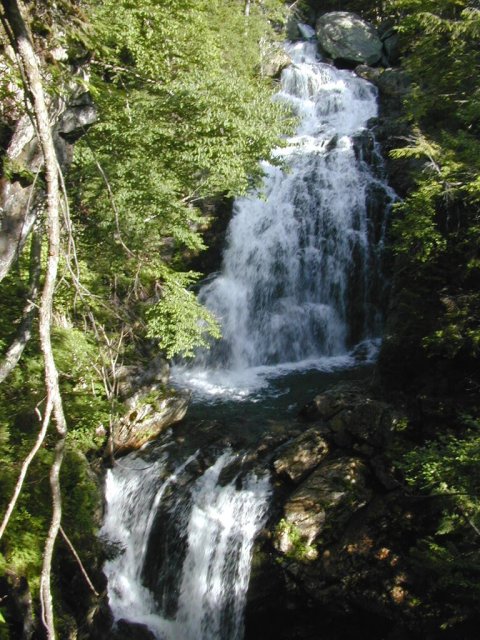
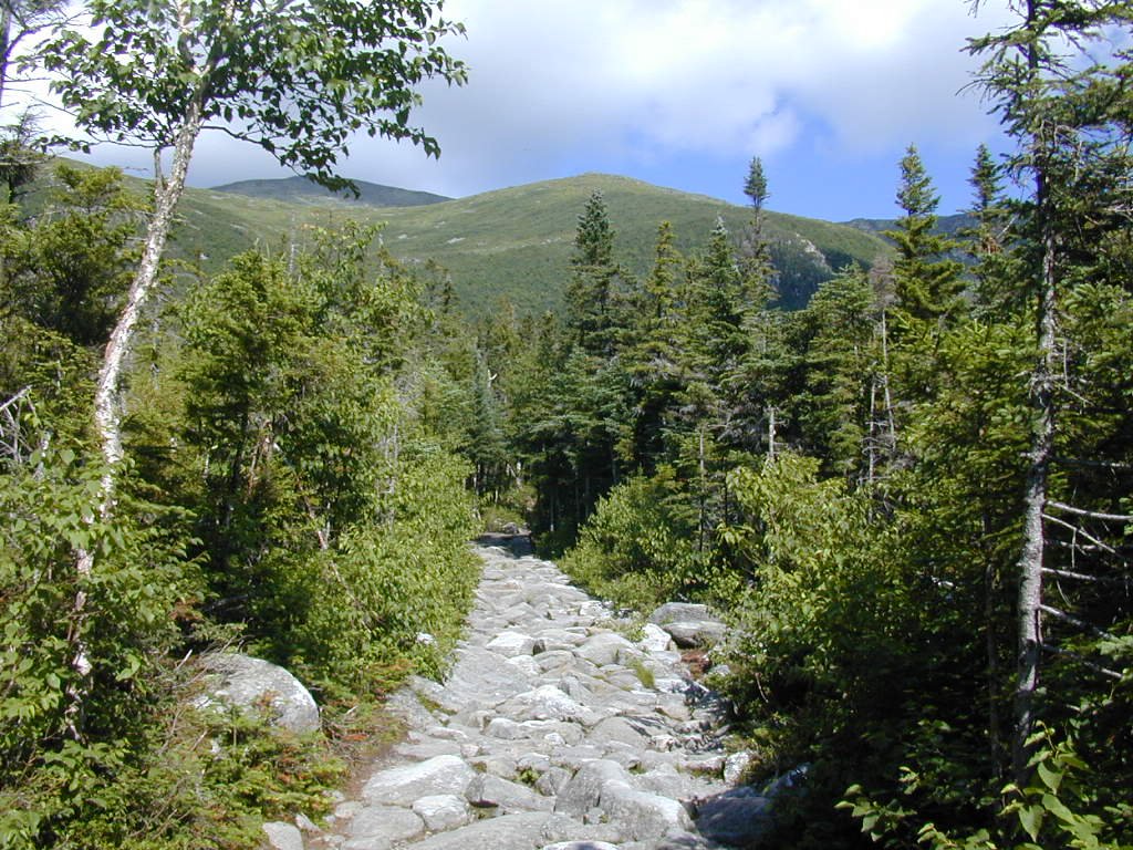
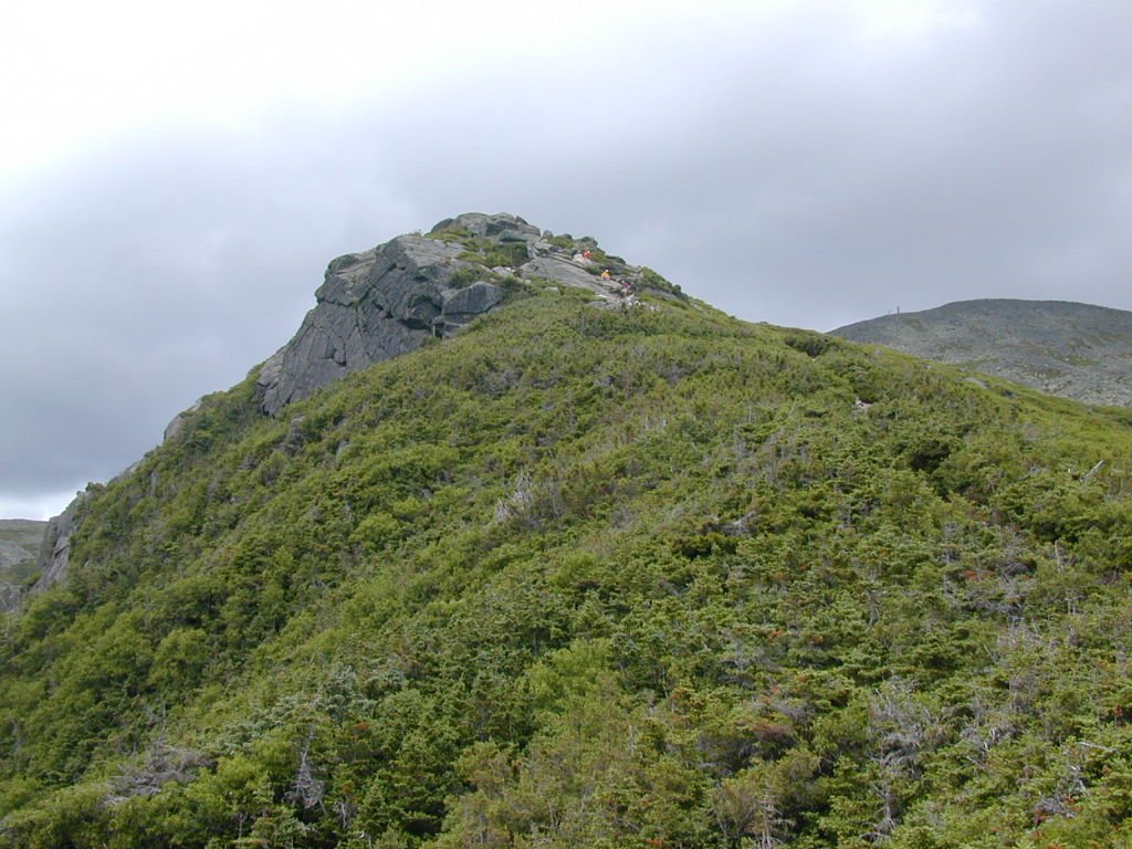
The trail starts off with very little incline for the first 1/4 mile or so and the pitch gradually increases after you cross the bridge over Cutler River and approach Crystal Cascade. Beyond Crystal Cascade the trail gets a little more steep but the steepness of this trail is not the hard part but rather all the large rocks that you are constantly stepping over and around. The origins of this trail are supposedly as a tractor road -- I would like to see someone get a tractor up this thing. Maybe if you took the tractor apart and packed it up on the backs of mules -- maybe. This trail is the most popular route to the top of Mount Washington but I do not think it is by any means the easiest. It is likely the most scenic, however, which may be the heart of its attraction.
|
The trail starts to get more reasonable after you pass the junction with the Lion Head Trail and soon becomes more trail-like. It remains this way past Hermit Lake and the shelters located there and for a short distance beyond, until it reaches the start of the ascent for the Tuckerman Ravine headwall.
|
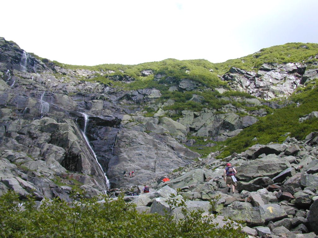
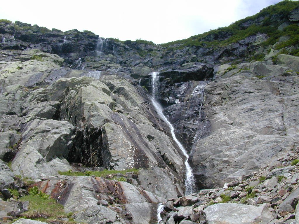
Once you reach the base of Tuckerman Ravine headwall the trail becomes much more of a climbing trail than a hiking trail. For the little more than a 1/3 of a mile that the trail climbs the headwall you will frequently be using your arms as much as your legs to climb up and over the boulders over which the trail ascends. It is along this section of the trail that some of the best views of the Pinkham Notch area are to be had. If you are lucky enough to be blessed with clear weather for your hike (which can be a rather uncommon experience when hiking in the White Mountains) you will more likely than not be astounded by the beauty of the area. Rest breaks from the climb become more and more welcome just to sit and take in the views as well as restoring energy levels.
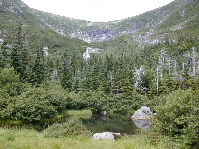
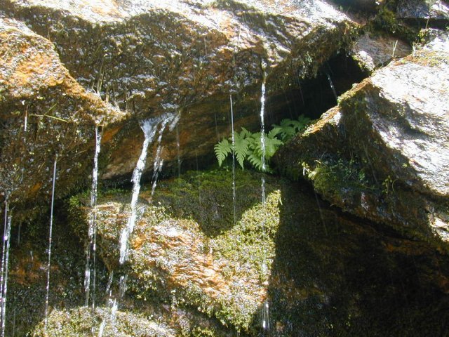
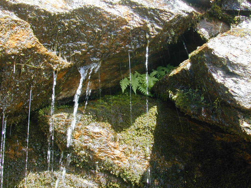
If you hike the Tuckerman Ravine Trail in late spring or early summer (sometimes until late June or even early July) there can still be snow at the base of the headwall and a magnificent snow arch typically is formed by the water as it cuts its way through the snow. If the snow arch is there please remember to stay clear of it and under no circumstances should you venture beneath. At least one person has died and several have been injured as a result of having pieces of the arch fall upon them while they were under the arch. Some of the blocks that break off can weight up to several tons. There is usually lots of water cascading its way down the headwall during the summer months and it appears to be alive with dozens of little waterfalls and cascades.
|
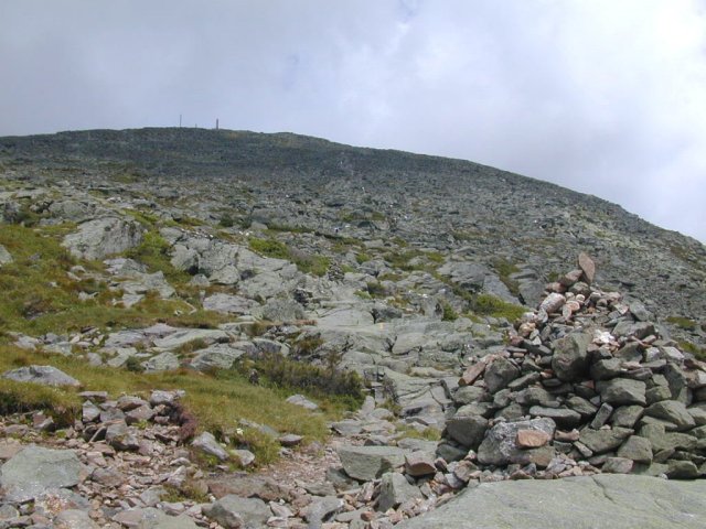
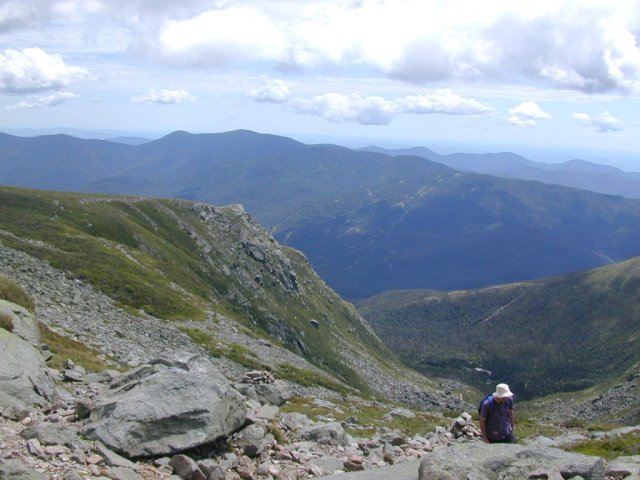
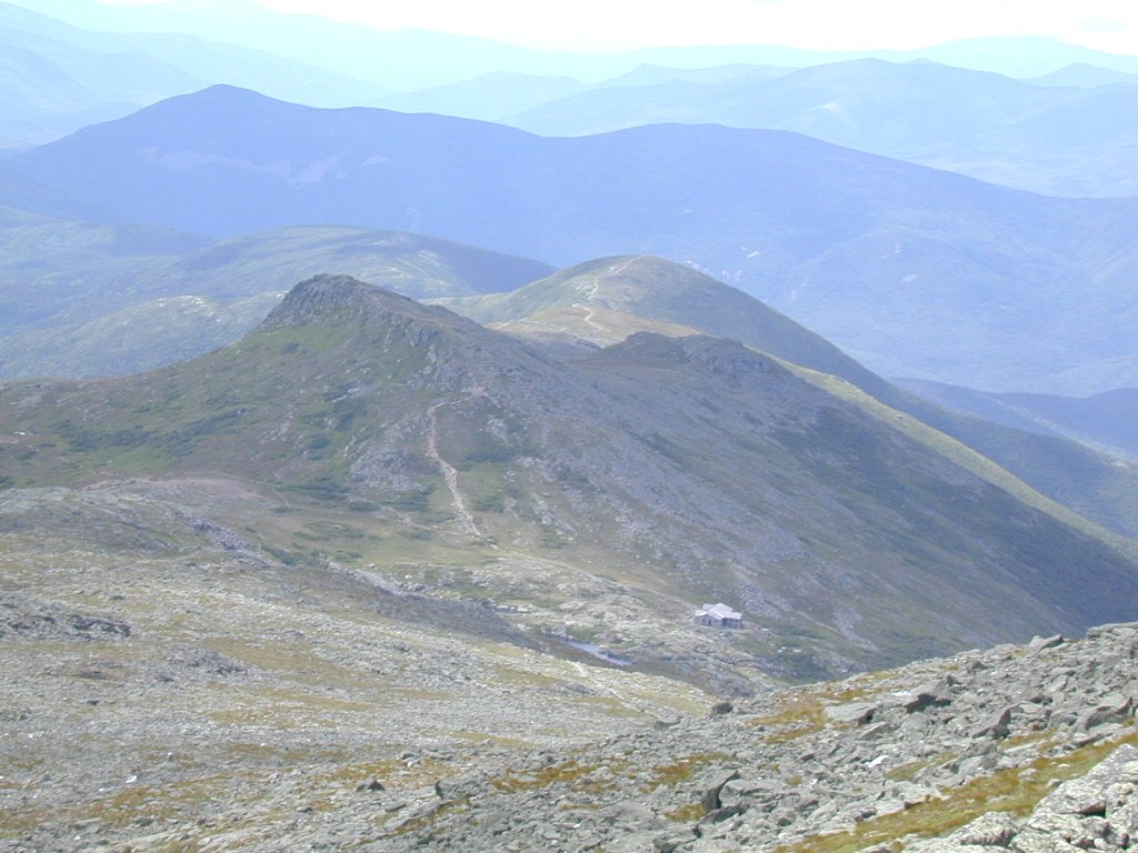
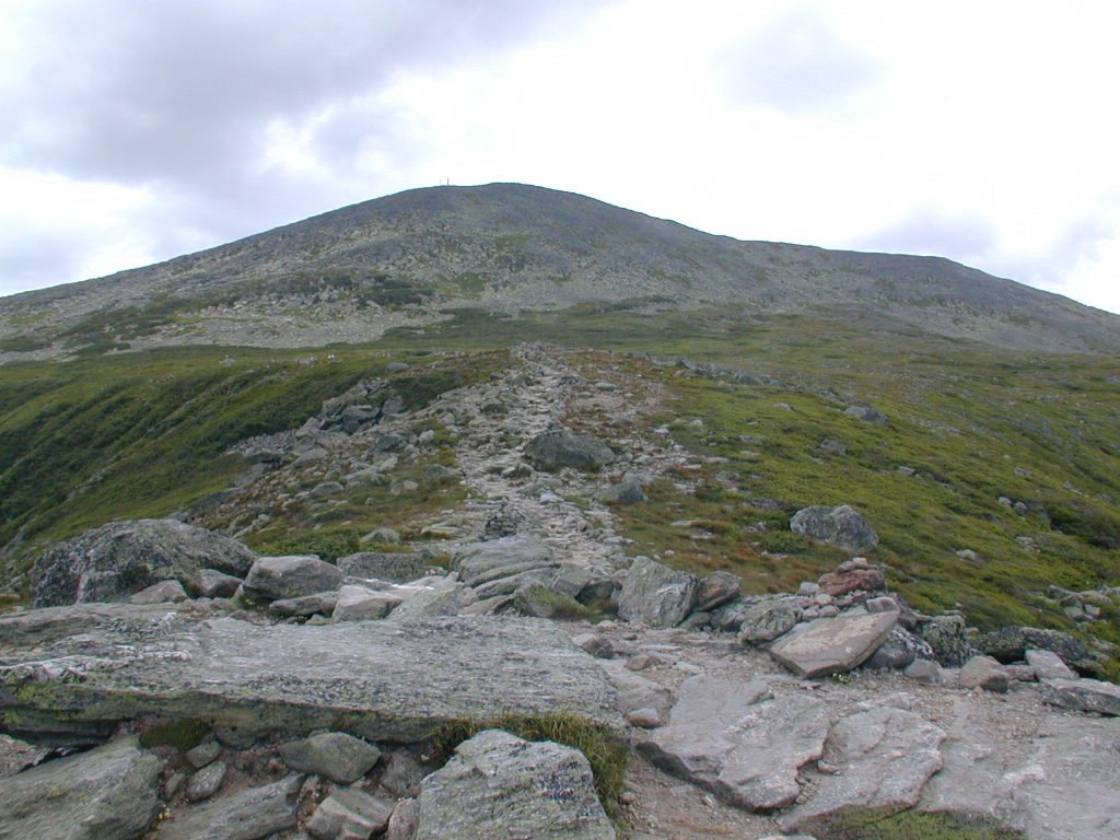
Above the headwall you will shortly enter the Alpine Garden and you can breathe a short sigh of relief. The trail becomes much less steep as you approach Tuckerman Junction, the point where the Tuckerman Crossover and the Lawn Cutoff intersect the trail. The Tuckerman Ravine Trail continues north up the cone of Mount Washington. The top of Mount Washington is marked by the antenae in the distance. After you pass the western junction of the Lion Head Trail the Tuckerman Ravine Trail becomes more difficult again. Ascending the cone of Mount Washington is not easy regardless of which trail you take to the summit and you will constantly find yourself navigating over and around the massive blocks of granite that make up the cone. The trail is well marked by both cairns and painted markings on the rocks but these can sometimes be difficult to locate if the summit is socked in by clouds. Make sure to take time to stop and enjoy the views behind you as you ascend the cone. The views of the Alpine Garden, Tuckerman Ravine and the Lake of the Clouds AMC Hut are all magnificent.
|
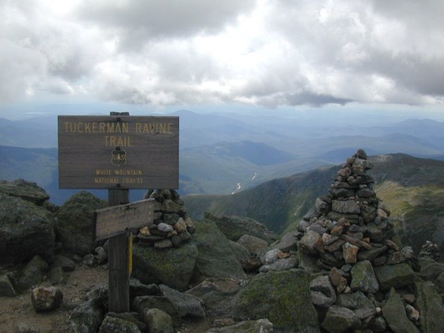
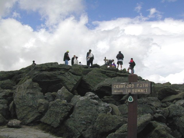
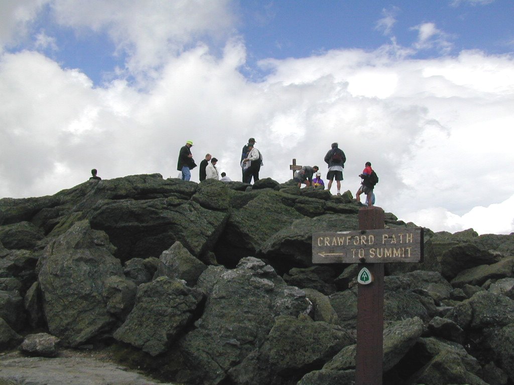
The final assault of the summit is less than a 1/2 mile from the Lion Head Trail and is typically done in about a half hour or so. It is unclear whether the Tuckerman Ravine Trail actually goes to the summit or not as it appears to end at the Auto Road. From there you make the final ascent via the Auto Road itself, a huge set of stairs and then finally the Crawford Path.
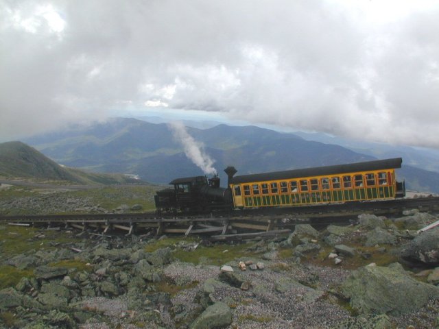
On the top of Mount Washington you will find numerous attractions to occupy yourself while you rest up for the descent: the Weather Station and its museum; the Tip-Top House, which was once a hotel; the Visitor Center; a couple of gift shops; a cafeteria; and the Cog Railway.
|
When I started this hike I originally intended to descend via the Great Gulf Trail, the Madison Gulf Trail and the Old Jackson Road Trail. Once at the summit, however, I realized that I had started the hike too late in the day to accomplish this and would need to change my plans. I started the hike at just after 8:00 am and reached the summit around 12:15 pm and the route that I had planned to use for the descent was about twice as long and I was not sure I would finish before daylight finally faded into darkness. After a little talk with the Forest Service ranger at the Visitor Center I decided I would give the Lion Head Trail a try since I had never done this and it would also bring me back to the Tuckerman Ravine Trail just below Hermit Lake.
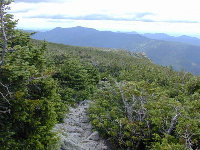
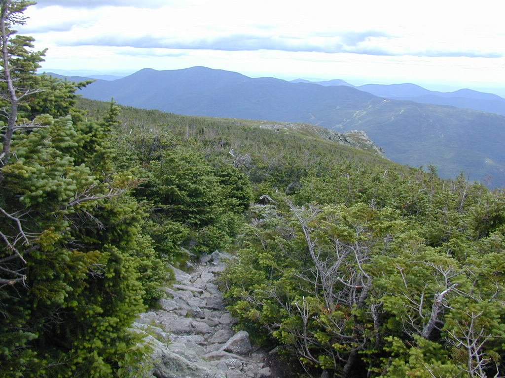
To get to the Lion Head Trail I would first have to start down on the Tuckerman Ravine Trail. The Lion Head Trail then branches off to the east near the base of the cone and heads out along the Alpine Garden. The views along this section of trail were spectacular and I thought that it was rather serendipitous that I had been forced into changing my plans and had lucked-out into using this trail. The upper portions of the Lion Head Trail are rocky in places but not too steep. The rocks are not nearly as large as those on the cone of Mount Washington or those to be found on the Tuckerman Ravine Trail and this section is more like a poorly cobbled path. There are a couple of steeper sections but nothing too tricky. The character of the trail changes drastically shortly after you descend past the Lion Head itself, at which point the trail becomes little more than a controlled (hopefully) fall down the cliff faces and through the forest below. The fact that the steepest part of the trail is in the forest does make the going a lot easier as there are plenty of trees, branches and roots to use to control your descent. At one of the trickier spots a set of stairs has actually been constructed to aid the descent.
When I finally finished the Lion Head Trail and arrived back at the Tuckerman Ravine Trail below Hermit Lake I wished that I was somewhere else - anywhere else. I did not enjoy coming up this trail and I knew that I would dislike it even more going down. It seemed to keep going down forever and my feet were screaming by the time I finally reached Crystal Cascade again. The trail was somewhat easier beyond that and I was very happy to be there and to know that Pinkham Notch was not very far away. It never felt so good to get out of hiking boots and back into sneakers again.
|
Part of the problem that I had with this hike coming down was the fact that I had brought the wrong set of hiking boots with me - a pair that I had retired because of problems they had been giving me. I held onto them hoping to use them for less strenuous hikes but come next trash day they are history. By contrast my next hike in the Whites, the following week, with the correct pair of boots, presented no problems at all even though it was almost two miles longer, much steeper and involved about 200' more in elevation change.
|
|
|---|
|
|---|


