|
Tonto and Grandview Trails, August 1994 |
|---|
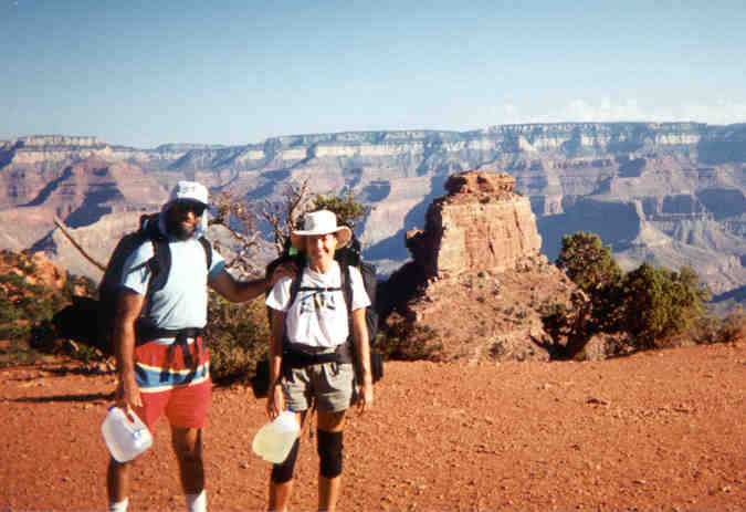
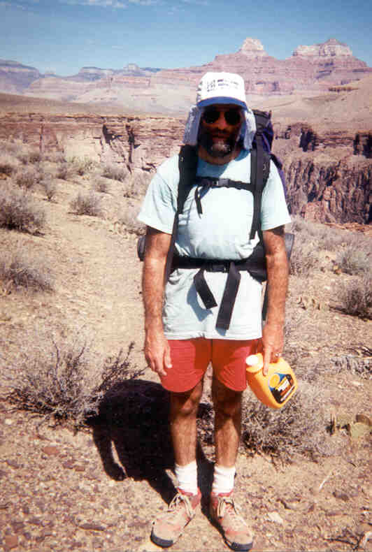
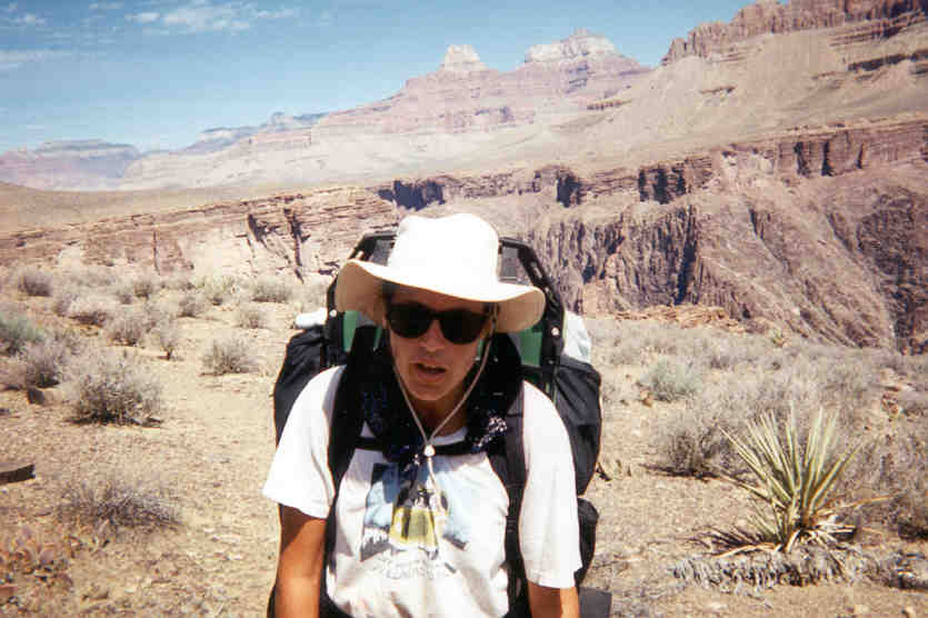
David and Sara
South Kaibab Trail from the South Rim
Photo by Bob Ribokas, www.kaibab.org
DAY 1
It was late summer, the absolute worst time of year to hike in the Canyon, don’t do it, like we do. We parked our VW van at the South Kaibab Trailhead (something you can’t do any more), late morning, and started our hike in the heat of the day, don’t do that either, as we always seem to do. The best idea is to camp overnight at the Mather Campground at the South Rim and start at the crack of dawn, but we never seem to manage it. I know what we said after the Tanner Trail hike. We have no worries about South Kaibab in the heat, though. True, it’s bloody hot, with little shade, but it’s down hill, and the “short” distance (7 miles) allows for ample rest. But don’t hike UP South Kaibab in the hot sun, you will fry.
About two and a half miles per hour is a good, steady pace, downhill or on the flat with a heavy pack, and in the summer it’s good to allow about the same amount of resting time as walking time. At least from Tanner we learnt to take plenty of water. The literature and the Canyon rangers recommend one quart of water per hour per person in the summer, and after Tanner’s tough lesson, I take one more quart for good measure. We took sports drink, too, even though true to the ranger’s predictions and previous experience we craved plain water after a while. But the electrolytes are a benefit. We kept swapping bottles.
Like every trail I have been on in the Canyon, South Kaibab is spectacular, thrilling, and absorbing. It is wide, wide enough for mule trains to pass backpackers if they (the backpackers) stand off to the side, and it’s well-maintained. We find the walking medium-difficult. It has some mildly steep and slippery places (no grades steeper than 1 in 18, we were told by a ranger), some loose rock and gravel, and puddles of mule urine adding olfactory interest. The main difficulty is in walking downhill for so long, it’s hard on the leg muscles, big toe nails, skin on all toes, and the knees. Shaky knee syndrome usually kicks in after a short time, but you just have to walk through it. Sara’s knees were holding up well, a bit of an unknown quantity after Tanner. Blisters are more or less inevitable. Take plenty of bandaids and moleskin and first-aid cream. I have a theory that boots one size larger than usual would be better on the toes for long downhill hiking. I’ll try it one day.
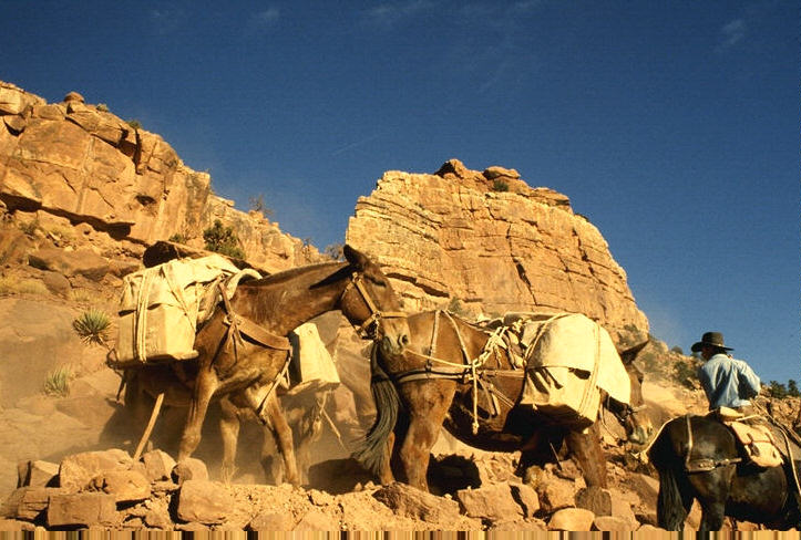
Mules on the South Kaibab Trail
Photo by Bob Ribokas, www.kaibab.org
Once or twice a day hikers have to step aside to make way for the mule trains. It’s not a problem, you get plenty of warning, and all you have to do is stand off to the side and stay still. No whacking the mules on the ass. Heh, heh. The mules are very calm and don’t spook easily, which is why they’re used instead of horses. People are more likely to fall off the trail than mules. No mule passenger has ever died, but a lot of hikers have. We also heard a story that when mules die of heart attacks, they collapse straight down instead of toppling over. A good trait. They don’t die often on the trail, but sometimes they do. The mules are very well trained, and serve an apprenticeship for years, walking the trails with baggage or freight before they carry people. Everyone we spoke to loved the trip, although there were a few sore spots. It costs about $300 including a bunk bed and overnight meals at Phantom Ranch. There is a 200 pound weight limit, so that rules out Yarno and Kyle. The main disadvantage of mules is their extremely fragrant urine, which is usually deposited in great quantity. The puddles it forms are just long enough so that of you hold your breath, you have to take another big gulp of air just BEFORE the end of the puddle.
We made it to Bright Angel Campground in time for Happy Hour at Phantom Ranch. The campground and the ranch are both at the bottom of the Canyon. They are only a few hundred yards apart beside Bright Angel Creek, which flows from the north into the Colorado River. The ranch has cabins, a dining hall (canteen), a ranger station, mule stables, and staff quarters. Happy Hour is a delightful custom where the dining room is open for a while, and they sell soda and snacks, postcards and stamps...and beer! You can get a postmark on your letters and cards that reads, “Delivered by mule from the bottom of the Grand Canyon.” I apologize if you haven’t received one.
We noticed that the ground squirrels, which had been a terrible nuisance for Sara and a group of school students on a previous visit, were curiously absent. We asked a ranger where they were, and he told us that they had moved to the other side of the river. We asked if it was some kind of migration, and he said, “Yes, I migrated them, I caught them all and took them over the bridge. They haven’t figured out how to get back yet, but I’ll be waiting.” He had caught about 200 of the cute little critters, one by one in wire cage traps. Probably baited with candy bars and beer cans, being what the squirrels were used to. Thank you, thank you, thank you, Mr. Ranger, from us campers! Those fat little beggars would beg shamelessly for food, and if that didn’t work, they would unzip zippers, or just eat right through backpacks, tear open trash bags, steal food out of your hand, climb the “squirrel-proof pole”, and steal your underwear! The human food diet wasn’t doing them any good, they were all fat as a soccer ball.
The ranger’s name was Sjors, a Dutch name pronounced “shaws”. We were to meet him several more times over the years. He’s a great source of information and interesting Canyon anecdotes. Look him up and say “G’day” if you’re ever there.
We also learned something quite amazing from the rangers, you can drink too much water! We were listening to a ranger give a talk, when all of a sudden another ranger dashed up and said something, then our ranger said, “Sorry, gotta go!”, and they both ran off. Later we found out that they had to subdue a large young man who had drunk about one GALLON of water per hour, four or five gallons in one day, and was suffering from pressure on the brain. He was hallucinating, fighting and biting. The rangers held him down, gave him a shot of valium and a $3,000 ride to Flagstaff in a helicopter. The illness is called “water intoxication”, and apparently is more dangerous than dehydration. Too much water and not enough food upsets the balance of sodium in the body. That’s why if you’re drinking a lot of water you need to eat salty foods. More proof that vegemite is good for you. The lesson is that if you need to drink more than a quart an hour then you’re asking your body to do too much and you could be in trouble, so stop and rest in some shade.
Another good lesson came when Sjors asked us if we were prepared for three days in the Canyon without water sources. We said that we were, we had several plastic gallon jugs to fill. Six quarts each per day for three days meant that we would start out carrying eighteen quarts each. The gallon jugs were the lightweight containers that usually hold water or milk in supermarkets, as pictured in the cover of this book. Sjors told us that one such jug he was carrying ripped open when it brushed an ordinary desert bush, and he had to delicately cradle the ripped jug with the remainder of his water in his arms, hoping that it would last. He suggested that we use smaller jugs so that if one burst open and we lost water it would not be so much of a disaster. Also, we should use thick plastic types, half-gallon juice containers are great because they usually have a good carrying handle. The rangers at Phantom Ranch had a stash of good containers which they happily loaned us, and threw our lightweight jugs in the trash. We returned the borrowed jugs to the Backcountry Office at the end of our hike. Since then we have carried bright orange Minute Maid 3-quart plastic juice containers when we hike in deserts, it’s our trademark.
DAYS 2 & 3
Our Tonto Plateau walk started with a steep hike straight up out of the Inner Gorge, with our packs at their heaviest. We had our three-day supply of water, eighteen quarts each, 36 pounds in water alone, and glad to have it. We had been told that we would probably come across a spring in Grapevine Canyon, about two and a half days away, but we shouldn’t count on it. That first climb was a killer. About a thousand feet rise in a mile or so. The trail was mostly steep switchbacks in dark red igneous rock, some of which was crumbly and loose. We were overjoyed to reach the relative flatness of the plateau.
When I first looked at the Tonto Trail on a map during our planning phase, it appeared to follow the river all the way from South Kaibab to Grandview. I pictured strolling beside the water, taking a dip whenever I felt a tad warm, using buckets of water for cooking, waving to the boaters...just a fun time in the desert by a river! Upon a closer perusal of the contours, however, I noticed that the trail was about 1,000 feet above the river. This would make swimming a little adventuresome. The trail runs along the Tonto Plateau, with the abyss of the Inner Gorge on one side and towering cliffs and escarpments disappearing upwards in layers on the other. There is a lot of relatively level hiking, many rolling eroded slopes, and the joy of the side canyons.
The side canyons tease you. You come up to one and see the trail continuing on the other side only a few hundred feet away. You look down for the short cut straight across, but there never is one. Several people have come to bad ends trying. So we had to turn away many times from the Inner Gorge, at right angles to our desired direction, sometimes for a couple of miles. The side canyons, and the side-side canyons, can add several hours to the planned trip time if you don’t watch out. A small scale map doesn’t do justice to the detours. Fortunately, we had been given a good set of contour maps by a very generous couple who were just finishing their Tonto hike as we were starting. We met them when we first came to the plateau after the killer hike out of the gorge at the place called “The Tip-Off”. It’s the junction of the South Kaibab and the Tonto Trails. They had enjoyed their days on the trail immensely, and encouraged us to head into the almost waterless desert, while they were only an hour away from cold beer. No wonder they were so happy. The maps proved invaluable later on when we needed to find a spring.
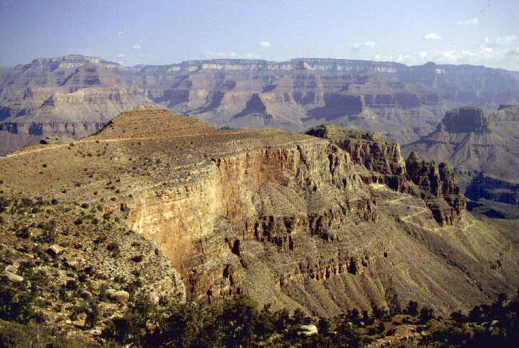
The side canyons are a treat, though, if you don’t mind the extra walking (and anyway, that’s why we were there). The trail changes character from its plateau route. At various times it runs across tumbled rock, through huge boulders bigger than houses, across loose scree slopes with rocks and pebbles tumbling down from each footstep, it teeters over rock overhangs looking straight down, skirts under the towering red cliffs of the Redwall hundreds of feet high, and then across the head of the wash right at the Redwall escarpment that is the start of the side canyon. The Redwall is the first row of cliffs above the Tonto Plateau, made of grey limestone but stained red with iron oxide from layers above. After you meet the Redwall, it’s the same distance back to the plateau. You see vegetation that differs from the low, spiky, water-jug-ripping bushes of the plateau. There are some larger trees back up the washes; cottonwoods, mesquite and palo verde, and we were lucky to be in the middle of a Century Plant bloom. These are an agave cactus, with a low spiky base, and when blooming a giant stalk rises twenty or thirty feet out of the middle. The stalks are astounding for sheer size, and the flower heads are brilliantly colored golden yellow, and a myriad of insects feasts on the flowers. They say these plants only bloom once every hundred years, and then die, hence the name. In fact, it’s about twenty years. But they do only bloom once, using so much energy to produce that monstrous stalk so quickly, that they kill themselves. We could see the older plants turning brown and starting to topple over. There is a big beautiful patch of Century Plants on the way to Botobolar beside the road from the Loaded Dog Inn near Mudgee, Australia.
Vista with century plant
Photo by Bob Ribokas, www.kaibab.org
Each day, around noon, we stopped and rigged up our ground cloth tied to some rocks for shade, and took a break for about three hours. It was well over 100°F (37°C), more like 125°F (52°C) in the sun, and resting during the heat of the day is another tip that we picked up from reading and the rangers. It’s common sense, too, if you’re an experienced desert hiker. But every hiker is an inexperienced one first, as the Tanner Trail had proven to us. Common sense isn’t always common. I appreciated the rangers’ advice. We would have lunch and doze. It was too hot to really sleep. Our midday breaks were like being in heaven, even with the heat. Part of it was the quietness, the remoteness, the staggering scenery, the immediacy of what we think of as real life, real nature, the lack of worry except that if we didn’t do the right things we might die. Part of it has no words.
In places, the trail is quite faint and a bit tricky to follow. There used to be many wild burros living in the Canyon, let loose by miners. None where we were hiking any more, they have mostly been relocated. But I have read that some survive in more remote areas. They had created a million trails in all directions like a maze between every little bush and rock. The trails last for decades after the burros are gone because of the hard ground, near lack of water erosion on flat areas, and very slow growth rate of desert plants. But you can’t get really lost for long, the landscape tells you where to go next. There are usually few alternatives between the inner gorge and the Redwall. Each night we found a flat place to camp, and Sara would build her snake-resistant wall with our boots on the open side of our campsite, and she would do her prayer-dance of appeasement to the snake god asking for a night free of the famous Pink Grand Canyon Rattler. So far, so good.
DAY 4
This day we were headed to Horseshoe Mesa, an old mining area up on top of the Redwall. We needed to find one of the springs marked on our maps, and described as “reliable” by a ranger, and confirmed by the two hikers we had met previously. The first was in Grapevine Canyon, the biggest of the side canyons, the second was in a smaller side canyon, Cottonwood, at the foot of the climb to Horseshoe Mesa.
When we reached the head of Grapevine, all was dry. No water in sight. There was a nice resting spot, though, with a flat sandy floor in a dry wash, and some decent shade trees. Dry washes are not good spots to be if there’s any rain about, flash floods are sudden and severe in desert canyon areas. You shouldn’t ever camp in a dry wash overnight, even if you think that there’s no rain in a desert in summer, especially if you have been out of radio contact for a few days.
A rest was not on our schedule, so we pushed on. Alongside Grapevine, the trail came perilously close to the edge of high, over-hanging cliffs, with only a narrow piece of level rock between the talus slope and the drop. It was a bit scary. At that point, we realized that we were hearing some background noise, and very gingerly leaned over to take a look. It wasn’t wind, but running water! We looked over the edge into Grapevine Canyon and saw a rushing stream far below. Too far to climb down to, and we had gone too far to retrace our steps to the head of the canyon and follow the stream bed down. So we stood there, panting in the dusty heat, watching all this cool, clear, fresh, inaccessible water, thinking, “Only another couple of hours of walking to another reliable spring, just like this one. A refreshing soak in a shady pool, a late lunch in the shade, a nice cup of tea. And strength for the climb out.” We were so entranced by this vision, that when, still beside Grapevine, a barely-flowing trickle of scummy water crossed our trail, we didn’t even fill our water bottles. I just wet my bandana and put it on my neck. It felt good for ninety seconds before all the water evaporated.
Finally, still early in the afternoon, we saw Horseshoe Mesa ahead, and came to the side canyon with the reliable spring. It was even marked on the map, “Spring”. We found a lovely shaded spot for lunch, and went searching for the “swimming hole”. We followed a dry creek bed up, came to some promising vegetation, even a large batch of reeds. Reeds mean water! We found a wet patch of ground amongst the reeds about a foot square with a frog sitting in it, and knew we were close! Just follow the reeds and the creek bed a little further. We did, but no more water. The reeds petered out, and the desert prevailed again, then the Redwall. We realized that the wet patch of dirt was the spring!
Boy, are we having fun!
The scummy trickle that we disdained at Grapevine was a river compared to this. Fools! Never pass up water in the desert!! Another lesson.
Nevertheless, we moved the frog, scraped out enough mud to make room for a cup, and started to fill our bottles. Our refreshing dip became a wash with a cloth, and it felt pretty good anyway. At least we now had some water to spare for a wash. For drinking, we had to let the water sit for a while to let the brown crud sink to the bottom, then pour off the top. We boiled the water to purify it, which turned out to be a problem for the hiking fools when it was time to leave. We had three gallons of hot water in plastic containers that were softened by the heat to pack in our backpacks, hoping they wouldn’t burst. At that time, we didn’t trust purifying tablets, but we hadn’t foreseen that we would be carrying hot water on our backs. We have since bought a pump with an iodine filter which works well.
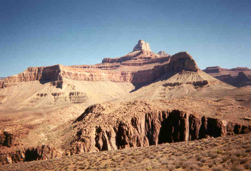
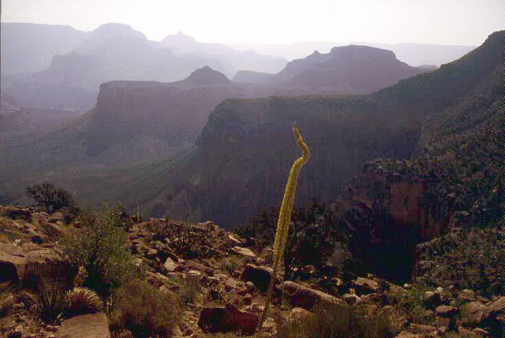
Zoroaster Temple, across the inner gorge from the Tonto Trail
The climb to Horseshoe Mesa looked to be a steep one. At first, we saw an erosion gully cutting vertically through the very steep escarpment, and said to each other, “Well, that can’t be the trail.” But it was! No other route presented itself, and the map confirmed the location. It was a real scramble requiring hands and feet and knees over loose rocks and slippery sand, then some precarious cliff-hugging ledges and rock clambering in a chimney in the Redwall, up to the saddle between the next row of cliffs and the mesa, which is a high, rocky point with a flat top. We passed a huge pile of old rusted cans from former mining days over 100 years ago, and the ruined walls of a stone cottage. There were also tailings piles and shafts of old mines.
We set up camp on the saddle, about 600 feet above the Tonto Plateau, in a flat area covered with small stones. There were magnificent views back west down the canyon where we had been, and east to where we wanted to go in the future, and towards the dreaded Tanner Trail. The Tonto Trail continues westwards to meet up with the Tanner. An inviting prospect. A spectacular sunset kept us enthralled for what seemed like an hour. And millions of stars gradually appeared in the blackest of skies. We knew that a full moon was going to rise later that evening, so we planned to leave before dawn for the final hike up to avoid the heat.
A little while after dark, as we were looking at the stars and talking, we heard a faint, strange, distant sound echoing from above. Gradually it came closer and became clearer, and we recognized a pleasant male tenor voice singing songs from musicals. We waited, entertained by the serenade, and at last some black shapes appeared on the dark trail, and became two youngsters and a man. We called out to them, and they came over to chat, equally as surprised as we were to meet anyone at this time and place. We enjoyed a long conversation with the enthusiastic father and tolerant daughter and son, aged about ten and twelve. It was Dad’s idea to hike in the dark, but the kids were obviously enjoying themselves, too, while Mum stayed at the rim in a hotel. They told us about many of the constellations we could see, and in turn, we taught them all the words and the meaning of “Waltzing Matilda”. The dad played a tune on his flute for us, and apologized for not having his saxophone, which his kids had persuaded him not to bring.
After goodbyes and goodnights, they moved on down the trail a little farther to set up their own camp, leaving us with the stars and the silence again. We were talking quietly, drifting off, when I heard a noise that I had never heard before but which I instantly knew. It was the sound of scales sliding over stones. It was coming from my feet and approaching my face. We had no tent. But I was only a little worried because I had heard that the Grand Canyon pink rattlesnake was not aggressive and reckoned that it would probably just slither by. I became unnaturally quiet and still, and Sara said, “What’s up?” I saw the pink head come into view sliding past my face about twelve inches away. I could tell that it was just on its way somewhere and wasn’t concerned about us, but I had to say something to Sara or she would have done something silly like whack me over the head. I said, as calmly as possible, “Well, there’s a snake going by.” She did something silly anyway. She yelled, “What!”, and jerked up onto her elbow raising her face above my head. She and the snake locked eyes above my face for a brief instant that proved Einstein’s Theory of Relativity. That instant was relatively an eternity. Then they both leaped backwards about twenty feet. The snake rattled at us when it was at a safe distance and then continued on its way. Somehow, I found that I was standing, so I said, “OK, it’s gone, let’s go back to bed.” But Sara was packed and headed up the trail already, saying, “I didn’t do my snake dance! We aren’t staying here. We’re hiking out! Come on! Hurry up!”
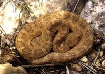
Pink Grand Canyon rattlesnake
Photo by Bob Ribokas, www.kaibab.org
So at about 10 pm, we headed up the trail, which hugged the side of Cottonwood Canyon, gaping to our right. The moon had just risen on our left, and was shining on the rocks across from us. The moonlight was not falling on our trail, but there was just enough reflected light to pick out our way. We whacked our shins on boulders a couple of times, though, and lost the trail for brief spells. The side of the trail often disappeared into a bottomless black void inches from our feet, pebbles dropping over the edge and never landing. At one point we realized that the void was on both sides of the trail, which was on a narrow, rocky ridge with loose gravel on both sides. Later, we thought that we might have been lucky not to be able to see what was below.
The moon continued to rise, and we had increasing light as we hiked upwards. But there were a few really frightening sections. One was the Funnel of Death, a loose gravel slope shaped like half a funnel, with the narrow opening hanging ominously over the blackness. The trail across this death trap was the width of a single boot. With each step, stones tumbled down the funnel and plunged silently into the void. Sara took one look at this and sat down, refusing to budge. I reasoned with her, suggesting that maybe we could wait till daylight, “No! It’ll be scarier then!” Finally, I crossed the Funnel of Death, then came back and took Sara’s pack across. She was still refusing to move, when suddenly she changed her mind and came across in a kind of hands and feet crawl, clinging to the slope and cursing every inch. After the Funnel of Death was the Giant Stairway. Stone steps built on the side of a vertical cliff to the biggest dimensions that a burro could step, which was about four feet (a meter and a half). Too high for a normal person to step up, so we had to lean over with our chest, throw one leg up and then clamber over using our hands to pull ourselves up. We later found out that the Giant Steps were supported off the side of the sheer cliff by 100-year-old timbers. We decided that the dad we met at the bottom with his two children was definitely crazy starting down this trail at dusk, especially when he had been there before and knew what was ahead.
Then there was the Extremely Narrow Ledge. I turned at one point to talk to Sara, but the trail was so narrow that my backpack hit the cliff wall and would have pushed me over the edge had I kept turning. When my heart stopped racing, I talked to Sara by slightly turning my head and yelling, “Don’t turn around!”
We kept looking up in the hopes of seeing the last ridge silhouetted in black against the starry, starry night. But it’s a trick of the Canyon that the ridge above you is almost never the last one, but you think and hope it might be. Each cliff top except the last reveals another escarpment and another cliff, so that when you are actually at the top you don’t quite believe it. However, we knew we were there when we heard voices, and then saw a young couple with no hiking gear sitting on a rock looking out over the vast and beautiful moonlit Canyon. We said hello, hating to disturb them, and a few seconds later came out on the parking lot. It was 1.30 am.
We sat on a low stone wall in a daze for a while, contemplating the fact that our van was parked seven miles away, considering our options. A three hour walk, with or without backpacks. Or one person walk and drive back. Or, wait and ask the young stargazers for a ride. There was a station wagon parked nearby, with room for two smelly hikers and their packs. We waited, not too long, and the stargazers strolled up the trail. They were, it seemed to us, at the start of a beautiful romance and at peace with the world. They readily agreed to give us a ride, no doubt recognizing kindred spirits in the two tired smelly hikers who were in the middle of a beautiful romance and at peace with the world and seven miles from their vehicle. We apologized for our four-days-without-a-shower-hiking-in-the-summer-desert aroma, and traveled with the windows open wide. The guy’s name was Dave (what a beautiful name, I said), and the girl’s name was Misty Blue. She was Navajo Indian, but her name is from a Jimi Hendrix song, which happens to be my favourite. She said her parents were hippies, not a surprise. They both worked at the South Rim tourist village, and luckily for us decided to take in one of the most spectacular panoramas in the world on the full-mooned Night of the Rattlesnake.
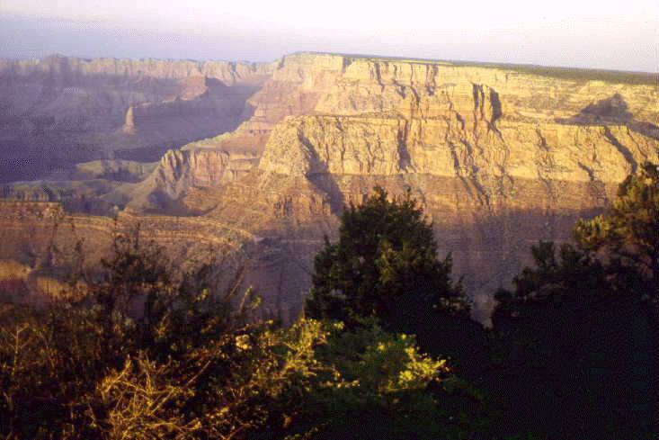
View from Grandview Point on the South Rim
Photo by Bob Ribokas, www.kaibab.org
Back at our van, we were too tired to try to wash, we just threw down our packs and fell asleep, but first we put on clothes with long sleeves and long pants so we didn’t have to smell ourselves or each other. The night was cool enough and we slept well until the sun hit us. Then it was time for some of the great rewards of hiking in the Canyon - a shower at the campground, a big meal and a beer in a restaurant.
Copyright © 2003, by David Sheppard, Belleville, Illinois
|
|
|---|
|
|---|