|
I got up at 4 am and broke down camp and packed it all up under flashlight. I had no breakfast in camp and would stop on the trail somewhere to eat something. By the time I was ready to go, at 5 am, there was just barely enough light to see by and I had to use the flashlight to find some of the cairns as well during the ascent out of Garnet Canyon. The trail seemed easier to following on the way up that it had been on the way down and parts of it did not seem familiar so I expect I may have taken a slightly different route out, at least in the lower portion. Some parts in the upper section were very difficult little climbs up small overhangs where two hands were definitely needed. Finding the correct positioning for my feet to get over these things seemed to be the biggest problem. I don't remember having to do any of that on the way down. I was out of Garnet at 5:20, back on the Tonto Trail proper at 5:30 and out at the river overlook at 5:35. There was a river party camped on the other side of the river. Everyone was still asleep so it was probably a private trip.
I passed through the three smaller drainages before getting to the first of the larger, nameless, side canyons. At 6:10 I stopped for some breakfast and to watch the sun come up, or actually watch the shadows go away. I also mixed up some Gookinade. At 6:45 I started again and passed through the first of the nameless side canyons on the way to Copper. I was finally out in the sun when I reached the other side. I stopped for another short, 10-minute break at 7:30 just before entering the pair of nameless canyons near Walthenberg Rapids. I knew that today was going to be a long day and knew that I would need frequent rest stops to get through it. Once moving again it took about 25 minutes to negotiate the first canyon of this pair and just over an hour for the other, finally coming back out to the river at 9:15. I crossed a few other, smaller drainages on the way to Copper and arrived there at 9:55, stopped just short of it for another rest and to mix more Gookinade.
Shortly after I started hiking again I ran into a pair of hikers heading west. They asked about the conditions in Garnet and at Elves, which they were planning on day hiking to the next day, and I gave them an update. I warned them about Mr. Bee and about the sharp limestone on the way over to Elves and asked if they had gloves. One of them did but the other didn't so I gave him the ones that I had brought along, they were cheap and I was not likely to be needing them again on this trip. We talked for a while and they told me that there was water in Copper if I needed it. When I looked at the watch once I started hiking again it was already 10:15 and I was running behind schedule. I had wanted to be on the other side of Copper by noon.
At 10:37 I started into Copper and ran into some more people that wanted to talk. The first was a pair of women who were other members of the party I had encountered earlier. I gave them the same update and neither of them had gloves either. Oh, well. The second party that I encountered was the man and woman that I had met hiking out of Bass on my first day. They had their fresh supplies and were also headed over to Garnet and Elves. I warned them of the other party, ahead of them, and said that it would probably be crowded at Garnet tonight. I also told them about a another good campsite which was on a nice little beach between Garnet and Elves. They seemed more interested in that than in sharing Garnet. At was 12:15 before I finally got out of Copper and it was starting to get warm. The morning had been wonderfully cool for the most part and I still felt pretty good. I had a good number of miles behind me and hoped that I was better than halfway to my destination, whatever that was. I knew that I was getting close to Bass and would be happy to retrieve my water cache. I still had one full two-liter bottle of the water from Elves Chasm and a little less than a liter in the other bottle. I continued on and started looking for some shade to stop and take a lunch break.
I finally found some at 12:40 but it required me to leave the trail and climb down over some overhangs to get to it. This was in the little drainage just to the east of Copper that I had confused with Copper a couple of days earlier. It was a very nice lunch spot, under a large overhang, with lots of shade. I took off my boots and socks and checked my feet and they looked and felt OK. I planned on staying here a while, until 1:30 or 2, and so I left the boots off while I made myself some lunch. There was a nice cool breeze blowing up from the river and it really felt great, especially on my feet. The view from this location was spectacular as well.
I was going to wait until 2:00 to start hiking again but I knew that I was running behind schedule and so started back up a 1:40. At 2:30 I reached the junction with the spur trail down to the Bass Overhang Camp and at 3:15 I reached the junction with the South Bass Trail.
As I headed north along the combined South Bass / Tonto trail to the junction with the Tonto Trail east I was becoming worried. None of this looked familiar at all and when I finally did reach the Tonto east junction I had no clue where my water cache was. Nothing looked familiar, nothing at all. I walked further down the canyon thinking that maybe there was another junction with the Tonto east but never found one and ended up in the bed of Bass Canyon. This wasn't right. I then back tracked to the first junction and dumped my gear and set off in search of the water. I walked back to the Tonto west junction and then further up Bass canyon hoping for another junction up there. No such luck. What the hell was going on here! I continued back down the South Bass, was there another branch of the South Bass Trail, someplace? If there was I couldn't find it. This was getting ridiculous. No, I really didn't "need" that water but it just annoyed the crap out of me that I couldn't find it. I walked back to where I had left my gear and was ready to just give up and leave it, I was wasting too much time and still had some miles to cover. I did still have a full two-liter bottle from Elves and that should get me to Serpentine. But the water had to be here, I cached it right at the junction of the South Bass and Tonto east, I know I did. I looked around again, still nothing familiar, there were some rocks off to the west but they didn't look right. I remembered a pair of very large boulders with a gap between them and I just didn't see that here. I went to take a look anyway and the closer I got to them the better I felt. They were pretty large and had there lower portions had just been obscured by brush when viewed from the trail. I walked around the side and there was a gap between them and there were some rocks piled in there and under those rocks I found my water. Duh! No, I didn't need it... but I wanted it regardless. The moral of the story: Usually what you need most is standing there right next to you, as long as you're not too blind to see it.
I was finally on the trail again around 4 pm and could not believe the time that I had wasted. I still felt pretty good though my feet were tired from all of the running around in Bass Canyon. I found some shade and sat down and rested for a while to give them a break. At 4:30 I was moving again and at 5:30 I reached the west side of Serpentine. I was now in the Ruby Use Area and could camp anywhere I wanted. I really like the wide, open feeling that you get on the Tonto Platform, and it was really nice out there but I knew that I could make tomorrow even easier if I could get a little further today. I decided to shoot for the backside of Serpentine and hopefully a wet camp as opposed to a dry one. It took over an hour to get back up into Serpentine, arriving there at 6:40. Serpentine is a very long canyon and has numerous side canyons that seem to take forever to negotiate. There was water flowing but it was dark back there and the sun would be setting soon. I had a serious problem in trying to find a level patch of ground big enough to pitch my tent on. I tried a couple of locations before I found one that would work. It was not completely level but it would do. After setting up camp I headed down to the creek to top off all of my water bottles. I was exhausted and had no interest at all in eating anything. I knew that this was not a good thing but I just could not force myself to cook and eat Lipton Noodles and Sauce right now. I felt OK but I really wanted to sleep. I forced down some of the snack mix and drank some Gookinade before crawling into the tent. When I took off my boots I noticed that one of my heels was screwed up. The moleskin had come loose and had rubbed off some of the skin and when I removed the moleskin a bunch of my skin came with it. It did not feel nearly as bad as it looked but I wondered how I would patch it up in the morning.
Serpentine also had a fairly large and very vocal collection of residents but nothing was going to keep me awake tonight. I did wake up a number of times throughout the night because my sleeping bag kept sliding down the slight incline that my tent was pitch on. I would just wake up long enough to get it back up to the top of the tent and then go back to sleep.
|
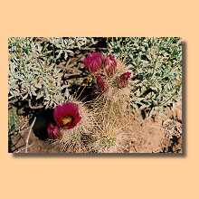
Brittlebush in bloom in side canyon
|
Beavertail cactus in bloom
|
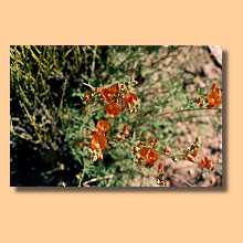
Globemallow in bloom
|
Globemallow in bloom
|
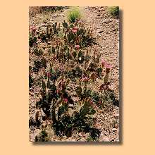
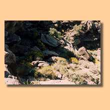
Beavertail cactus in bloom
|
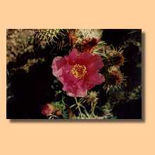
Beavertail cactus in bloom
|
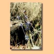
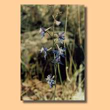
Colorado Columbine in bloom
|
Colorado Columbine in bloom
|
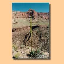
Banana yucca and unnamed butte (two days later)
|
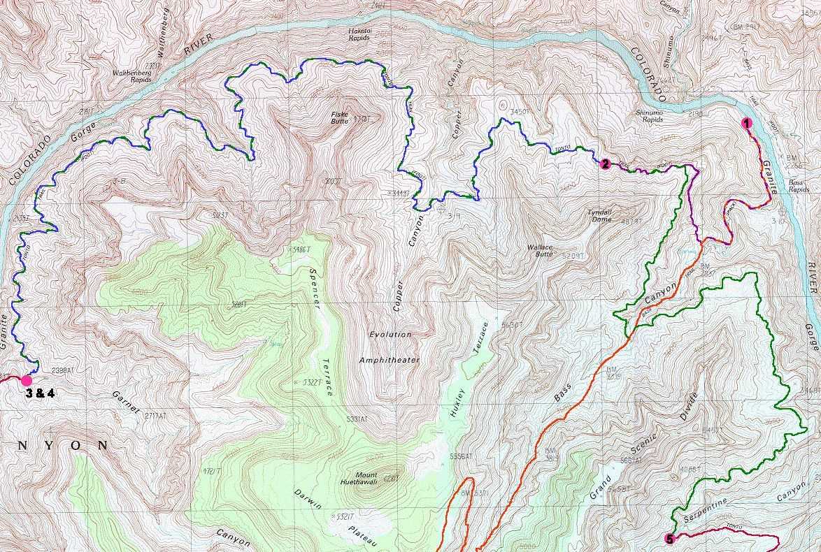
Bighorn sheep
|
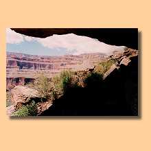
Shady overhang used for lunch and mid-day rest on day five
|
Spencer Terrace
|
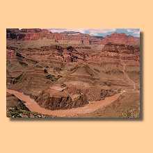
Shinumo Creek and Rapids
|
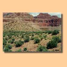
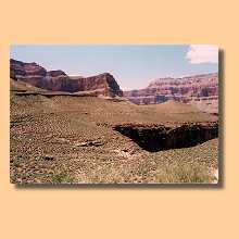
Approaching Bass Canyon
|
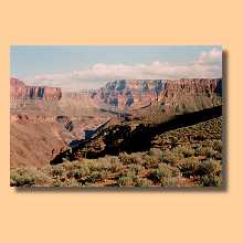
Approaching Serpentine Canyon
|
|