|
Natural Bridges National Monument |
|---|
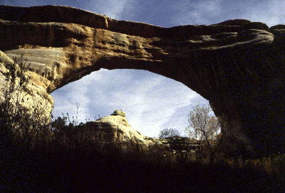
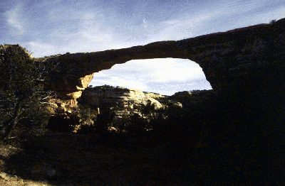
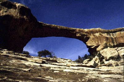
Natural Bridges was declared a National Monument in 1908 by President Theodore Roosevelt, at which time it was the first one in Utah. The monument is comprised of three natural bridges, which are pictured below, their names being Kachina, Owachomo, and Sipapu. I don't remember which picture is which. The longest bridge is Sipapu, which has a span of 268 feet. All of these bridges were formed by water undercutting the limestone of which they are formed.
The park also has a visitor center and a modern campground, with water being available at both. An eight-mile, paved, loop road provides access to all of the bridges from the visitor center.
Numerous petroglyphs (ancient rock drawings) can also be found throughout the park, some of the best being located on the walls of the bridges themselves.
The park is located on UT-95 about 50 miles west of Blanding, Utah and the junctions of UT-95 and US-191. This stretch of highway is known as THE TRAIL OF THE ANCIENTS and features many other noteworthy attractions: Edge of the Cedars State Park, Westwater Ruin, Cottonwood Falls Site, Butler Wash Rest Stop, Comb Ridge, Arch Canyon Overlook, Cave Towers, Mile Canyon Ruin and Rest Stop, Salvation Knoll, and Grand Gulch Primitive Area.
 GIF, 400 x 272 x 256, 64K
[big], JPG, 768 x 523 x 256, 63K
 GIF, 400 x 252 x 256, 48K
[big], JPG, 779 x 512 x 256, 49K
 GIF, 400 x 263 x 256, 75K
[big], JPG, 778 x 512 x 256, 79K
|
|
|---|
|
|---|
![[big], JPG, 768 x 523 x 256, 63K](gc_oa_b1.jpg)
![[big], JPG, 779 x 512 x 256, 49K](gc_oa_b2.jpg)
![[big], JPG, 778 x 512 x 256, 79K](gc_oa_b3.jpg)