|
A Day Hike in New Hampshire's White Mountains |
|---|
OK, so it's not the Grand Canyon. But, people I meet on the net are frequently asking me what I do for hiking when I am not in the Grand Canyon, so I decided to put together this little page to finally answer that question.
The best place to go hiking if you live in or near Boston is White Mountain National Forest (the "Whites") in New Hampshire. There are hundreds of miles of trails through the Whites and many of these lead to some fantastic views. My favorite trails are the ones that go up Mount Washington (6288') and other mountains in the Presidential Range; and also those in the Franconia Notch area. As far as I am concerned if a trail does not make it above the tree line then it's not worth hiking. The biggest problem with hiking in the Whites is that the lower portions of the trails are in the forest and you don't really get to see much except for lots of trees and undergrowth. When you finally gain enough altitude to break out of the trees the views are magnificent. Below are a couple of links to good White Mountains web sites:
The hike that I will talk about here goes up the Old Bridle Path to Greenleaf Hut and from there to the summit of Mount Lafayette:
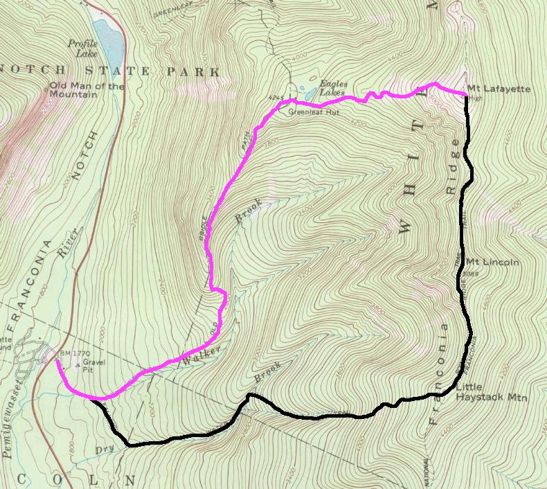
Click here to view a topo map showing the trail. We ended up only doing the portion shown in purple.
The vertical ascent from the start of the trail to the summit of Mount Lafayette is 3,490 feet and, in the Canyon, the hike would probably be equivalent to hiking from Indian Gardens to the south rim and then back to Indian Gardens. The nice thing about hiking in the mountains is that you get the uphill part done first.
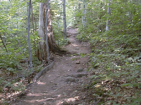
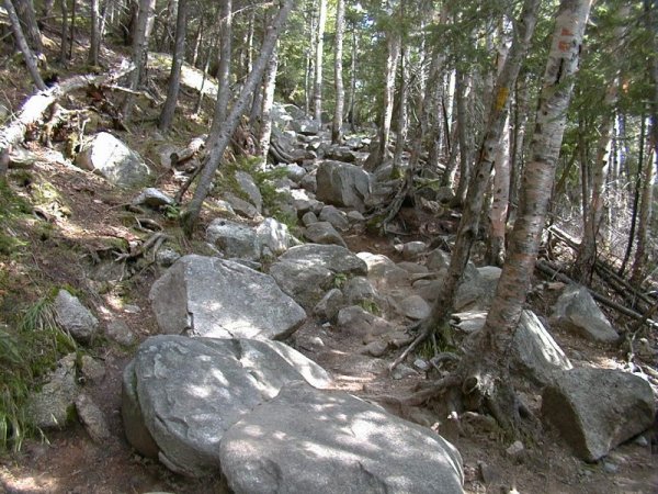
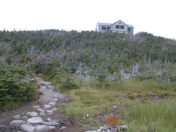
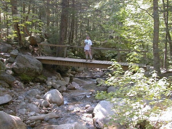
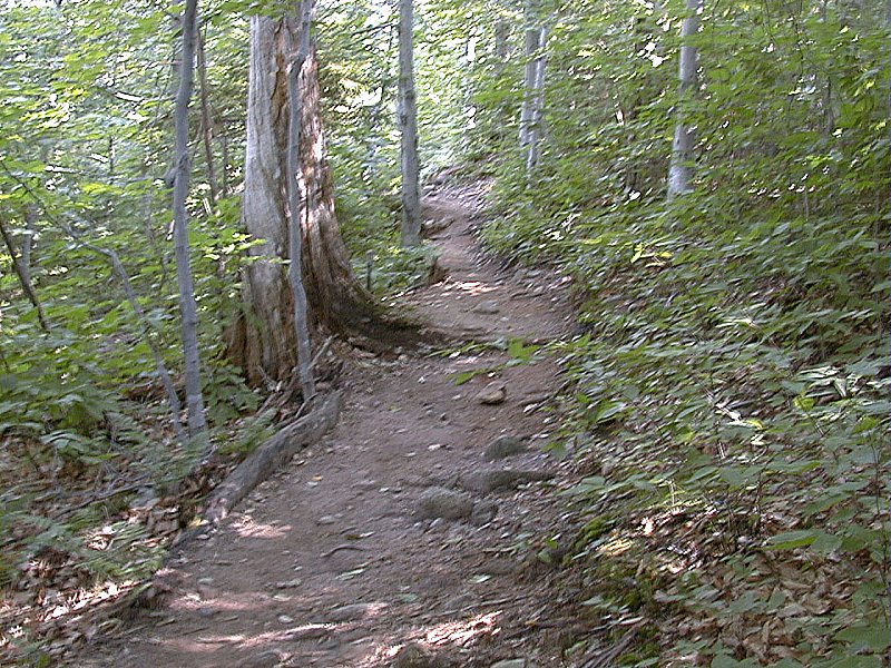
We started our hike at around 8:30 am. From the parking area the trail winds its way through the forest for a couple of miles before finally breaking through the canopy of trees. Luckily the morning was nice and cool which kept the bugs to a minimnum. These trails can sometimes get pretty bad (buggy) when the area beneath the canopy heats up, especially after a good, soaking rain. After a little more than a quarter mile from the parking lot the Falling Waters Trail joins from the south. This trail, used in conjunction with the Old Bridle Path and the Franconia Ridge Trail, can be used to do a 9 mile loop hike which will take you to the summits of Mount Lafayette, Mount Lincoln and Little Haystack Mountain. This was our original goal for the day hike but some inclement weather would cause us to change those plans. The Falling Waters Trail leads across the bridge to the south and the Old Bridle Path continues east. The photos here show sections of the trail as it meanders through the forest and finally begins its climb. The lower portion of the trail is very easy to follow and you just have to be careful of the tree roots. Once the trail begins to climb there are lots of large rocks and boulders to negotiate as well as more tree roots. The trail climbs gradually for the first mile or so and then gets more steep as it begins to ascent the ridge that leads to Greenleaf Hut.
| ||||||
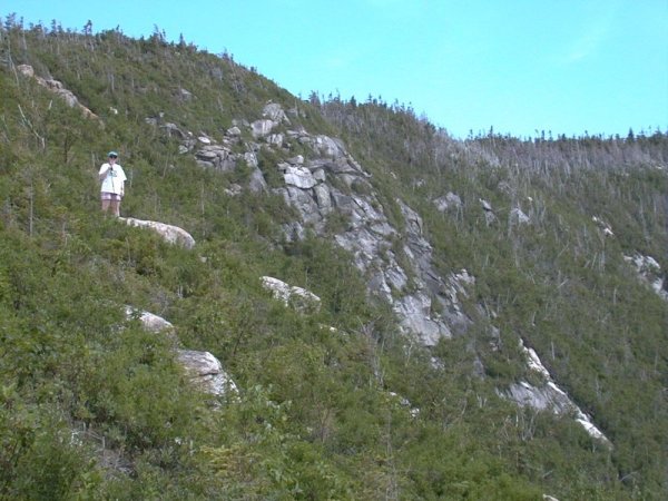
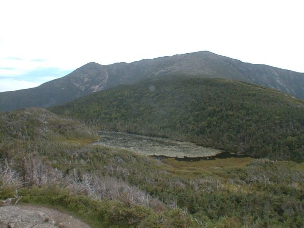
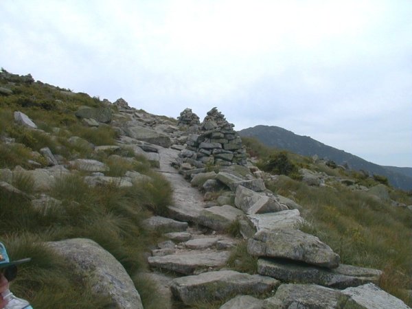
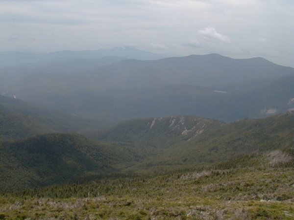
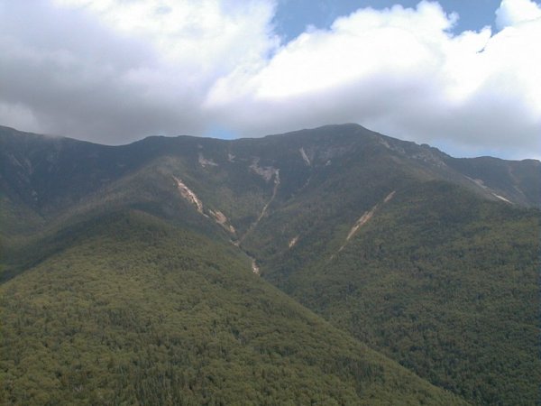
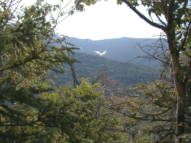
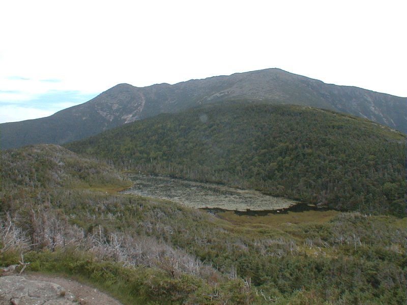
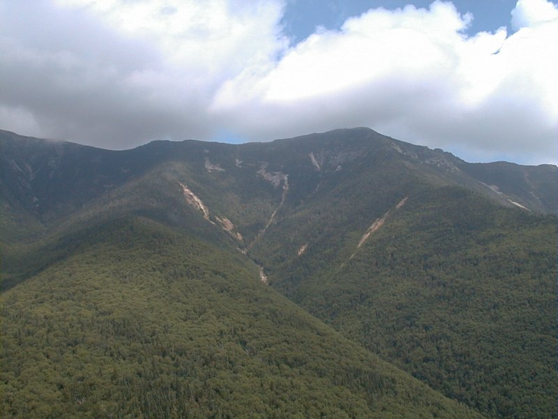
After about 1.5 miles you start to get some nice views through gaps in the trees and by the time you reach 2 miles you are above the tree line. The views from the ledges along this next section of trail are to-die-for. You can see the remainder of the ridge that leads to the western flank of Mount Lafayette and Greenleaf Hut and you can see the summits of both Mount Lafayette and Mount Lincoln looming ahead of you. Far below you can usually hear the faint roar of Walker Brook as it rushes to join the Pemigewasset River.
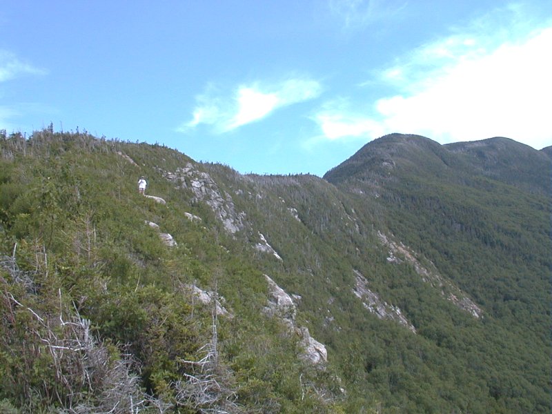
The trail climbs gradually along the first part of the ridge and then, at about 2.5 miles, there is a very steep climb up a very rocky section. Once above that the trail levels out again for the remainder of the distance to the Greenleaf Hut.
| ||||||
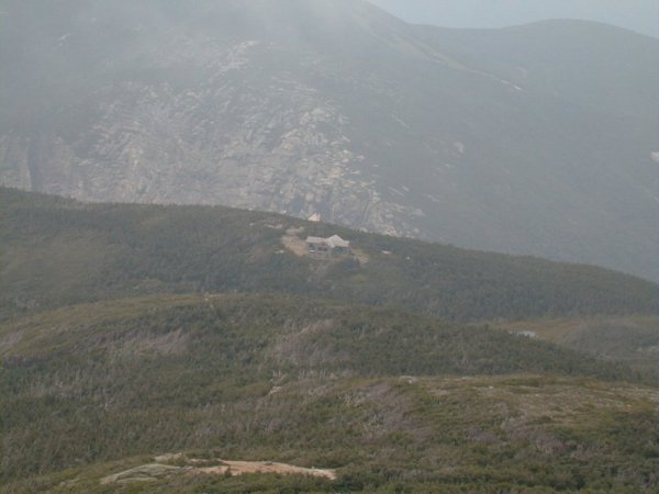
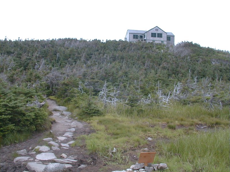
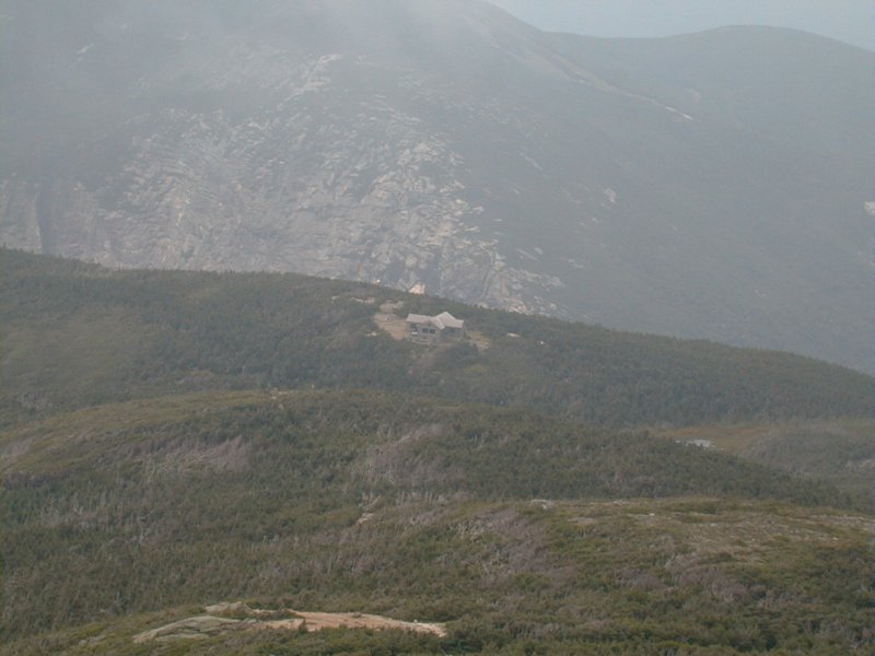
Around the time that we arrived at the Greenleaf Hut the weather began to deteriorate. We checked the latest National Weather Service forecast, which was posted inside the hut, and it was calling for late afternoon scattered thundershowers. It was still only 11 am so we decided to push on, figuring we could make it to the top of Mount Lafayette and across Franconia Ridge to Little Haystack Mountain before late afternoon arrived.
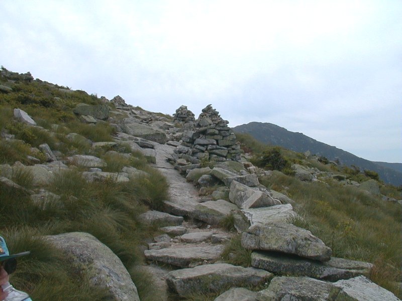
At this point we were actually on a spur trail of the Appalachian Trail which links the huts maintained by the AMC (Appalachian Mountain Club) and also connects the five peaks of Franconia Ridge. From the Greenleaf Hut to the summit of Mount Lafayette was still another 1.1 miles. We got to within maybe 1/4 mile of the summit before we heard the clap of thunder that stopped us dead in our tracks. We were in an extremely exposed area and the closest shelter was the Greenleaf Hut which we just left. To continue on it was still about 2.5 miles across the ridge to Little Haystack Mountain and the safety of the forest on the other side. We decided to abort the trip and return back down the way we came. We heard no more thunder while we were talking and so I decided to make a mad dash for the summit on my own, while Robin returned to the hut to wait for me.
|
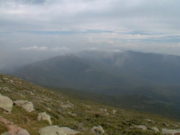
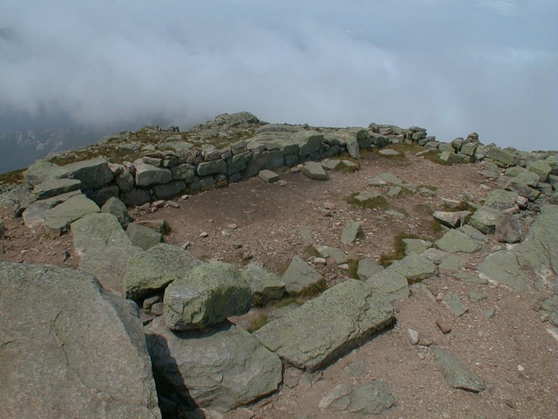
I raced up the trail while watching the clouds moving in and around the summit and in about 15 minutes I was on the top. I was surprised to see two other groups up there eating lunch but they didn't seem concerned at all with the weather so I didn't know why I should be. In spite of all of the clouds I hadn't heard any more thunder. I had a long chat with a group of three backcountry rangers from the National Forest Sevice who were doing a backpacking trip along Franconia Ridge and over to the Presidential Range. After about 15-20 minutes of taking pictures on top I started back down to the hut.
Once there I rejoined Robin and we had a snack before beginning the descent back down to the valley. The clouds still looked pretty menacing but we never did hear any more thunder that afternoon. I am still glad that we decided to turn back as being out in the open like that in the middle of a lightening storm would not have been very pleasant.
|
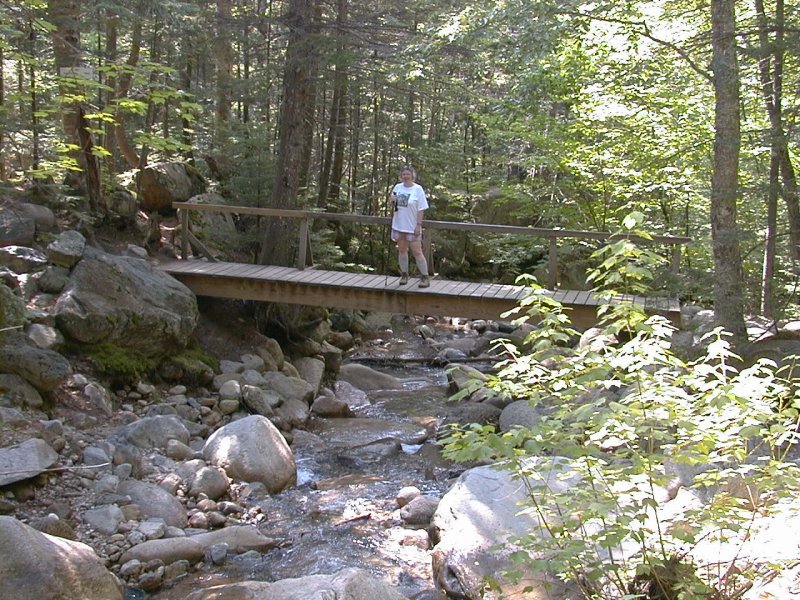
The hike back down was uneventful and we arrived back at the car around 3:30 pm. I stopped along the way to take some photos of the clouds and the ridge line along the way, and again at the foot bridge that crosses Walker Creek. We should have been coming back down on the Falling Waters Trail and coming across this bridge but not today. The total distance for the loop hike would have been 9 miles and going to the summit of Mount Lafayette and returning back down the Old Bridle Path ended up being 7.6 miles, which is still not bad for a day hike.
|
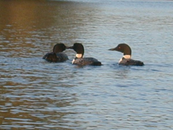
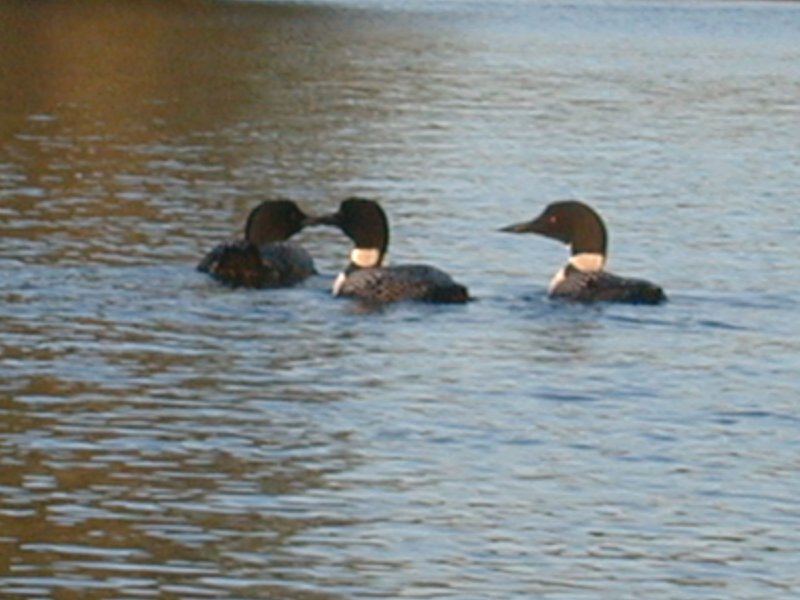
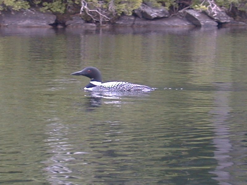
No visit to New Hampshire is complete without seeing loons, so here they are.
These were residents of Lake Waukewan in Meredith, New Hampshire, which is where the house that we were renting was located.
These photos were taken from my kayak while out on the lake.
| |||||
|
|
|---|
|
|---|


