|
Vose Spur day hike |
|---|
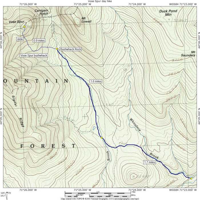
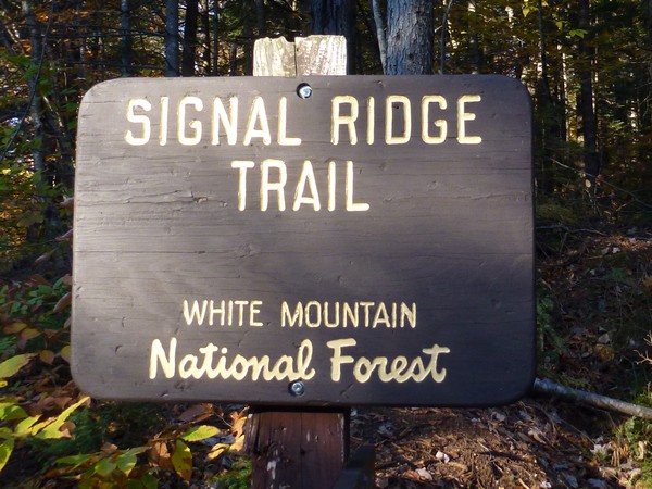
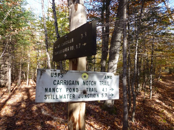
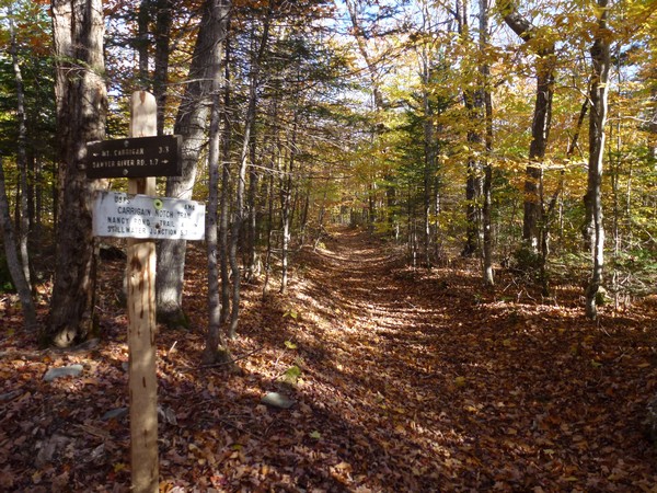
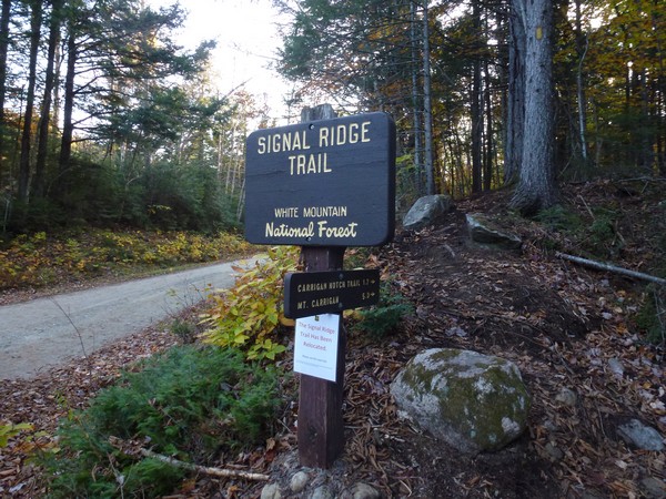
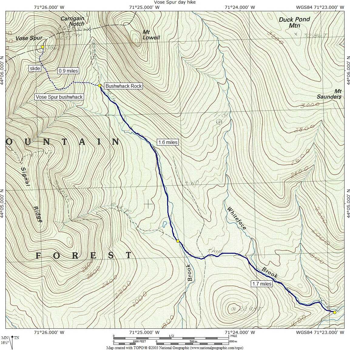
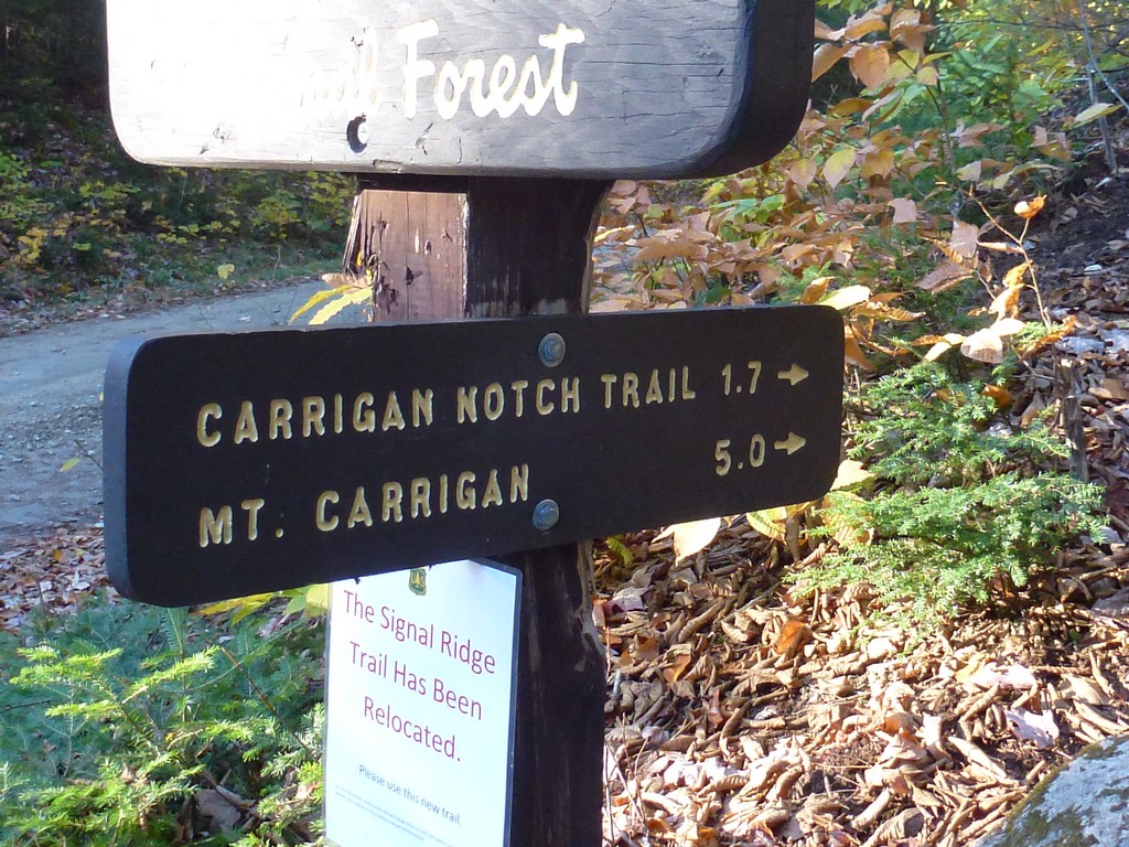
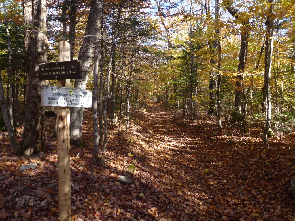
This day hike started at the parking area for the Signal Ridge Trail off of Sawyer River Road in the Livermore, New Hampshire. From the parking area I took the Signal Ridge Trail to the Carrigain Notch Trail to Buchwhack Rock. From there I bushwhacked mostly west and a little north towards the Vose Spur talus slope and then following that to the summit of Vose Spur. For the return route I went back the pretty much same way. I went to high to quickly on the way in and missed all but the upper portion of the talus slope but I went down the full extent of it on the way back.
|
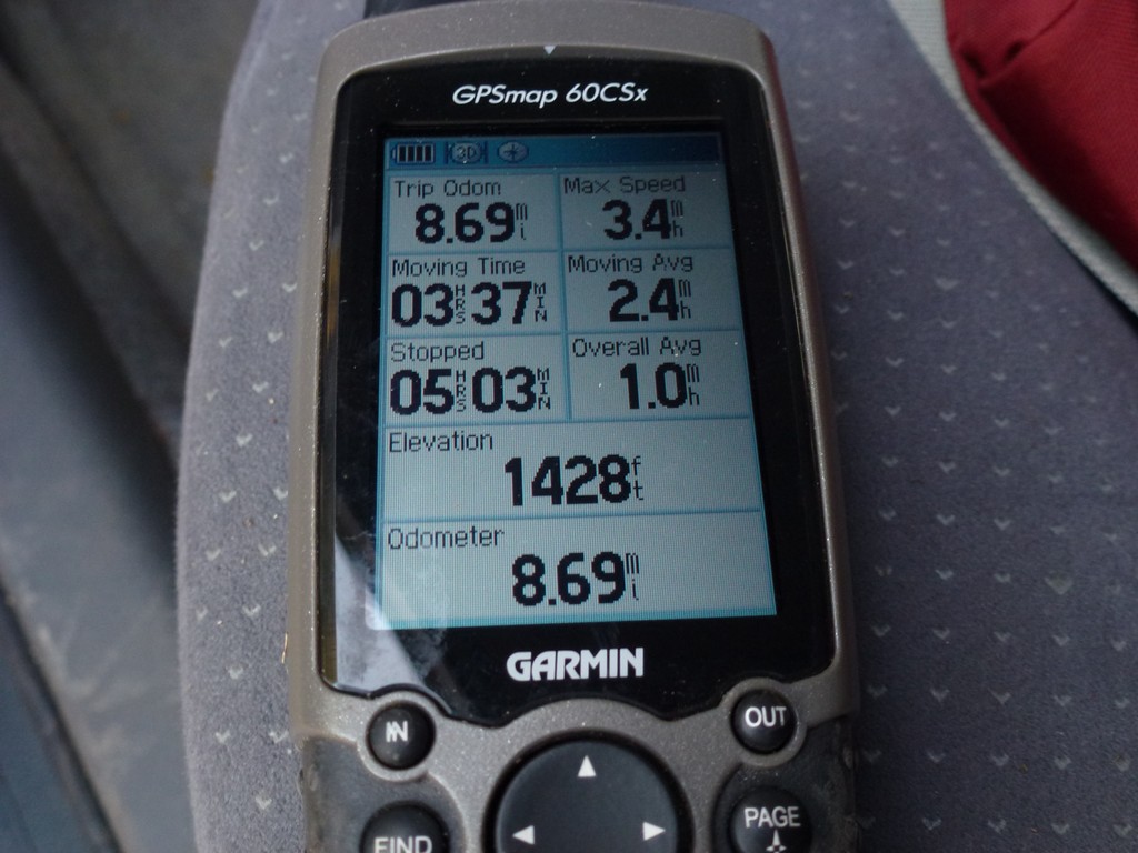
The starting point for this hike was a parking area at the trailhead for the Signal Ridge Trail on Sawyer River Road about 2 miles in from New Hampshire Route 302. Vose Spur would be number 63 on my New England Hundred Highest list. I arrived at the parking are around 8:15 and started hiking just before 8:30. There were a few other groups on the trail with me and we played cat and mouse up until the junction with the Carrigain Notch Trail. Most everyone was climbing Mount Carrigain though and I only saw one other couple along the Carrigain Notch Trail.
The eastern section of the Signal Ridge Trail, near Sawyer River Road, had been rerouted since the last time I had been there and the trailhead was now actually located on the south side of Whiteface Brook rather than the north side. After about a quarter mile or so I was back on the orignal trail as the old route crossed Whiteface Brook to continue on the south side.
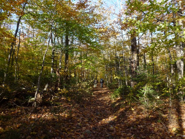
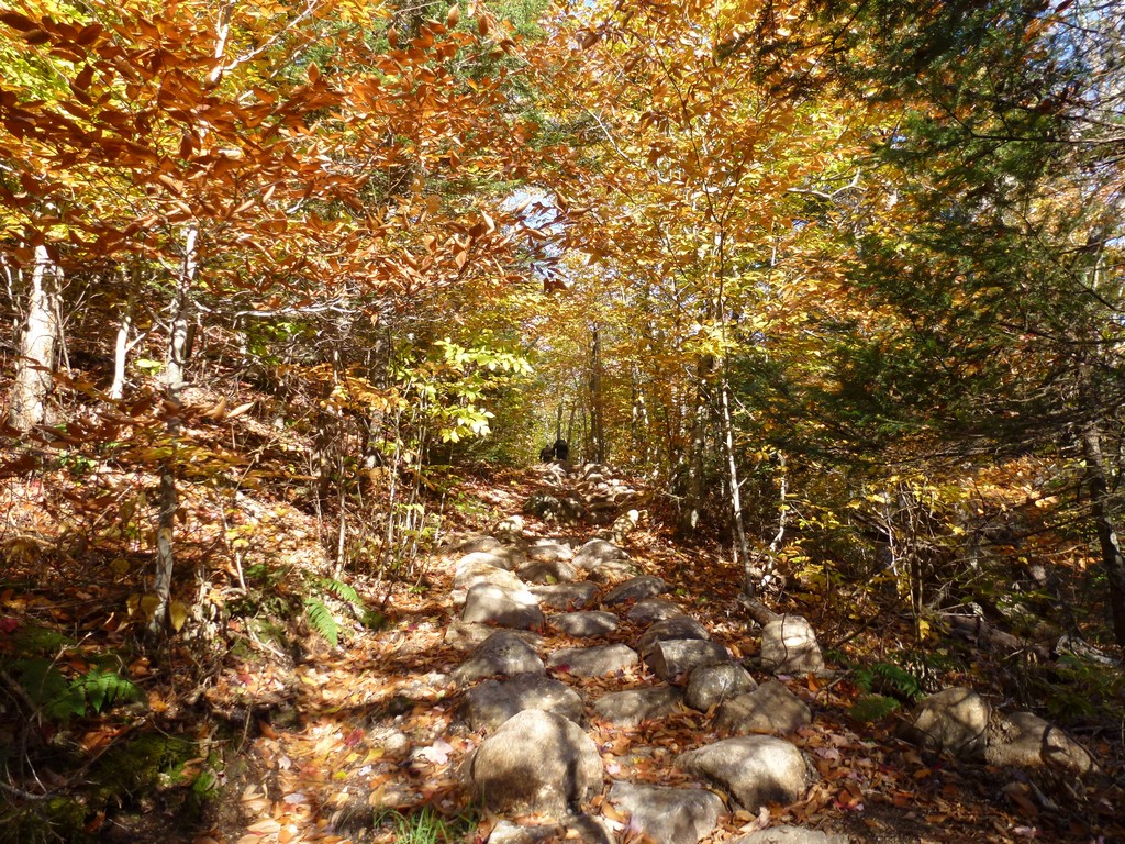
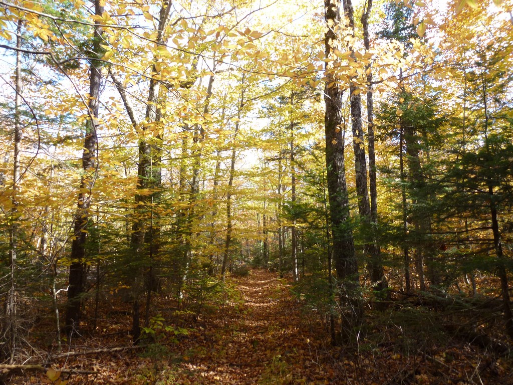
The hike along the Signal Ridge Trail to the junction with the Carrigain Notch Trail was a breeze and there was only about 500' of elevation gain over 1.7 miles. It was a very nice morning with bright, sunny skies and temperatures in the low 30s. It was a little chilly but felt rather nice once I started hiking and warmed up a little. I was glad I had brought gloves along this time though.
|
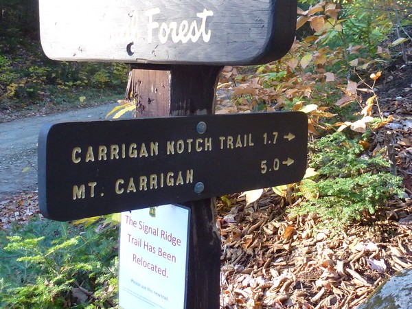
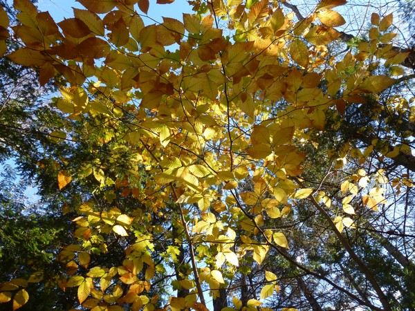
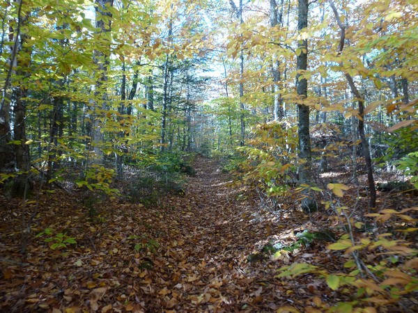
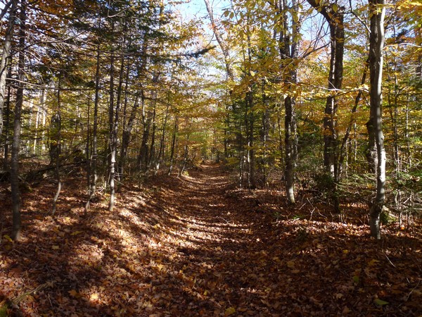
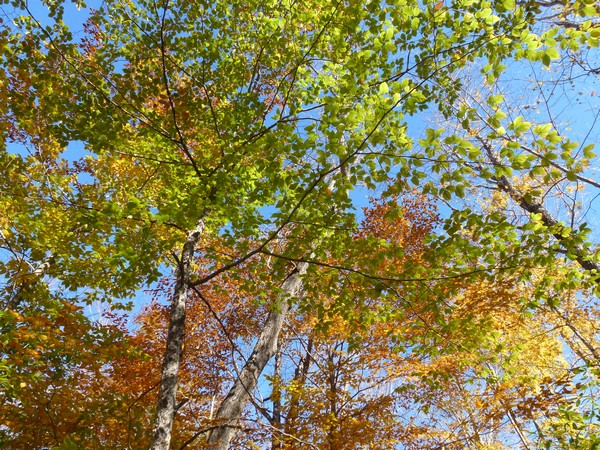
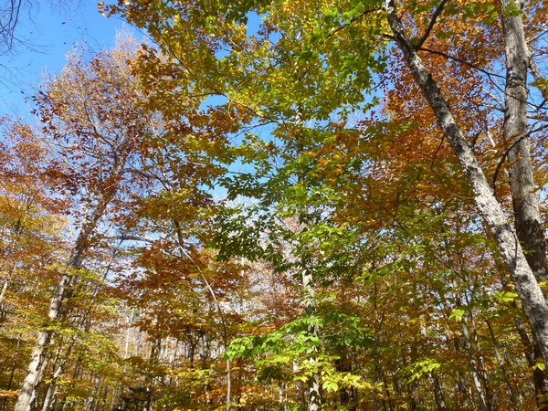
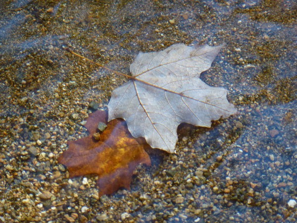
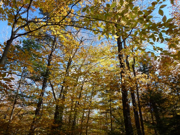
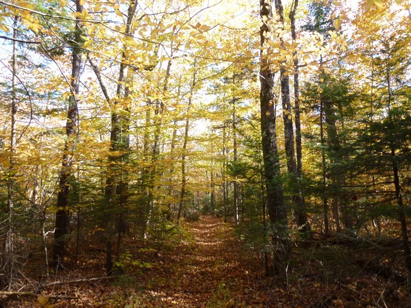
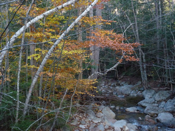
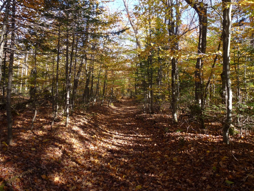
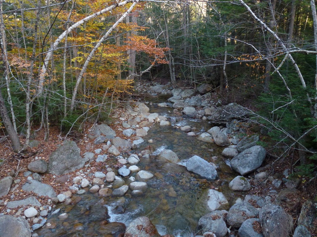
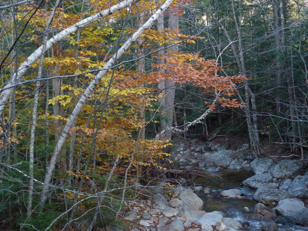
It took a little less than an hour to cover the distance to the Carrigain Notch Trail. From that point on I had the trail pretty much to myself. There were still lots of colorful trees and even a few that were still mostly green. There were a lot of leaves on the ground though and the pretty much the only sound was the constant crunch, crunch, crunch of the dried leaves.
|
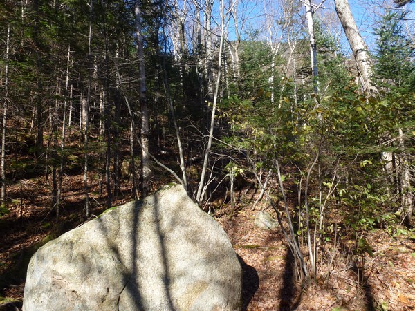
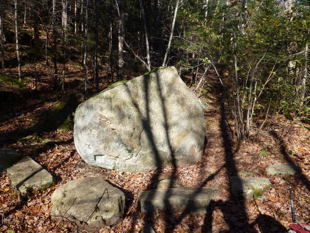
There was only about 300' of elevation change over this 1.6 mile stretch and it took a little less than 45 minutes to reach Bushwhack Rock. I was hoping I wouldn't miss it somehow and when I finally saw it I don't imagine how anyone could.
|
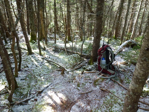
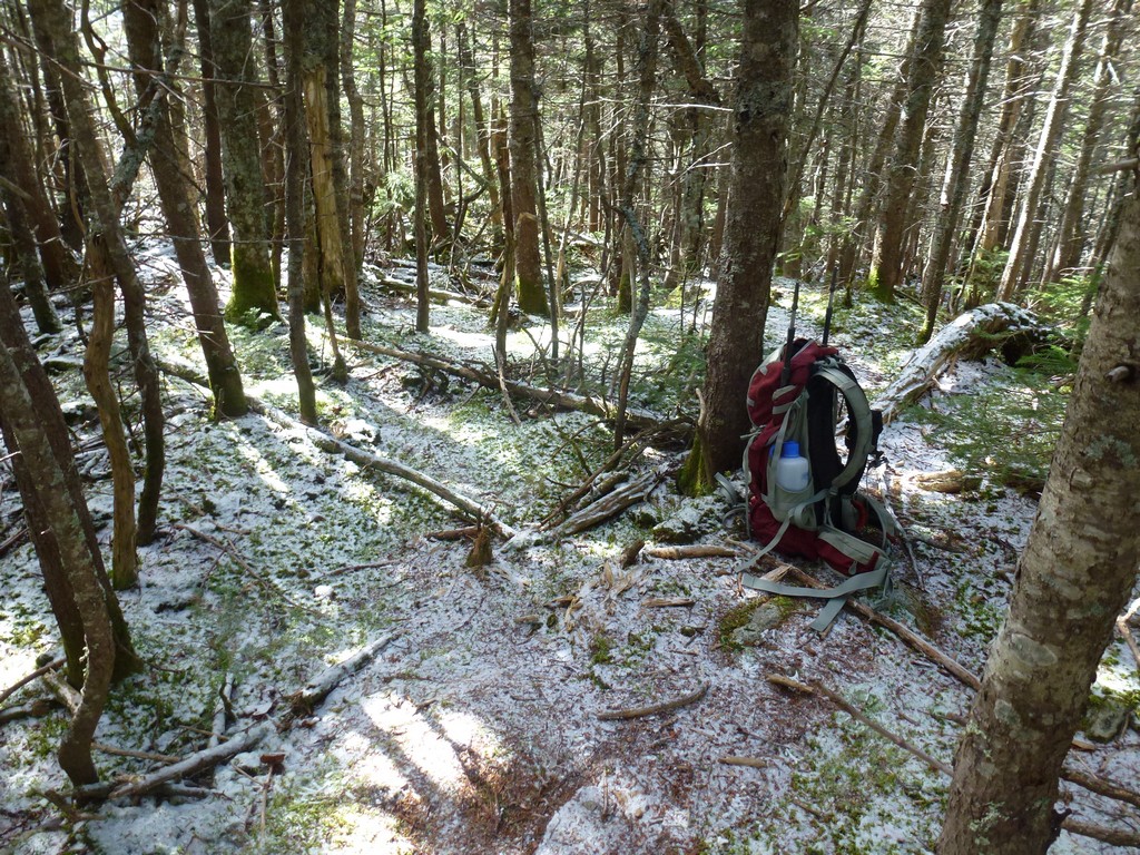
That's where the real fun started. I took a short break and ate a granola bar before starting the bushwhack. It was easy initially and for the first 100 yards or so I felt like I was following some kind of "trail". The trail seemed to be following along the north side of some sort of drainage that was slowly ascending towards a low ridge that comes down along the south side of Vose Spur and was heading the general direction of a waypoint I had set in my GPS.
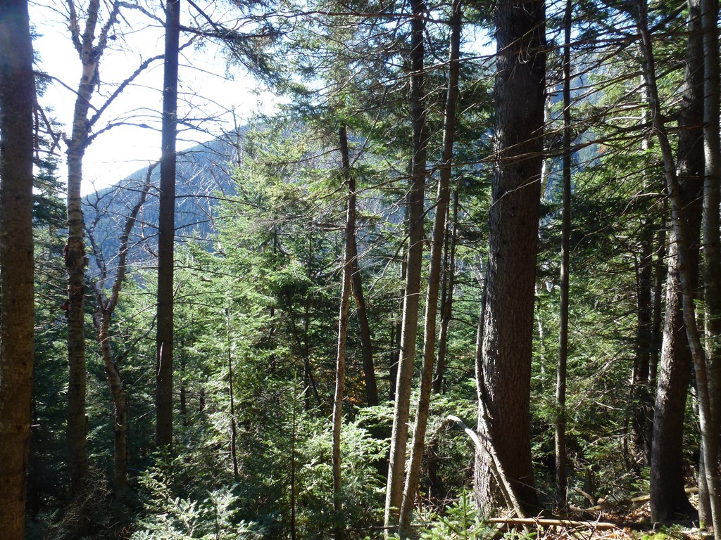
But then it just ended. The trees filled in and there was no further sign of anyone going up this way. I backtracked a little and looked around but I did not want to waste too much time looking for a trail since there really wasn't supposed to be one. Everyone just probably starts off in the same general direction from Bushwhack Rock and then their paths diverge.
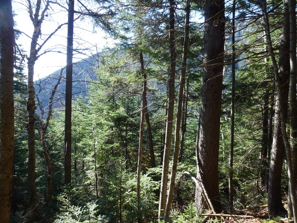
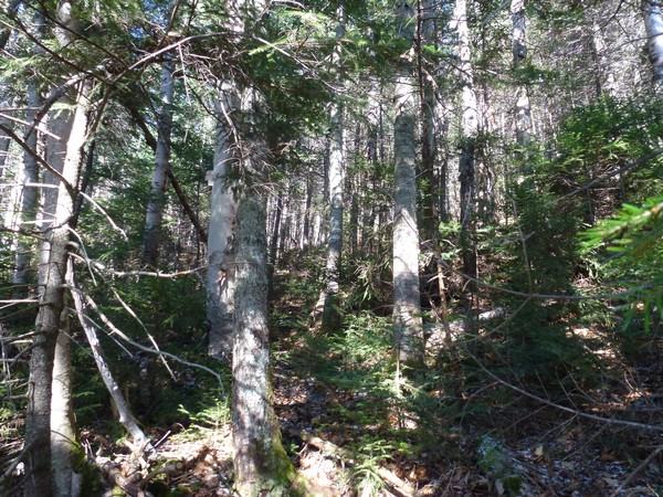
Walking through the forest was hard in some place and not so hard in others. The blowdowns were the big problems as there was usually no way through them or over them and I just had to find a way around. Some of these trees were big and usually a blowdown involved more than one tree so it was time consuming. This was not fast going.
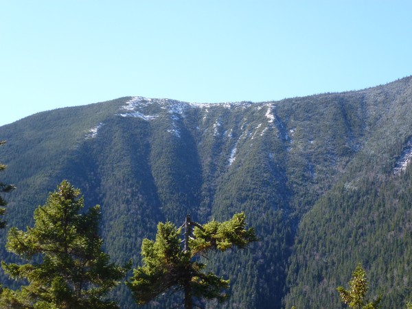
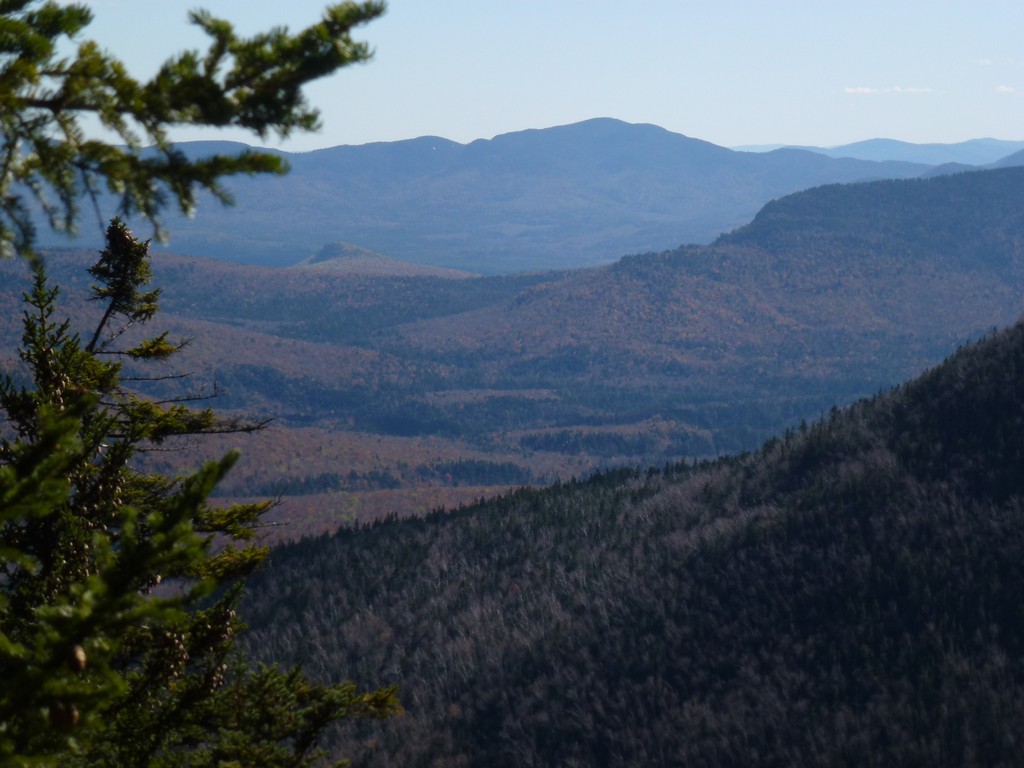
Things clear out somewhat as I got higher and once I reached the ridge itself it was pretty clear going up for a short distance so I just headed in that direction. The waypoint in my GPS was telling me to go further west but going north and up was easier so that's what I did. I should have listened to the GPS though as following it to that waypoint probably would have put me at the base of ths talus slope. By climbing up and going north I missed a good portion of it but I am not sure I lost any time as going up through the forest there was not that hard.
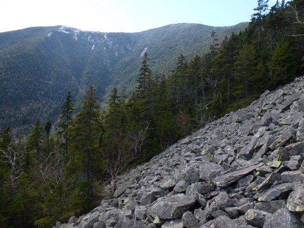
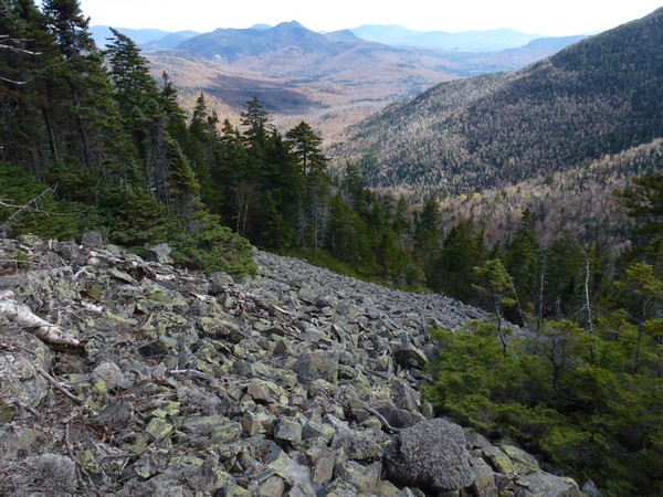
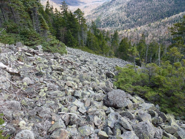
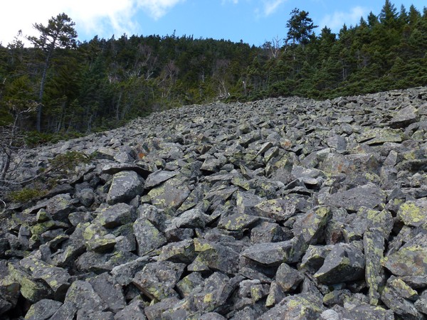
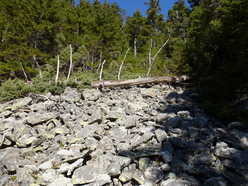
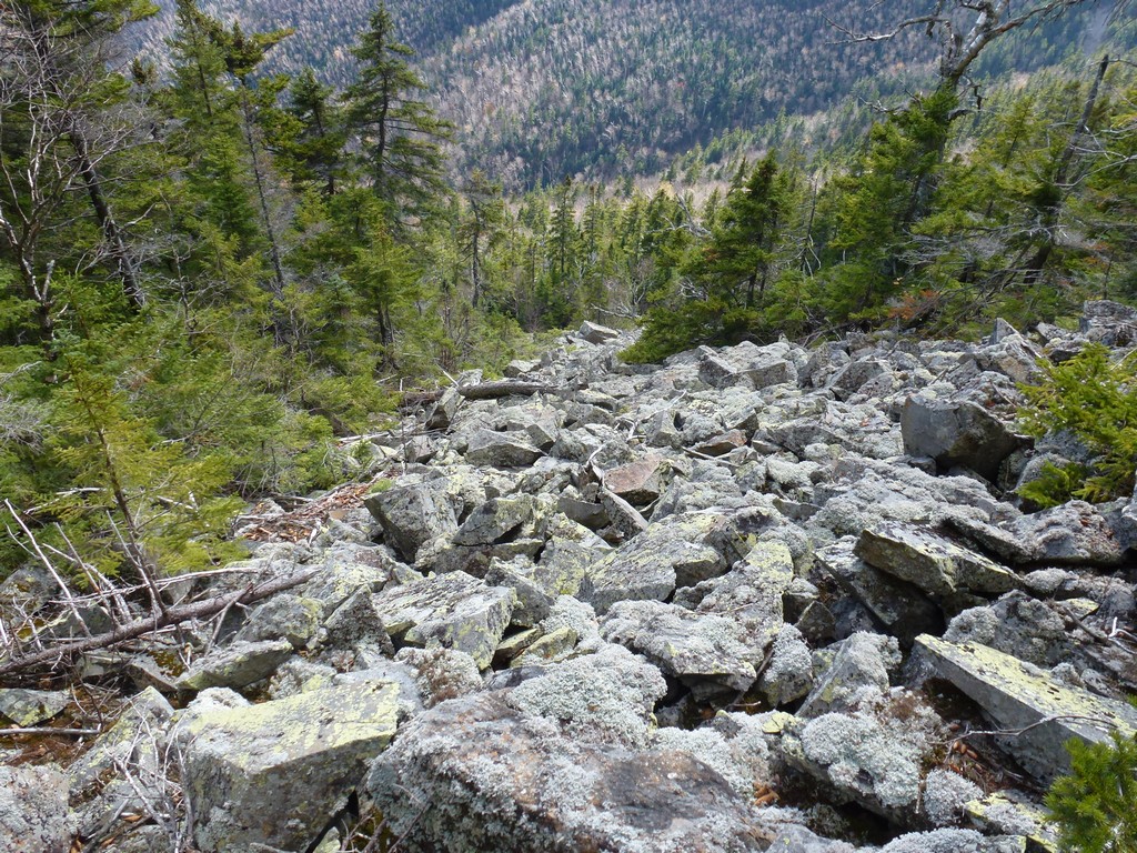
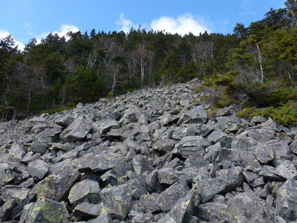
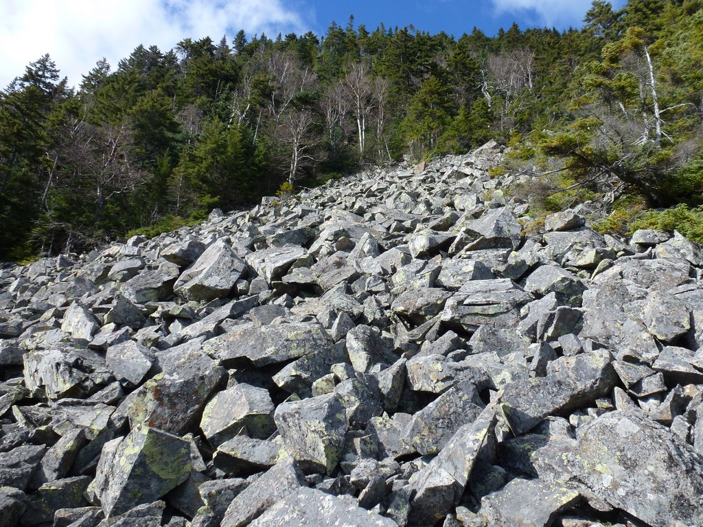
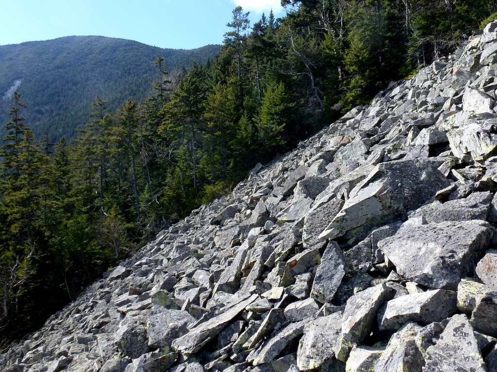
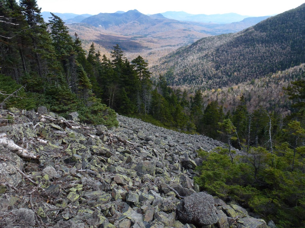
Then it got thicker though and I was forced to go west to get around. Eventually I came out to a small talus slope and briefly though I was on The Talus Slope but soon realized it was just way too small. I went up a short distance, crossed over, and contined west and after a short time came out to the real talus slope but I was already probably three-quarters of the way up and the top was not that far away.
|
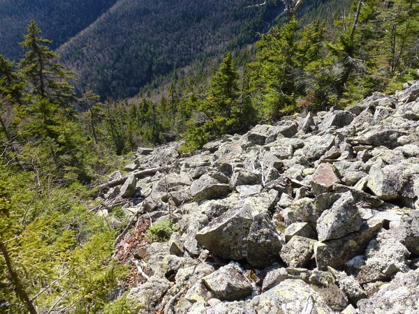
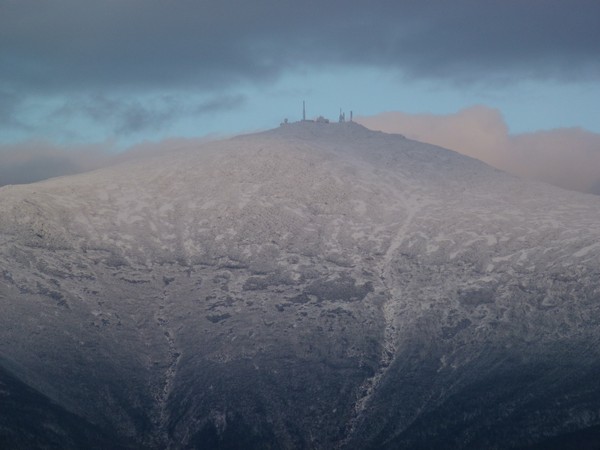
Climbing the top part of the talus slope was not that difficult but the rocks were not completely stable and occasionally one that looked firm enough would shift as soon as I put my weight on it. This thing was HUGE and I was not looking forward to going all the way down on it. I hadn't had too much trouble coming up through the forest and thought I would just try to go back the same way.
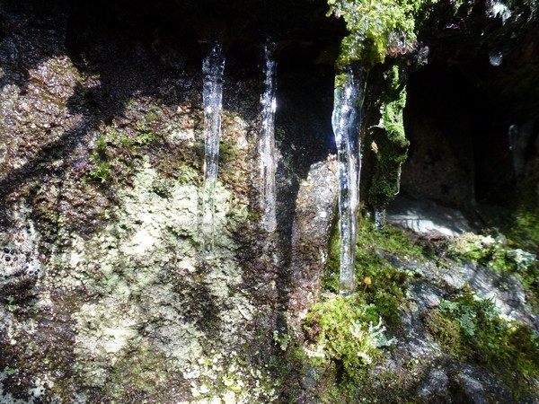
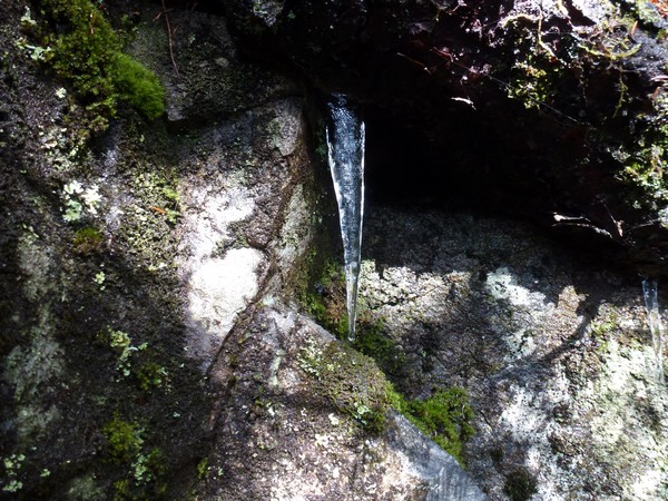
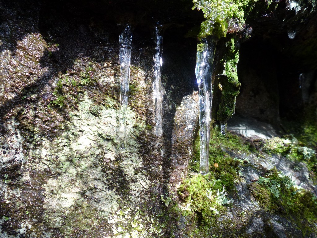
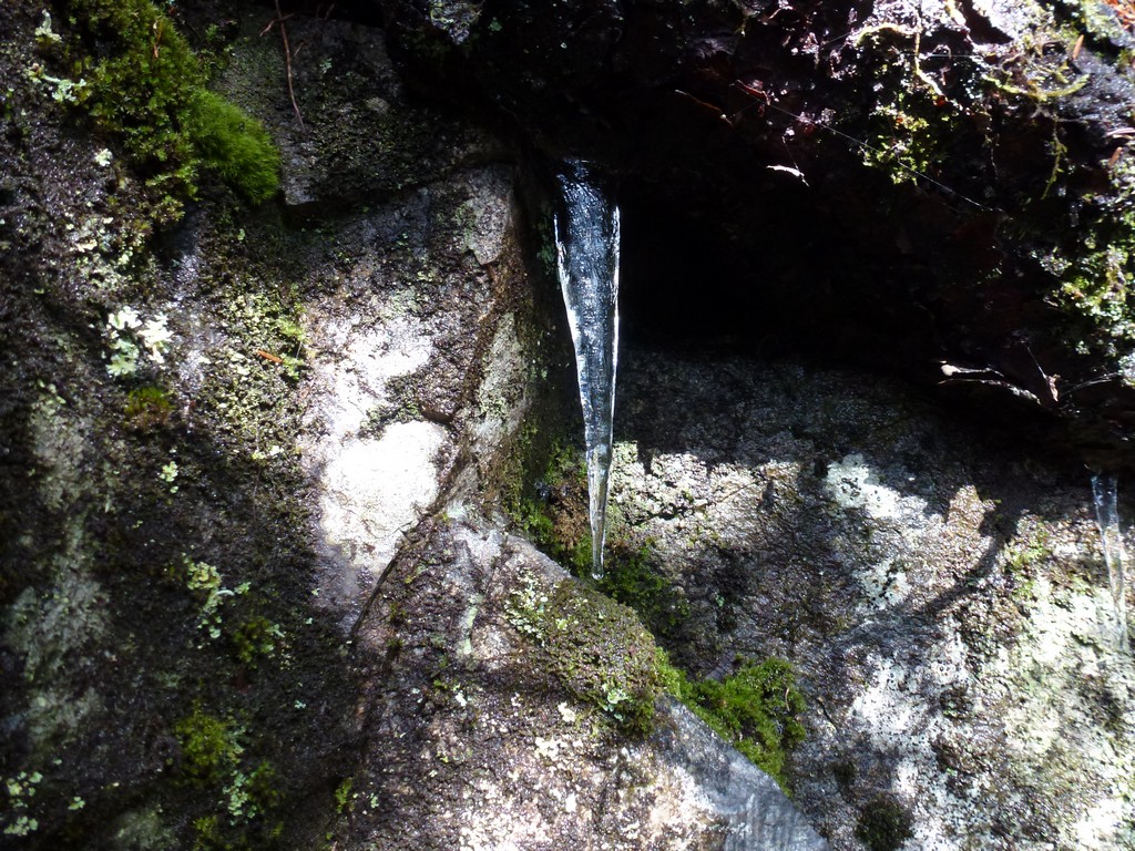
At the top of the talus slope I encountered a small cliff that presented some problems. I could not see any way up easily from where I was. I went east a little ways and didn't see any way up. I went west and after going around some blowdowns I managed to find a way up. There were some iciles already in some of the darker, shaded recesses of the cliff and I thought that was interesting. I did not feel cold at all so ice was surprising.
|
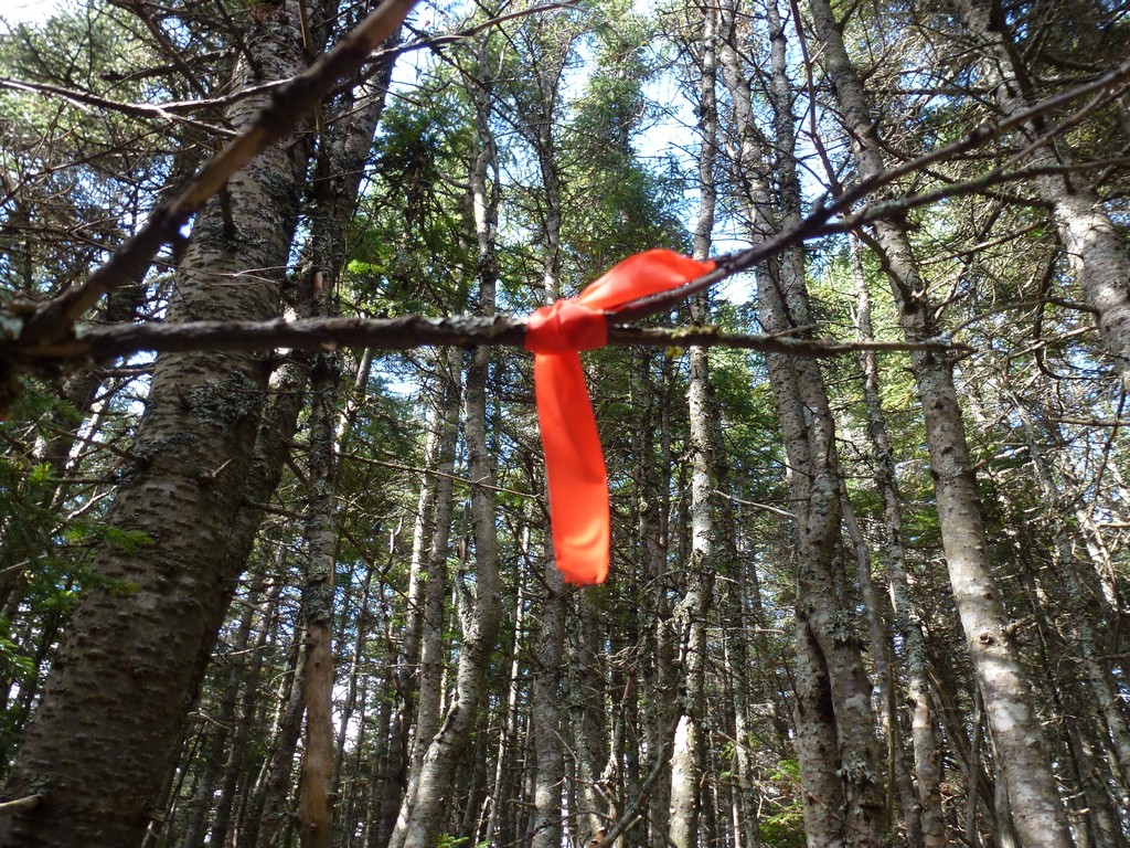
Once above the cliff I just tried to follow my GPS towards the summit. There was no obvious path and there were LOTS of blowdowns to work around. Some areas were just so dense with blowdowns that it was easier to go over them than around them. This creeped me out because it is so easy to get hurt if you miss just one step in a situation like that but I did not want to waste the time and effort to go around this mess. It didn't take too long and I eventually spotted a couple pieces of red flagging tied around some branches. I headed in that direction and came to a path that led me directly to the summit cairn.
I was sure I was on the summit. There was a small rock pile/cairn there and I did not see anything higher up and it agreed with the top according to my GPS. I looked around but I never did find the cannister with the log book.
|
I did not stay on top long. I took some photos and ate my sandwich and after only 10 or 15 minutes I was on my way back down. I followed the path that led towards the red flagging and that path continued for a short distance before it too petered out. I followed my GPS towards the top of the cliff that I had come up and happily avoided the big patch of blowdowns going this way. Once I got to the top of the cliff it seemed a lot easier to go down than up and very shortly I was at the top of the talus slope.
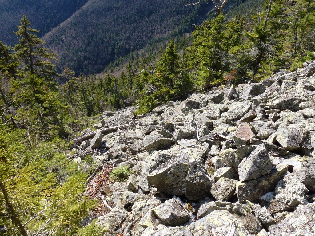
After giving it some though I decided to follow the talus slope down. It was going to be slow and I knew I needed to be careful but it just felt more like a trail to me. Coming up through the forest was not that bad but what were the chances of finding the exact same route going down. The talus slope although lose and steep was at least easy to follow and would get rid of a lot of elevation in a short amount of time... so down I went.
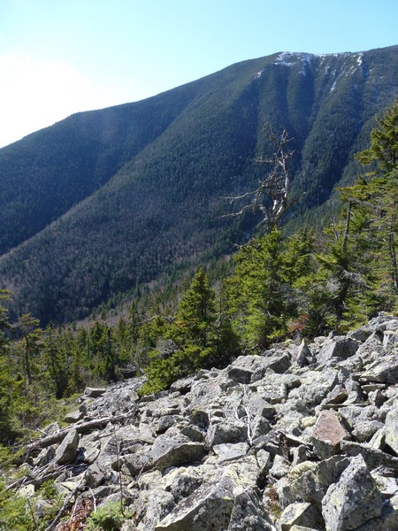
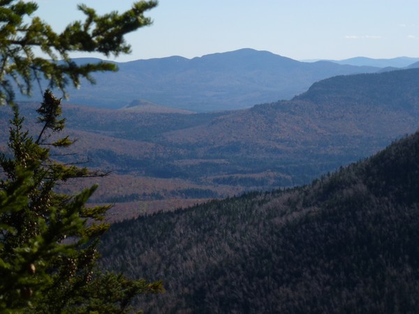
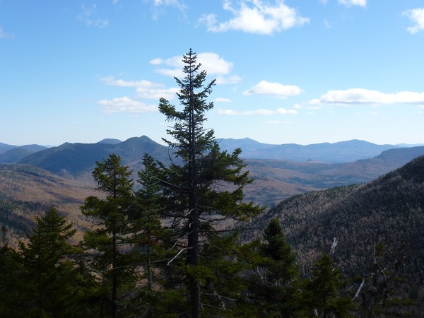
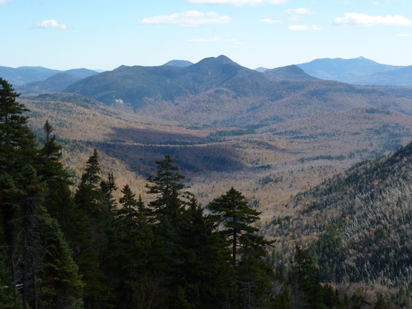
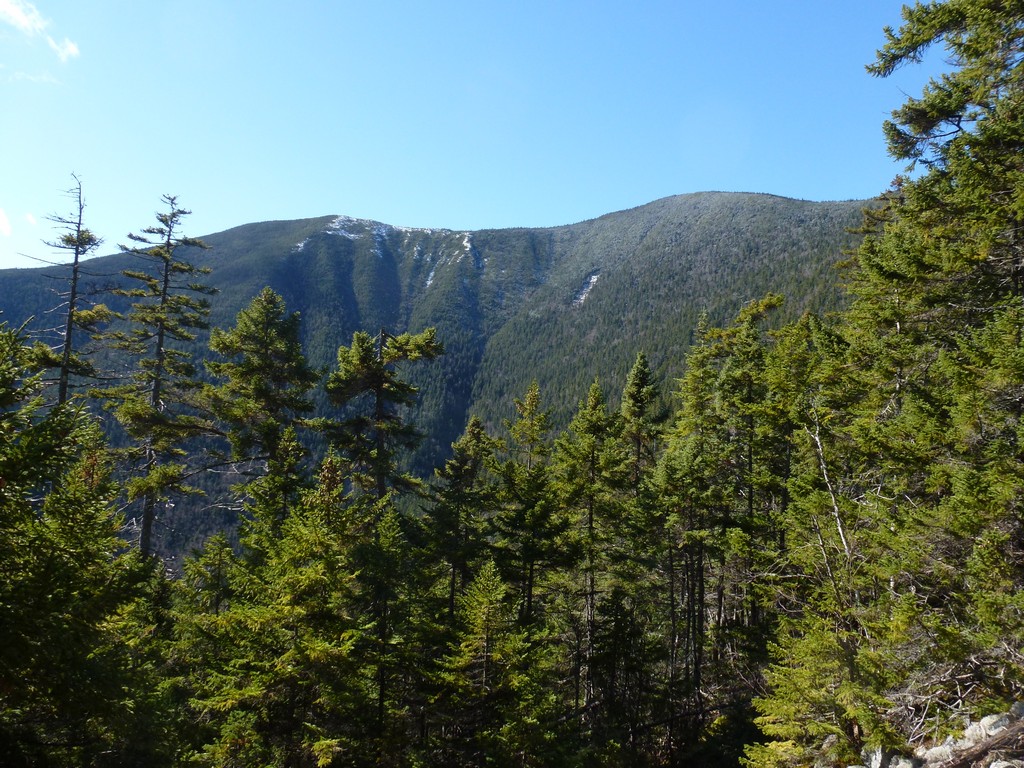
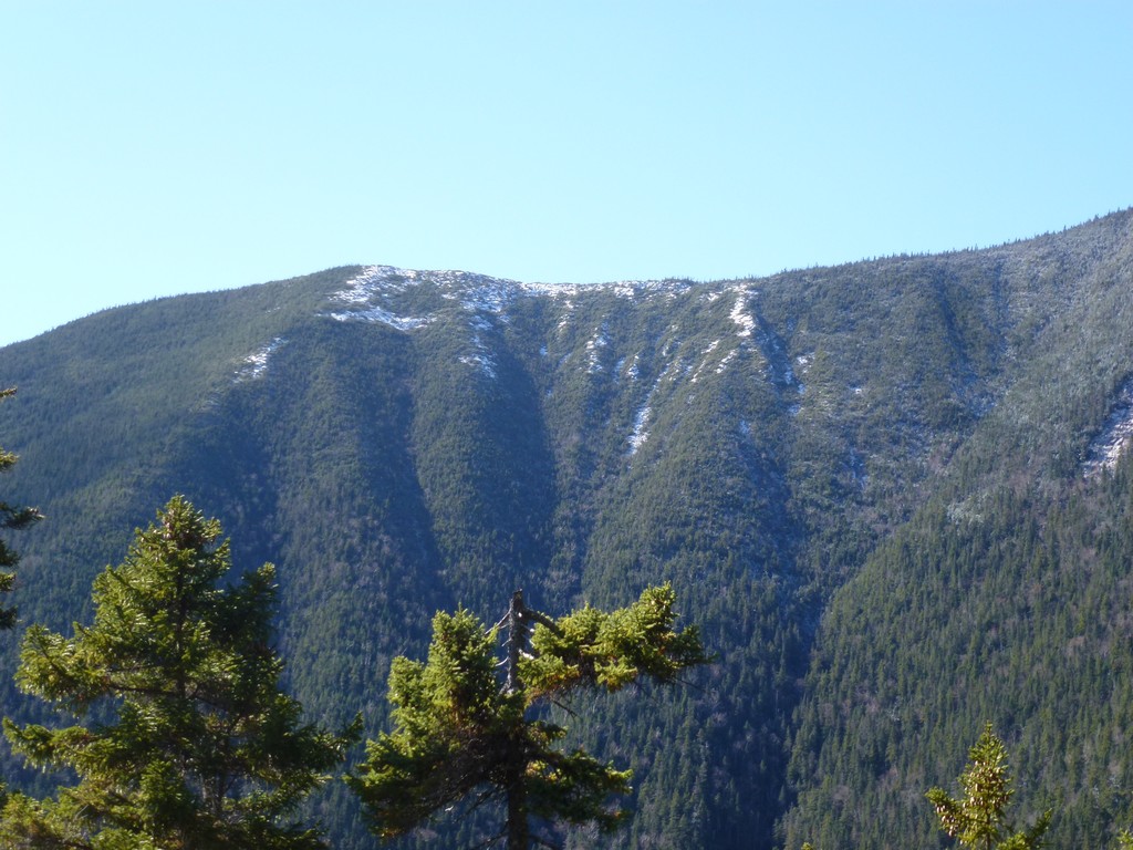
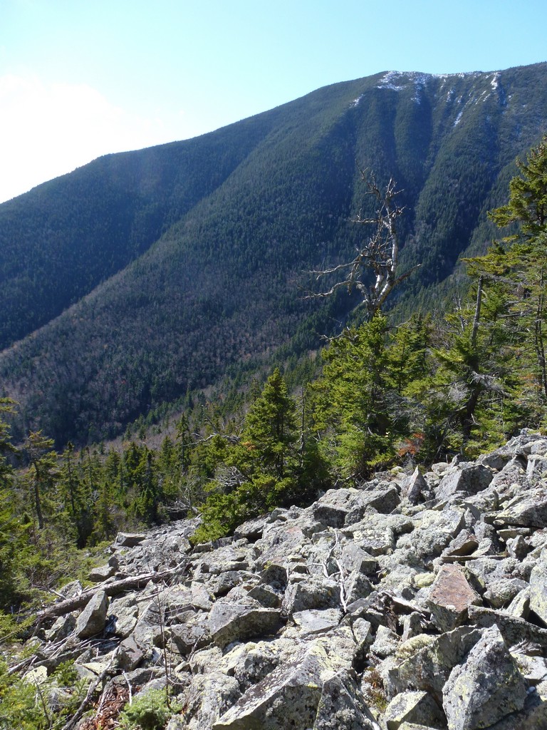
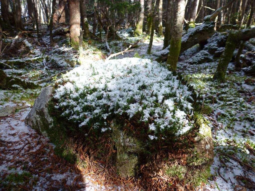
The views from the talus slope were also spectacular and there were no views to speak on in the forest so that was nice. It also gave me an excuse to stop and take a short rest every now and then just to look around and enjoy the scenery. It was an outstanding beautiful day.
|
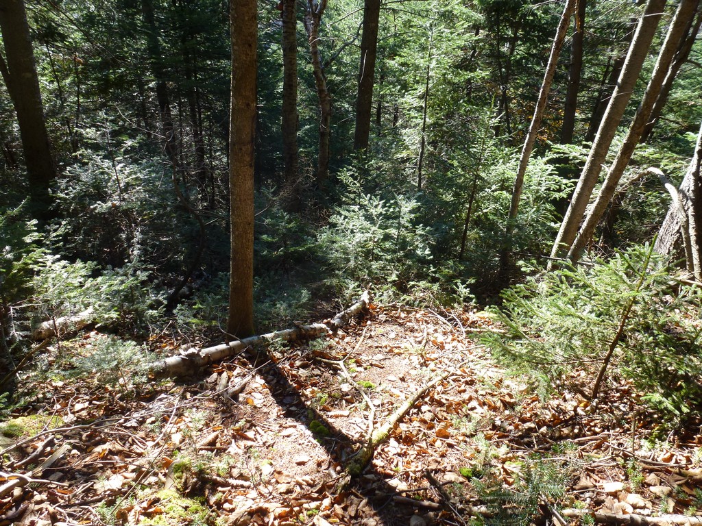
It only took about a half of an hour to go down the talus slope and at the base of that I was back in the forest... and back in the fun. The trees did not seem that dense initially but seemed to thicken as I descended. I followed towards some waypoints in the GPS and eventually came very close to the route I had used on the way up. There were constant deviations around denser growth and blowdowns and another short cliff and it took a little more than an hour before I came back out to Bushwhack Rock. The lower portion of the route as I got closer to Bushwhack Rock opened up again and was much easier going for the last few hundred yards. I actually came out to the Carrigain Notch Trail a little north of Bushwhack Rock and it took a little time to figure out which way to go.
I took another short break at Bushwhack Rock before starting the relatively easy hike back to the car.
|
The hiking along the Carrigain Notch and Signal Ridge Trails as like a walk in the park after the bushwhack. These are really nice trails and there was not much elevations change so it was very relaxing. It was still a beautiful day but it was starting to get colder again later in the day.
I managed to loose one of my gloves on the way up the bushwhack. When I started to warm up I took my gloves off and just put them in my pockets but someone one managed to fall out. By the time I discovered this there was no point in going back along the bushwhack to try and find it. It would have been like trying to find the proverbial needle in a haystack.
|
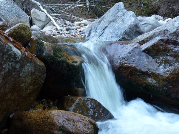
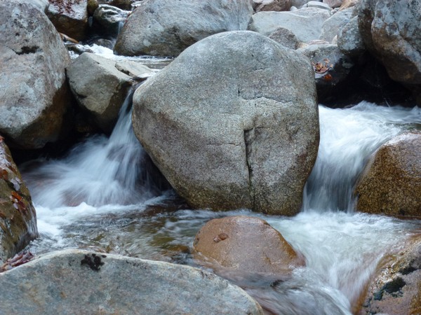
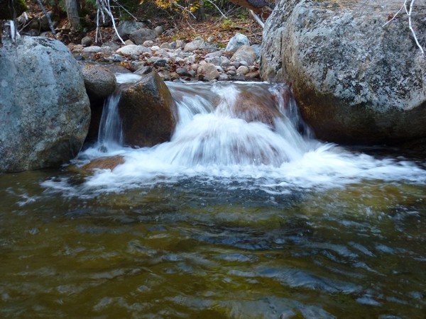
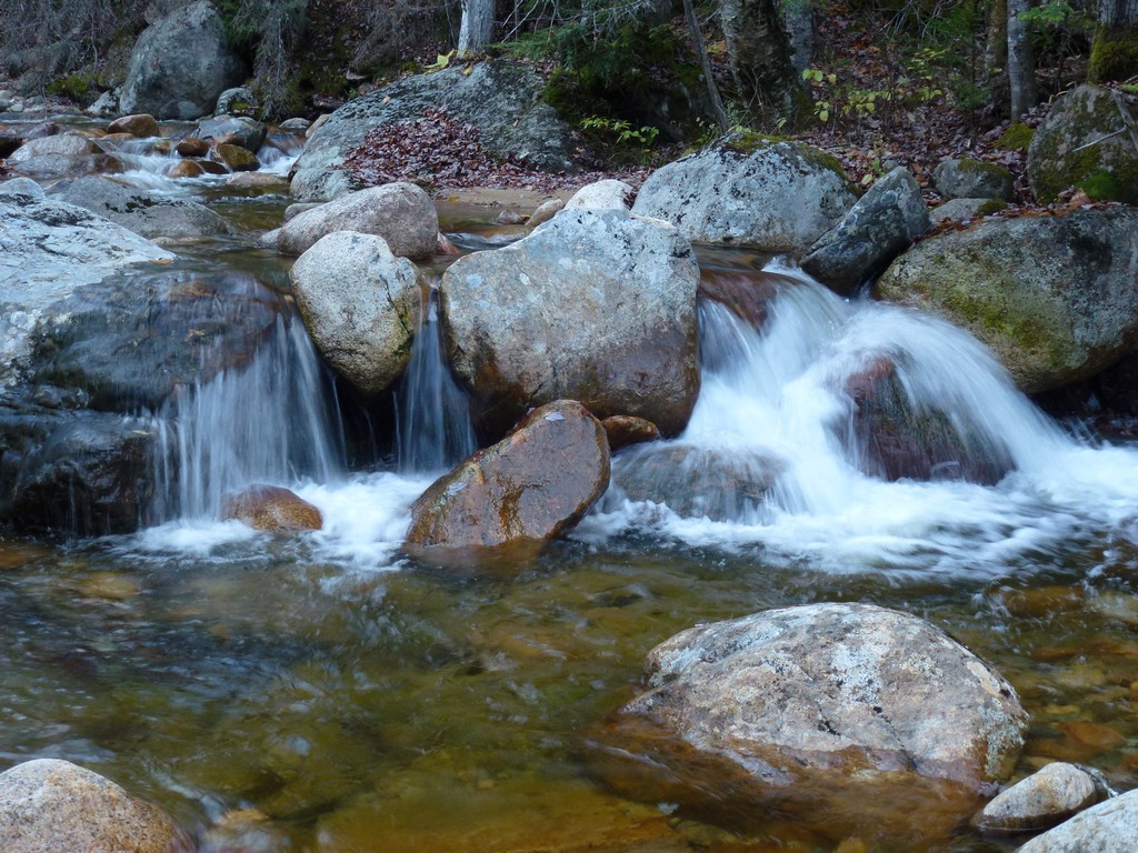
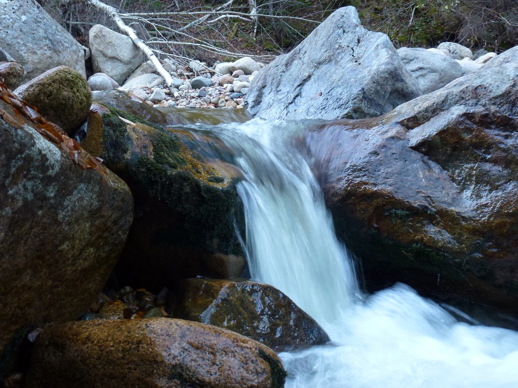
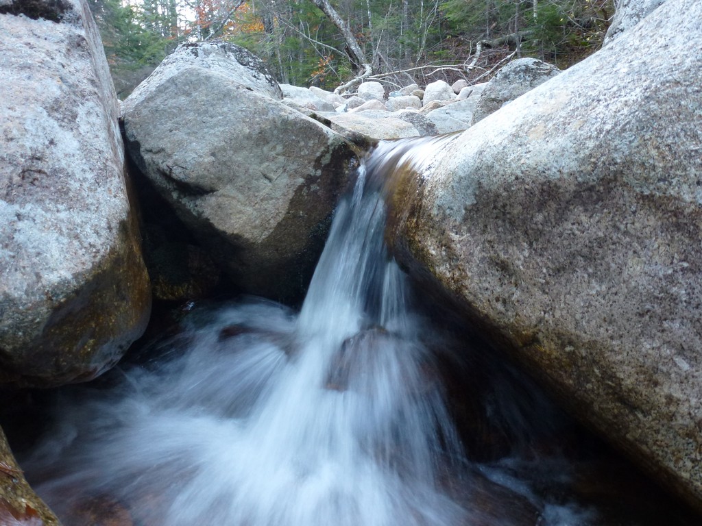
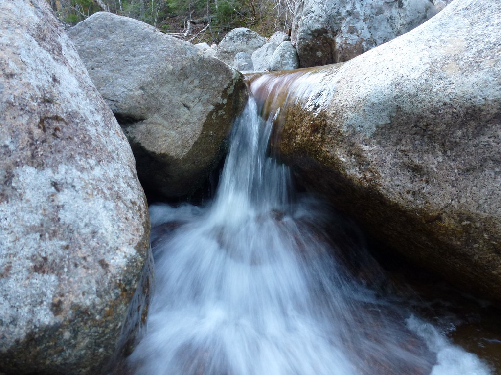
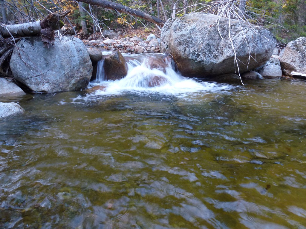
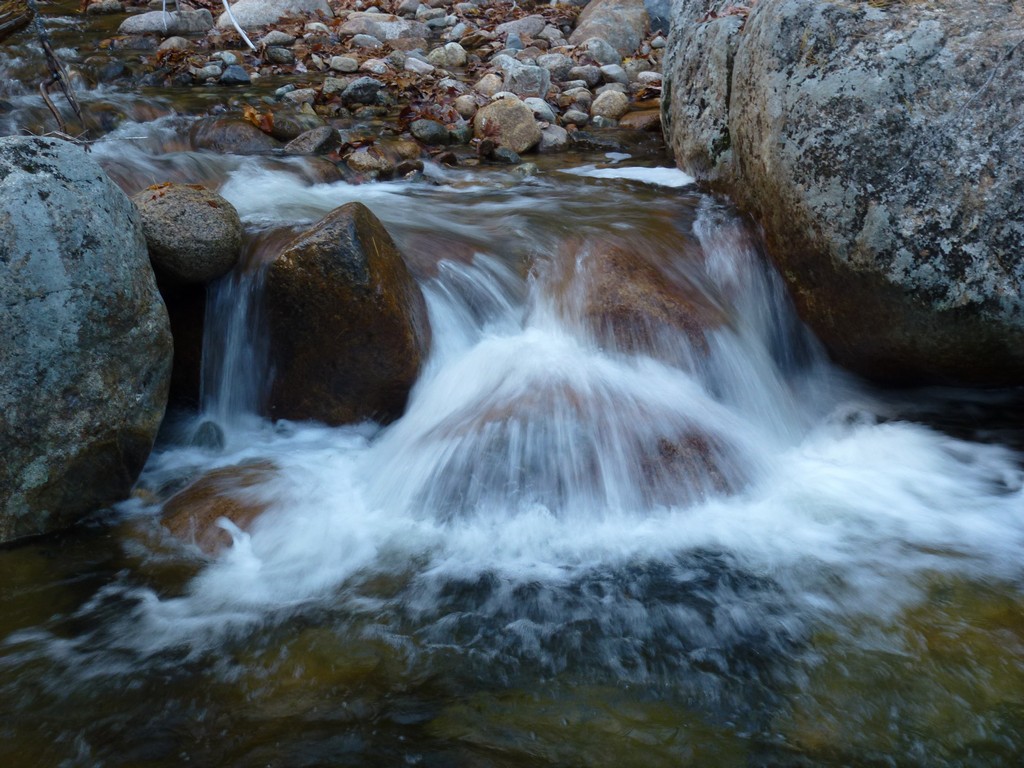
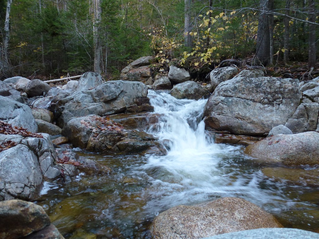
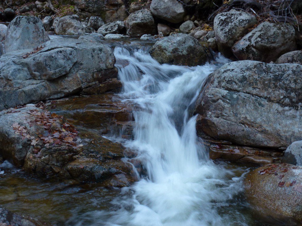
I did not want to waste any time during the hike in taking photos of the cascades in Whiteface Brook so I made detours to do this on the way back. Daylight was fading quickly after the sun went over and behind Signal Ridge but there was still enough for some good photos.
|
I arrvived back at the trailhead at almost exactly 5pm and was very happy to be there.
Vose Spur was definitely the hardest hike I have EVER done in the White Mountains and it felt good to have it done.
|
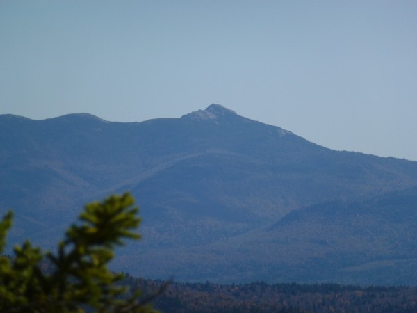
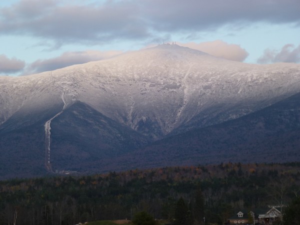
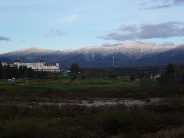
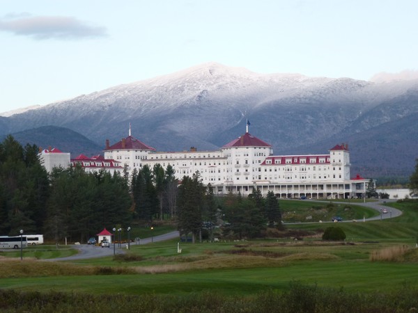
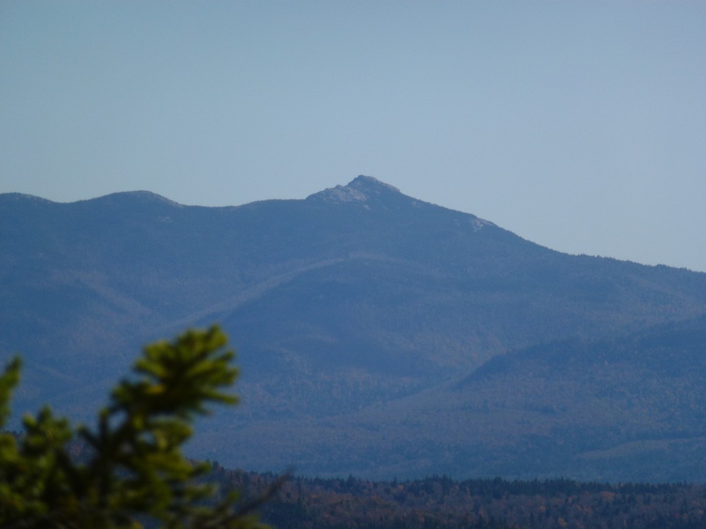
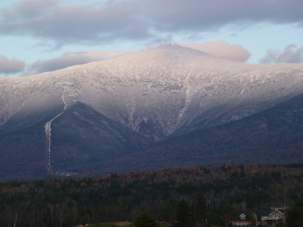
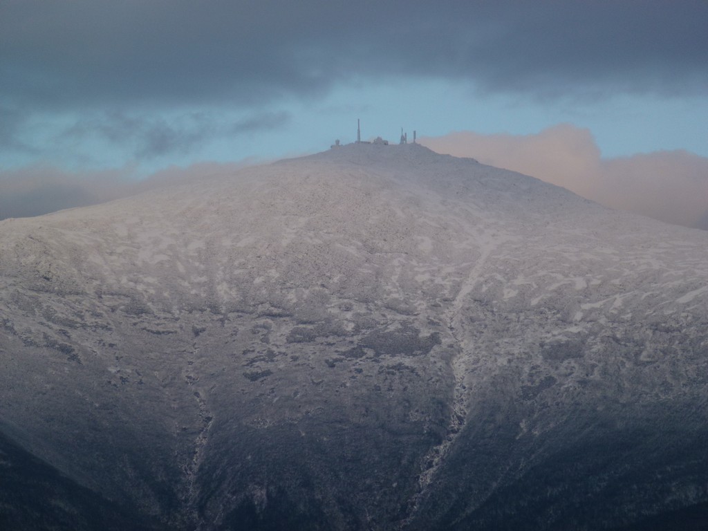
I stopped briefly at Bretton Woods on the way home to take a few photos of the last rays of the sun on Mount Washington.
|
I was lucky that I had such a beautiful day for doing this one. The bushwhack was hard but I felt good that I had been able to do it. I have done plenty of off-trail and cross-country hiking in the Grand Canyon but there aren't any trees there and not much in the way of any other kind of thick vegetation so in most cases it is a lot easier there. There are exceptions of course, primarily along water courses, but for the most part it is a lot easier than the White Mountains. Even the places where you need to climb in the Grand Canyon seem easier because there isn't stuff growing all over and around the cliffs.
|
|
|---|
|
|---|


