|
Mount Eisenhower, Monroe & Pierce day hike |
|---|
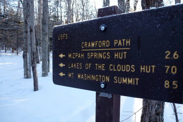
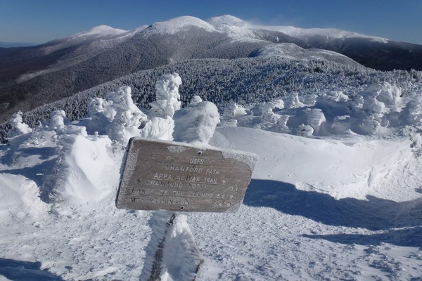
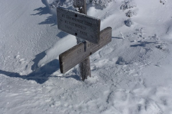
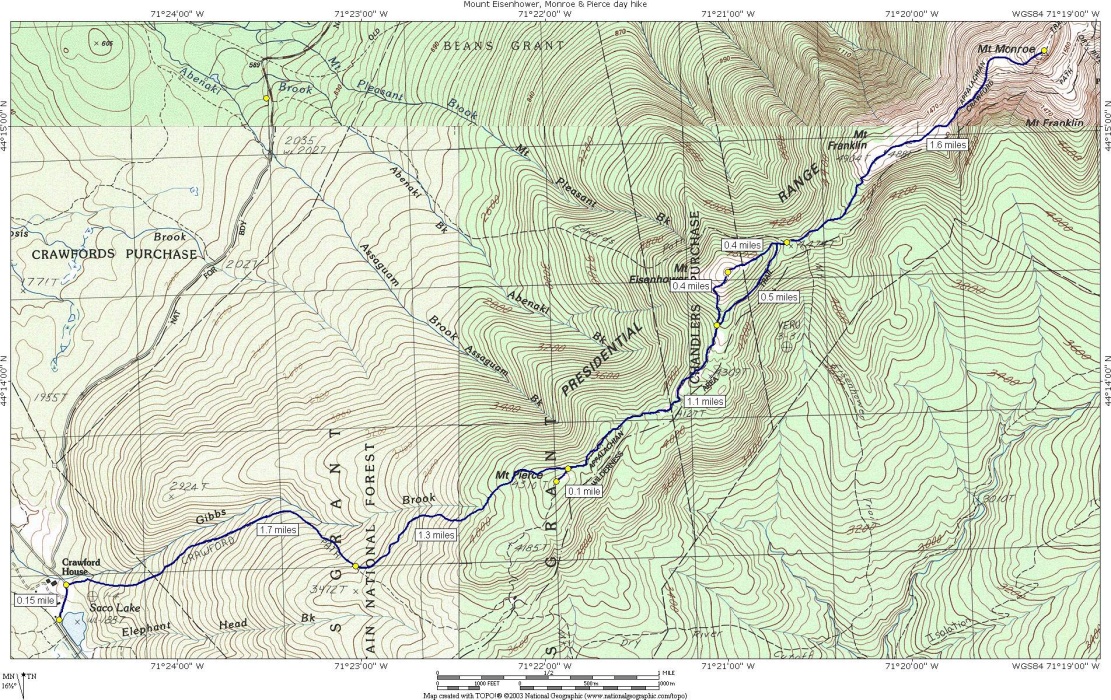
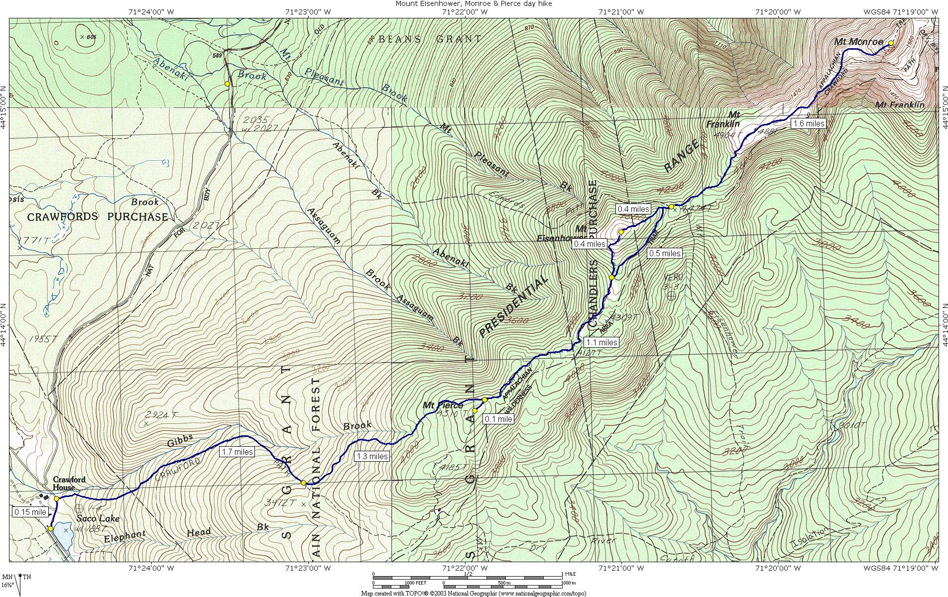
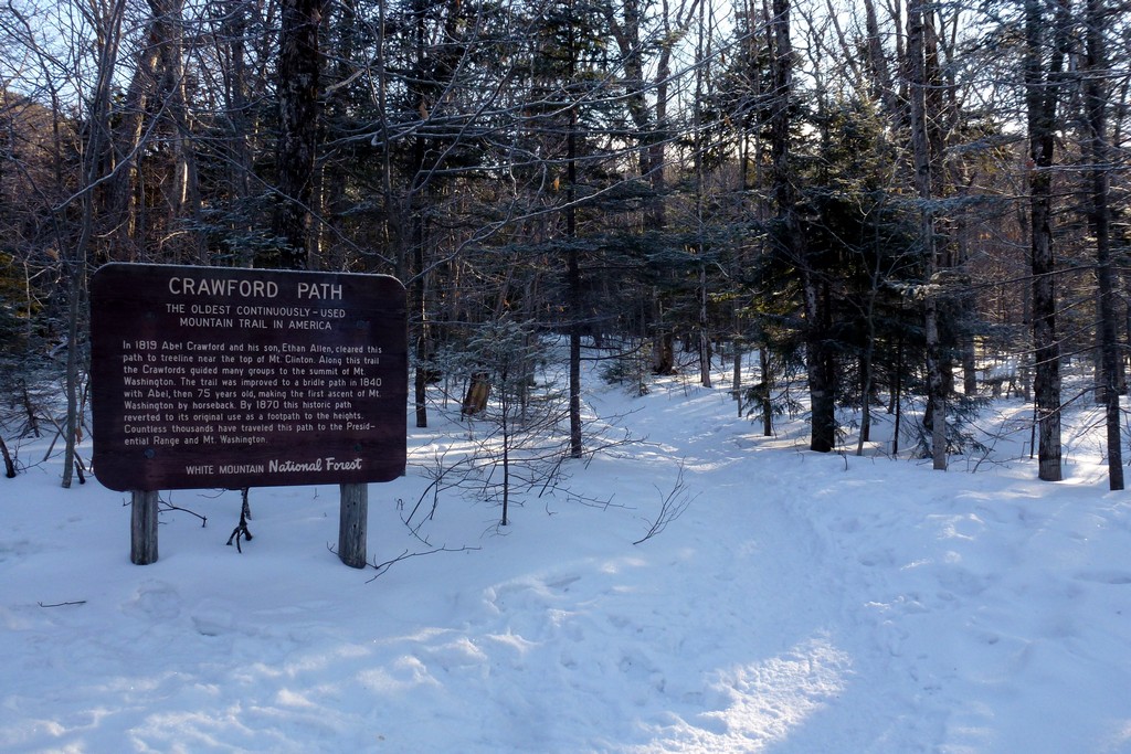
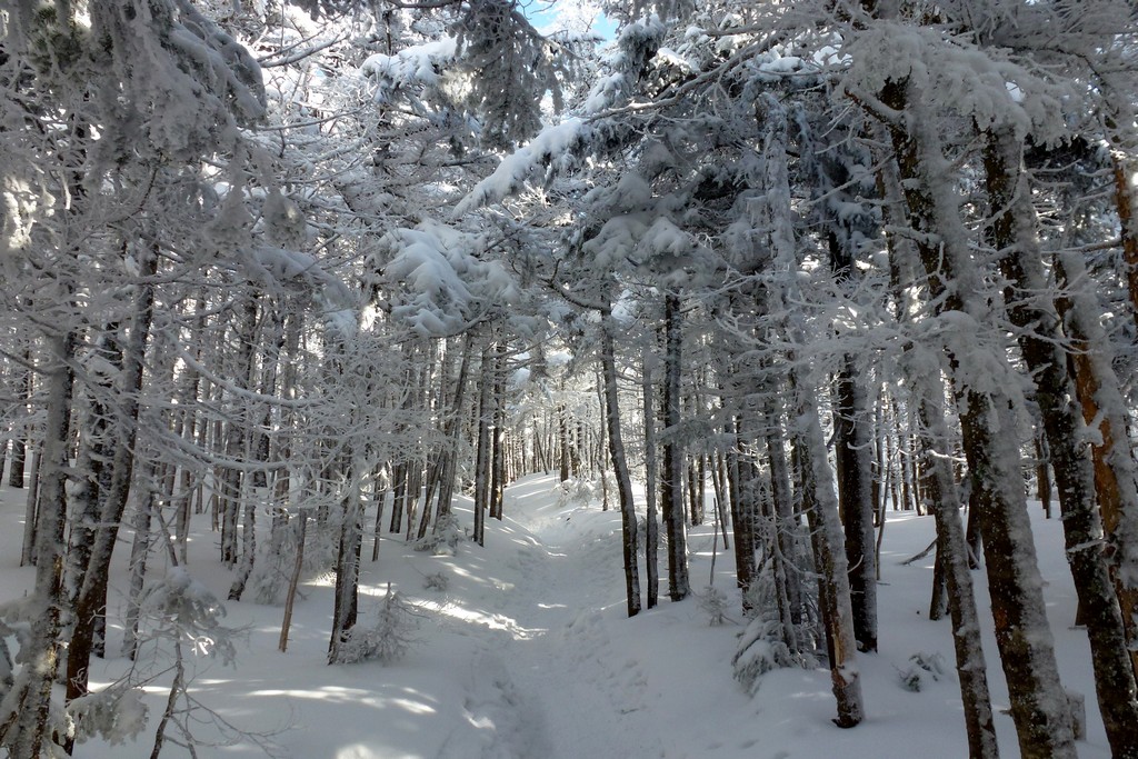
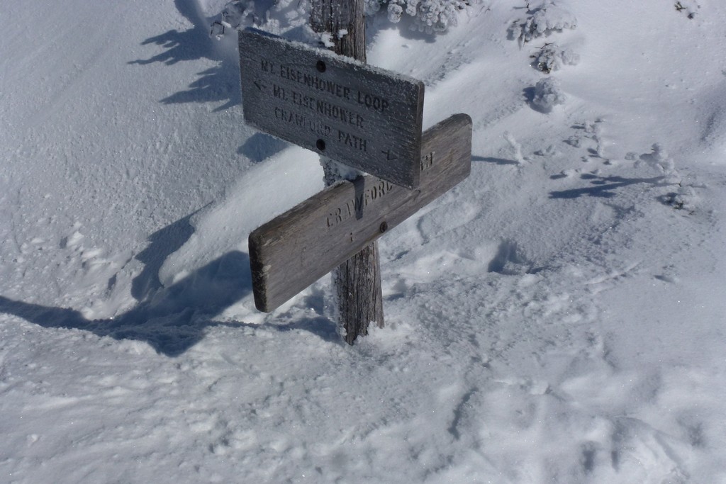
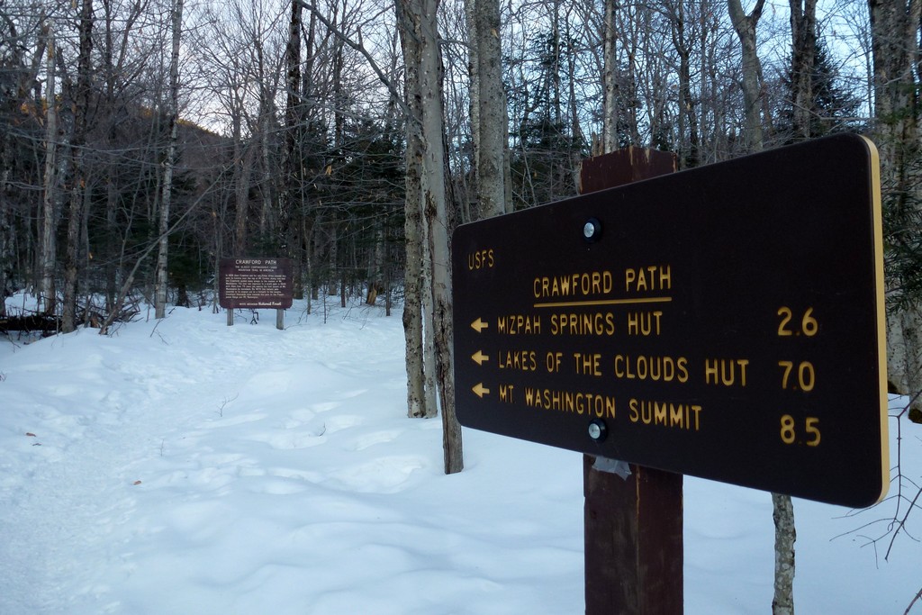
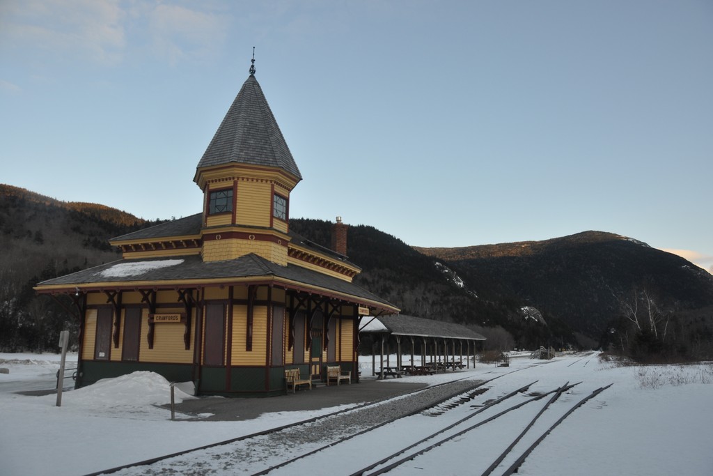
This day hike started at the parking area next to the railroad depot, just south of the Crawford Notch lodge, on NH Route 302. From there I took the Crawford Path up to Mount Eisenhower and then on to Mount Monroe. I returned along the Crawford Path to the Webster Cliff Trail and then to the top of Mount Pierce. The original plan was to take the Webster Cliff Trail to Mount Jackson as well and then head back to the parking area by way of the Webster-Jackson Trail. Getting to and back from Mount Monroe took a lot longer than expected though and I just ran out of time. From Mount Pierce I ended up taking the Craford Path back down to Crawford Notch.
|
The starting point for this hike was the parking area next to the railroad depot, just south of the Crawford Notch lodge, on NH Route 302.
The purpose of this hike, aside from enjoying the wonderful scenery, was to get numbers 12, 13 and 14 on my winter 4000-footers list. The hike was originally planned to include a number 15, Mount Jackson, but I ran out of time for that and had to bail out after Mount Pierce and head back down the Crawford Path.
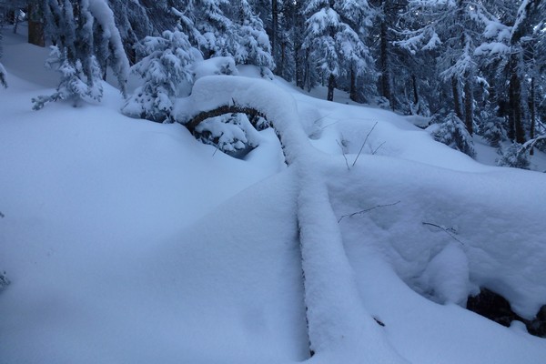
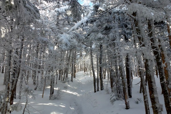
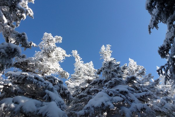
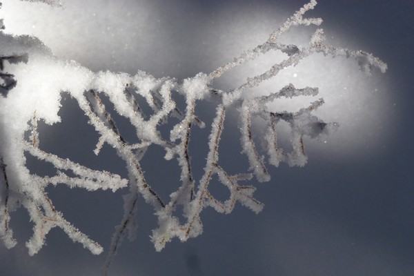
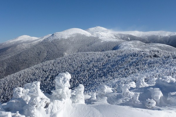
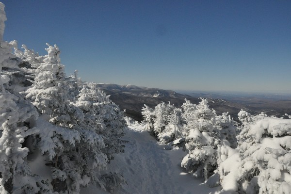
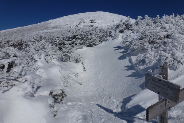
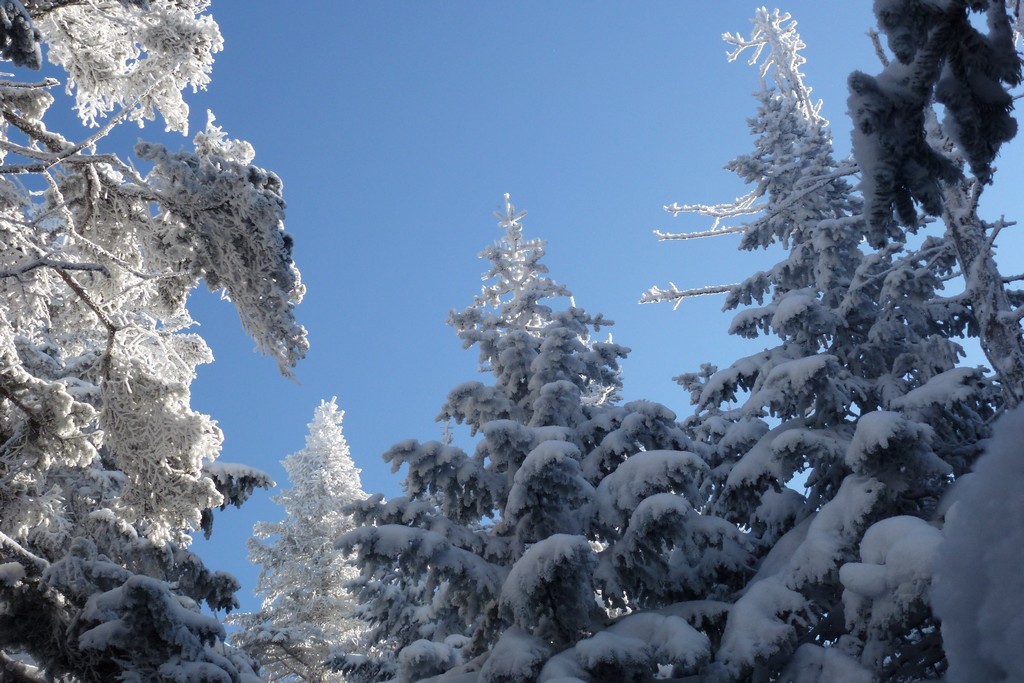
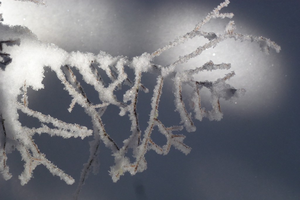
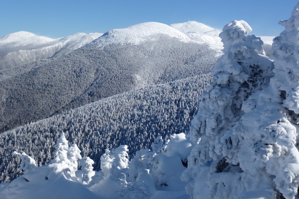
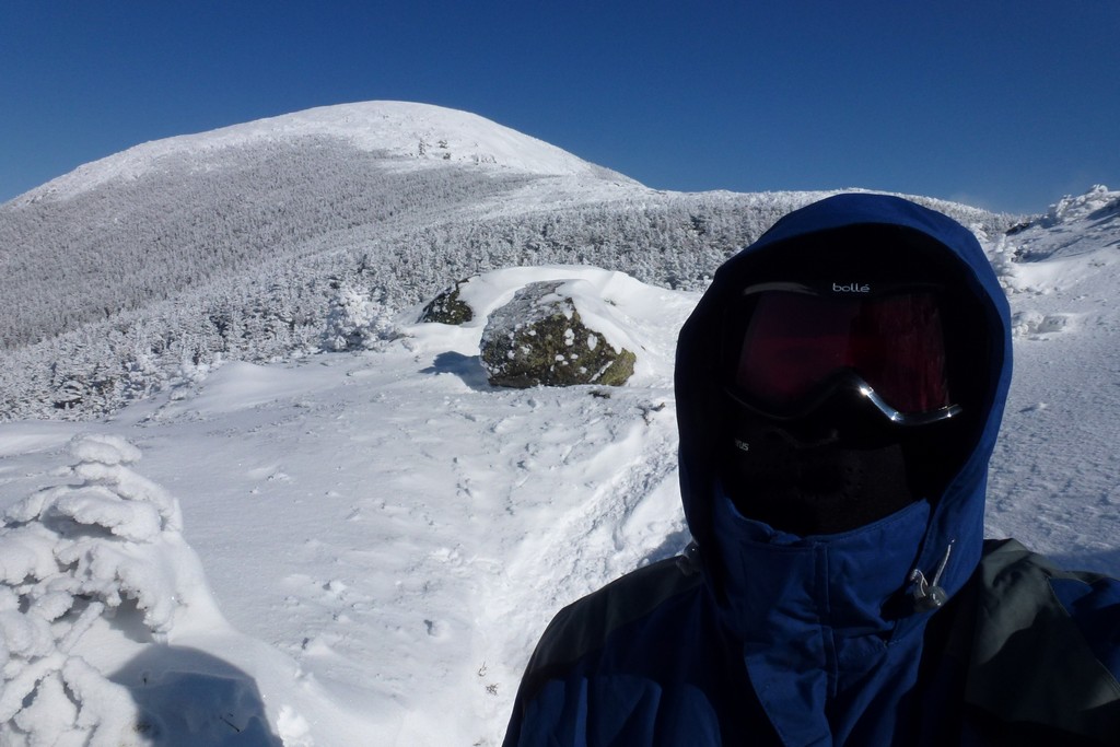
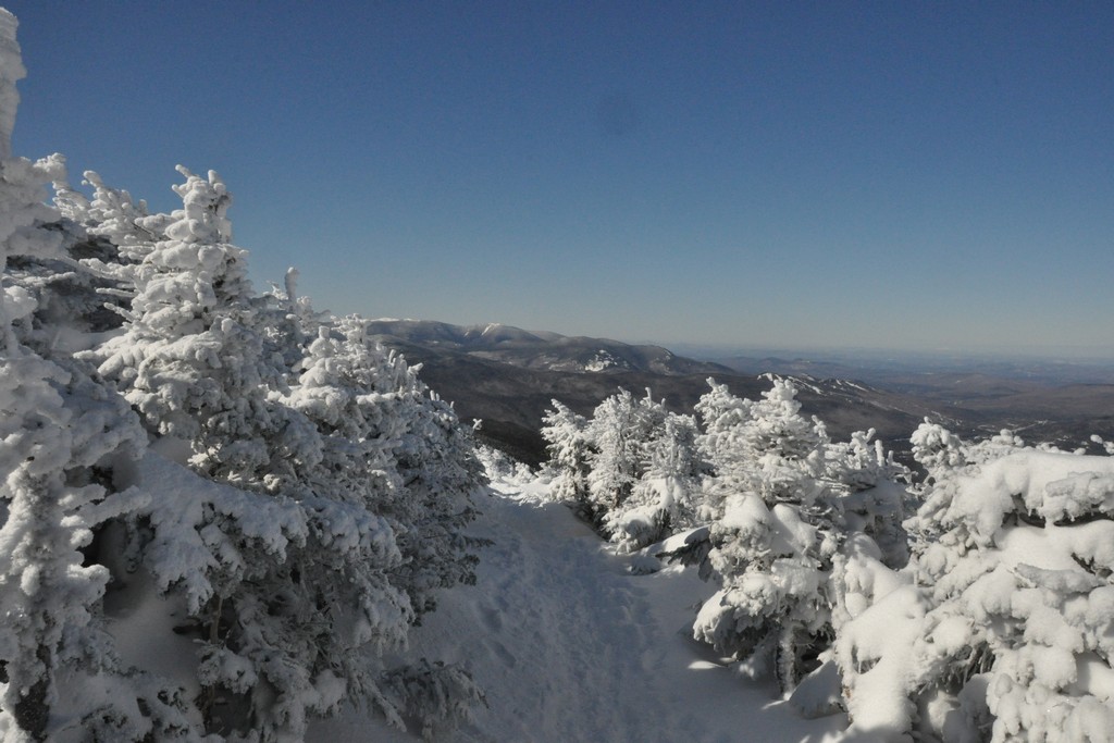
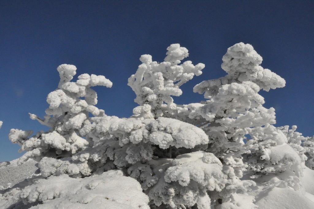
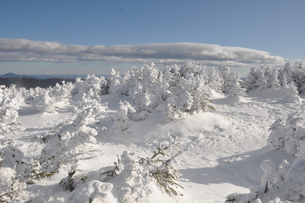
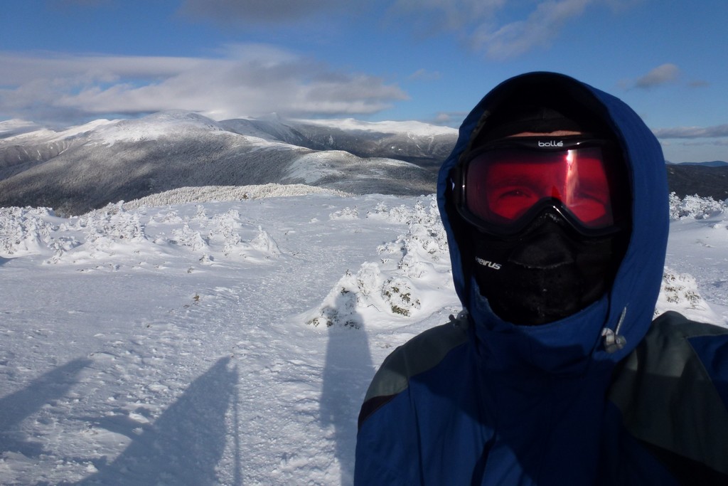
The hike up the Crawford Path was nice and easy. That really is onebeauty of a trail. I started just after 8:00 and arrived at the junction with the Webster Cliff Trail right at 10:00, so a little under two hours to go a little over 3 miles. Not too bad. I stopped several times for photos as well as the scenery was simply astounding. When I started it was a bright sunny day with not a cloud in the sky. It was cold at the start and the gloves I had on initially were just not cutting it so I had to duck into the lodge at Crawford Notch and put on my liner gloves and mittens to keep the hands warm. After that I was fine. I started without my winter jacket, with just my base and middle layers, and after probably less than a mile I had to get rid of that middle layer because I was getting too warm.
The winter jacket ended up going on just before I reached the junction with the Webester Cliff Trail. It was windy up there on the ridge and that was sucking the warmth away.
|
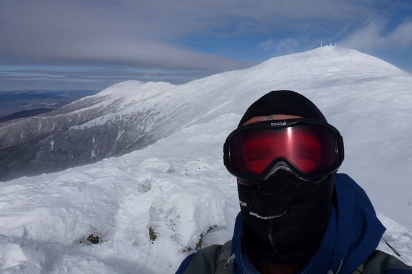
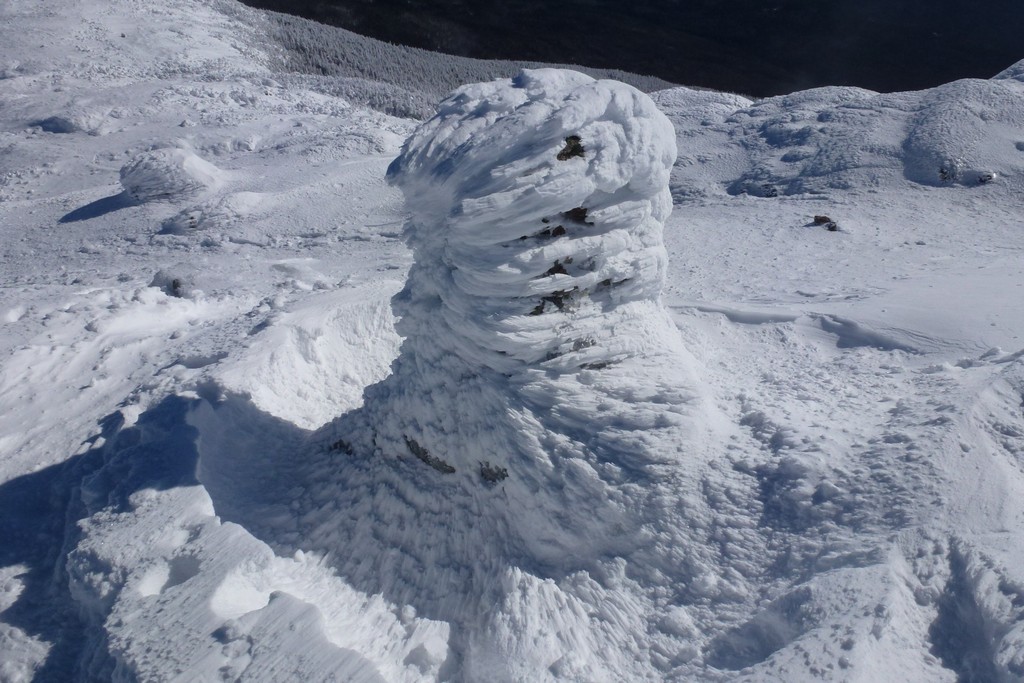
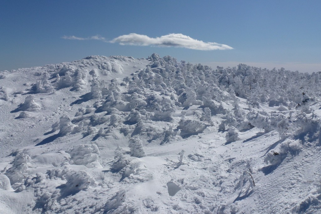
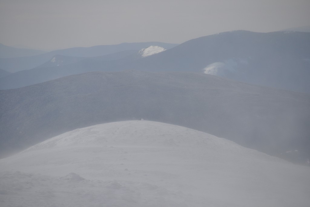
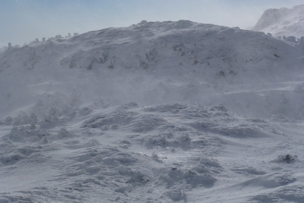
The wind just got more and more intense as the day progressed and by the time I got to Mount Eisenhower I was already having second thoughts about continuing on to Mount Monroe. I had to put my balaclava durng the approach to Eisenhower as when I was out in the unsheltered areas of the ridge the wind was just too cold. It was ok when I was in among the stubby trees as they blocked the wind. As I gained elevation on the approch thought the trees finally went away completely and the wind was non-stop.
|
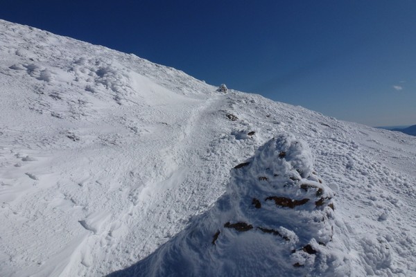
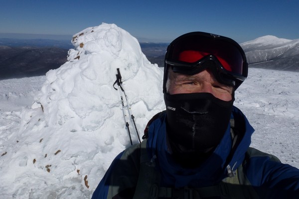
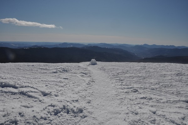
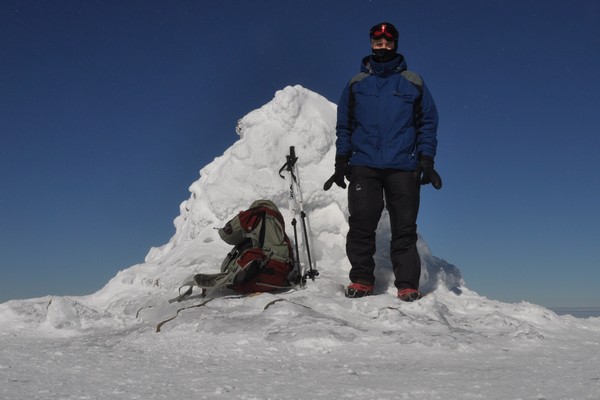
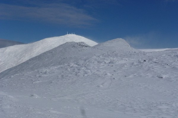
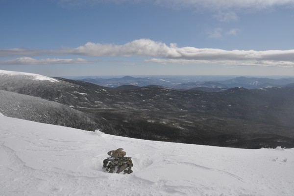
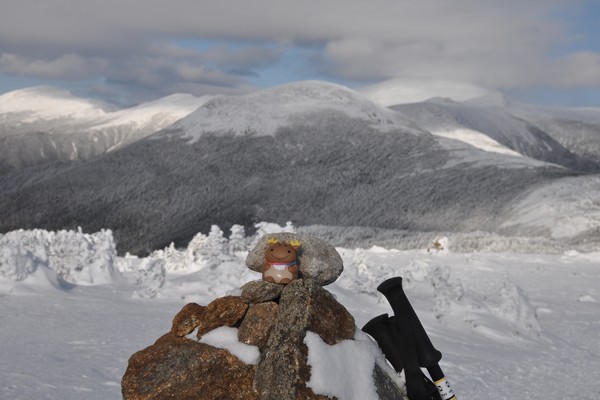
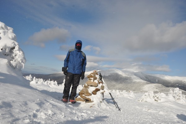
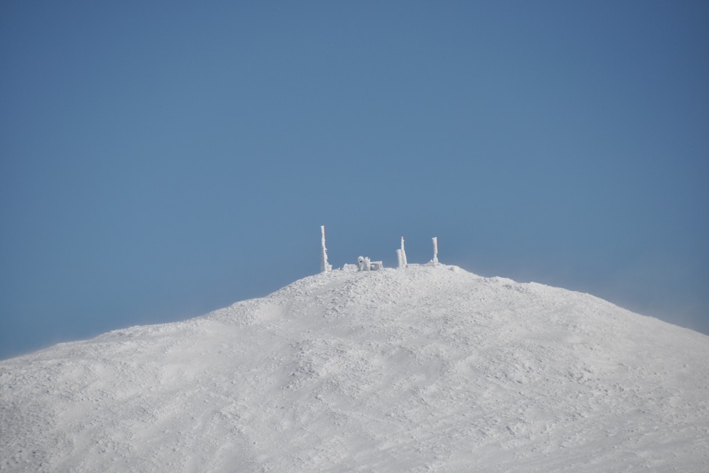
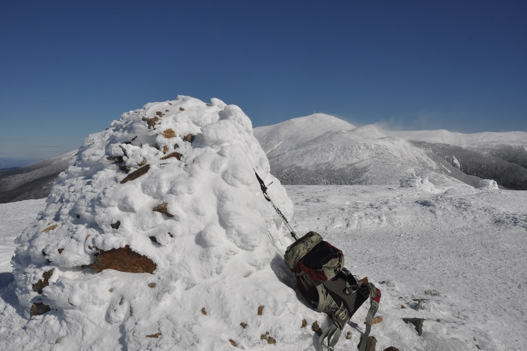
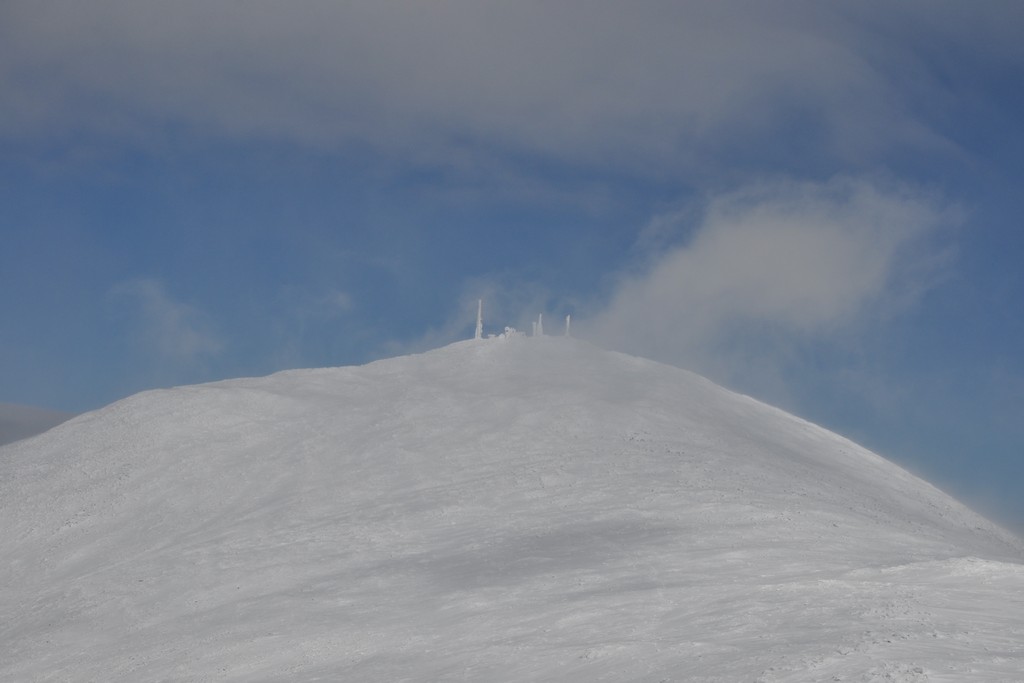
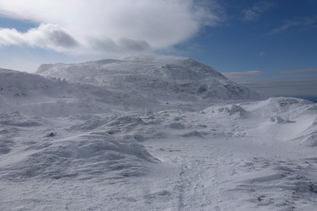
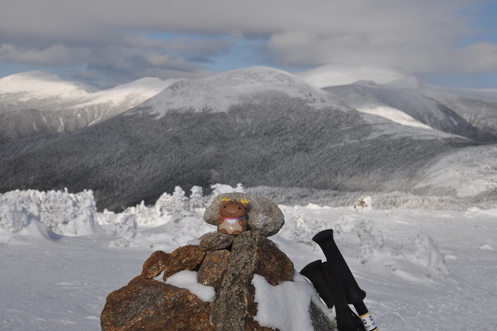
It took about an hour to get to the top of Eisenhower and I arrived there right around 11:00. The wind was constant up there as well and the only place there was any relief from it was behind the summit cairn.
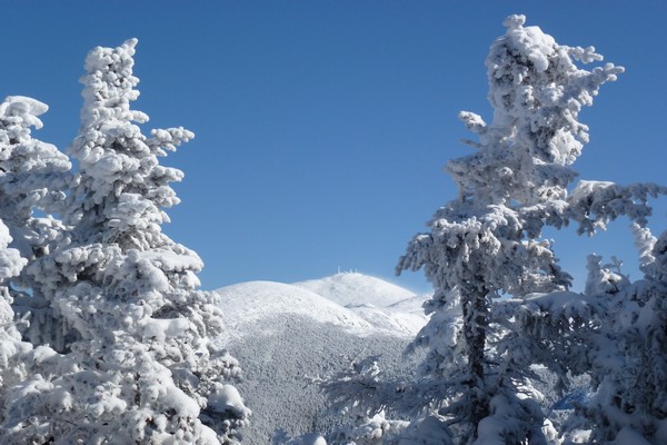
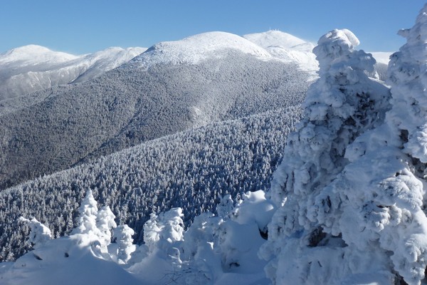
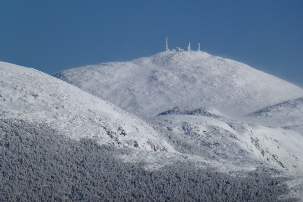
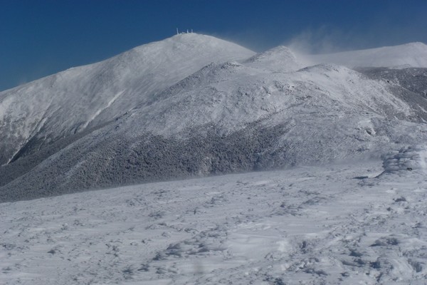
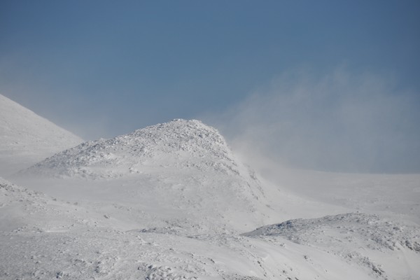
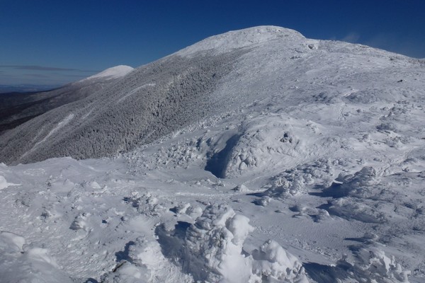
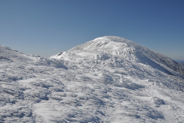
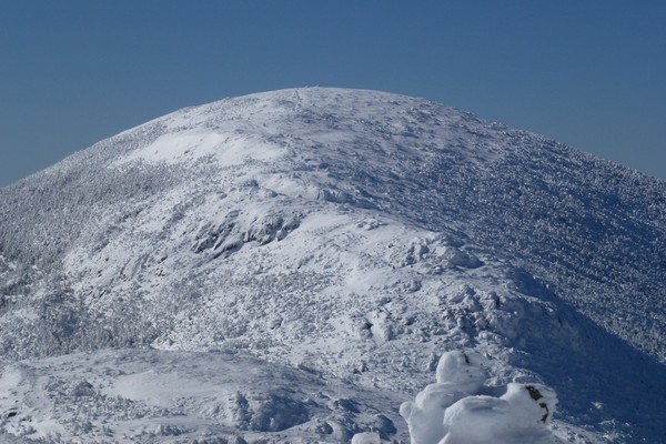
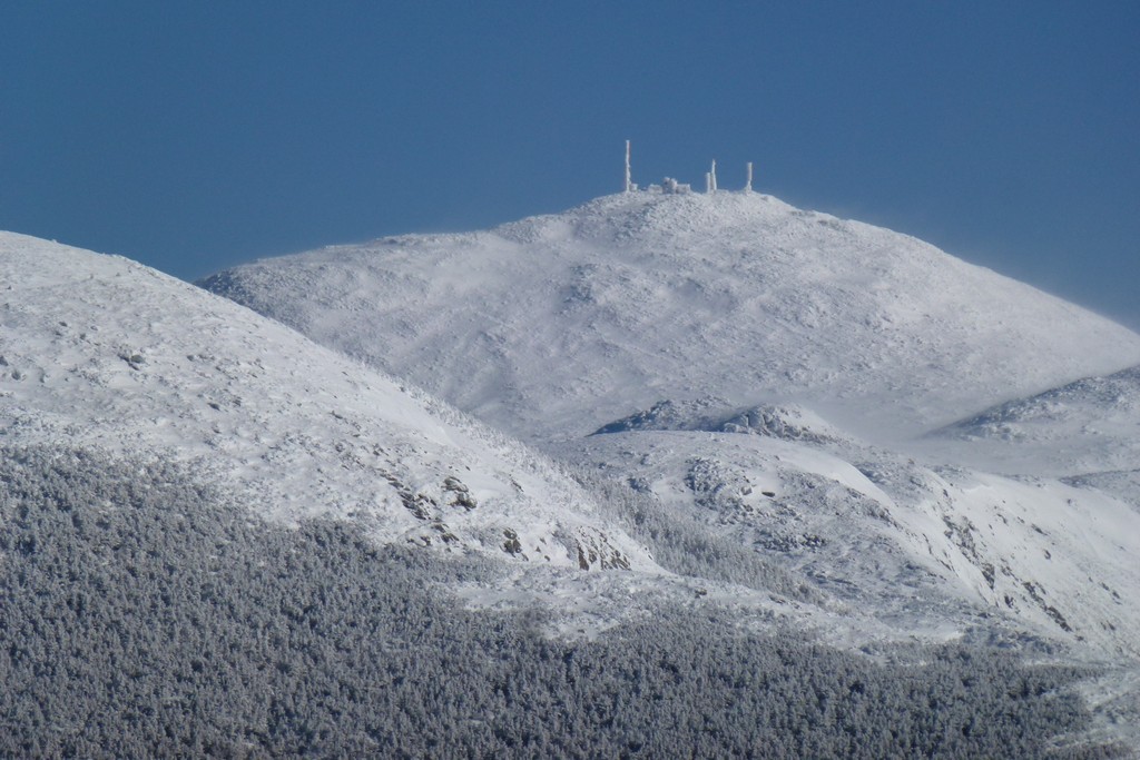
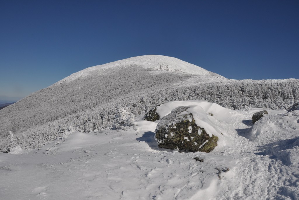
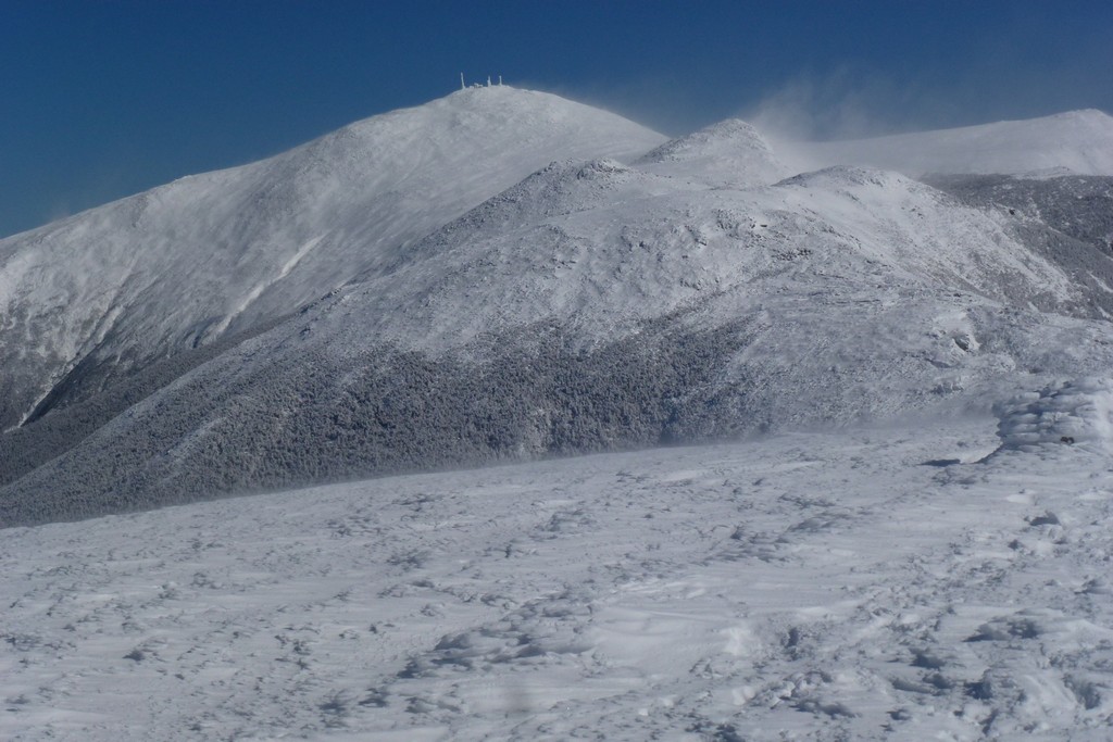
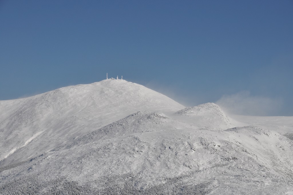
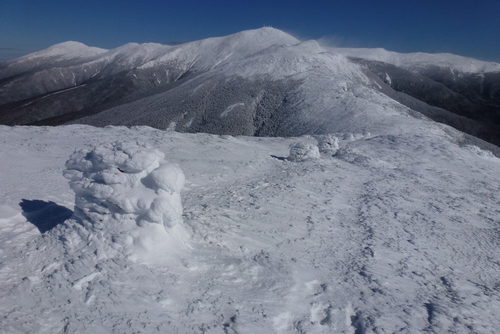
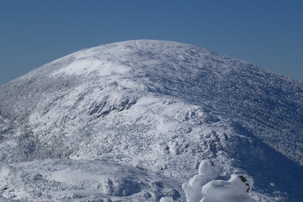
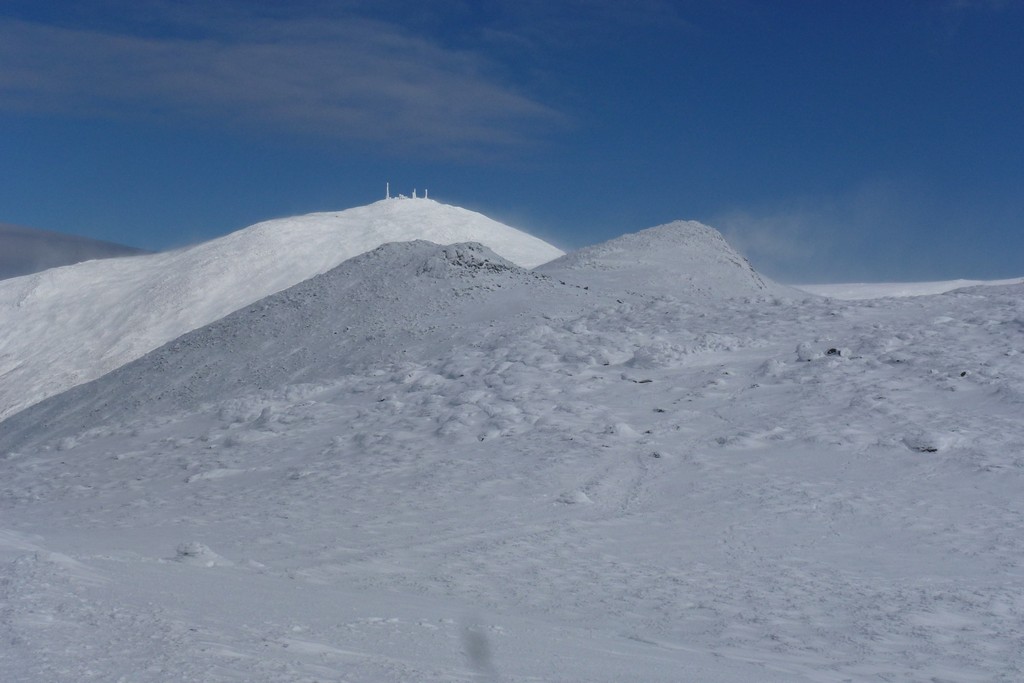
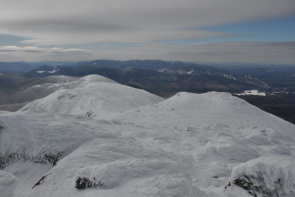
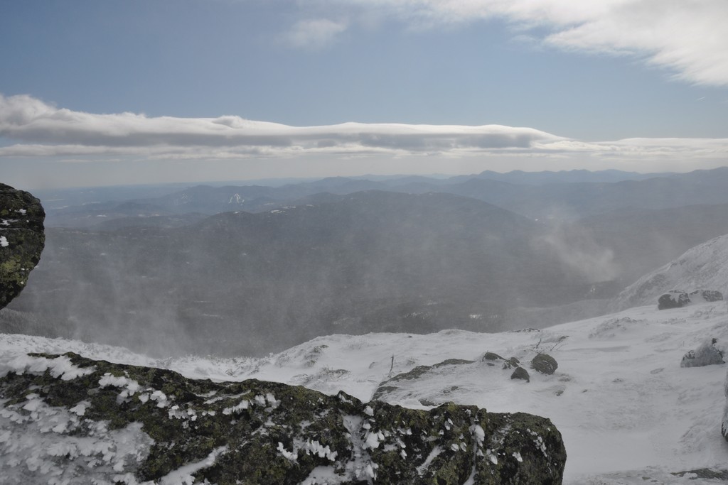
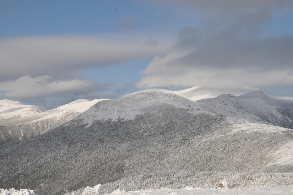
The views from up there were incredible, especially of Mount Washington, which seemed incredibly close. The wind and the snow blowing off the top of Mount Monroe was scary though. And I could also see a lot of strong winf and blowing snow inbetween Eisenhower and Monroe. It was only two miles though and with not that much elevation change. How long could it take? I took a lot of photos from the top of Eisenhower even though I was only up there about 10 minutes before continuing on.
|
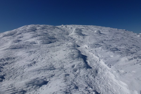
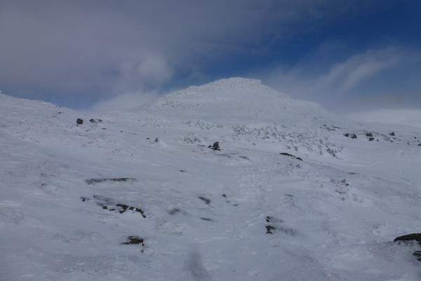
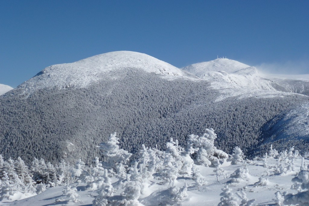
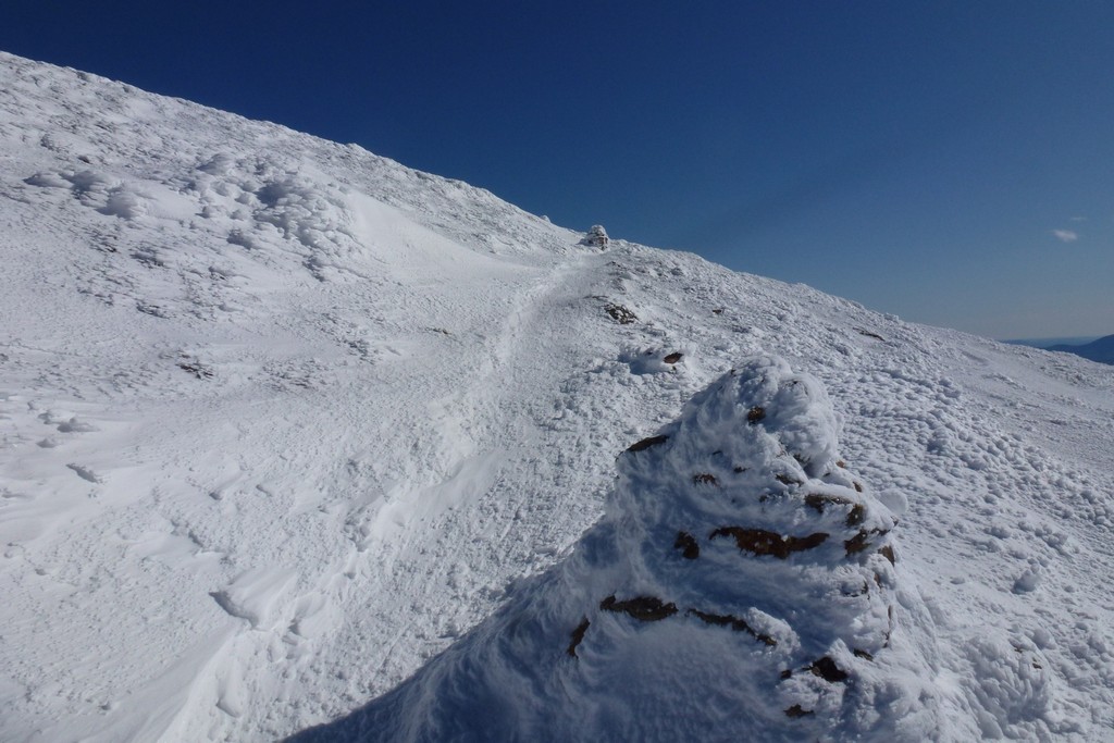
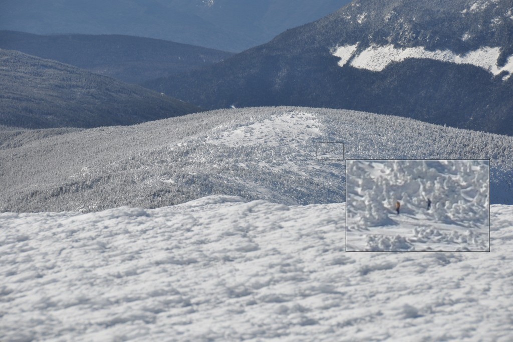
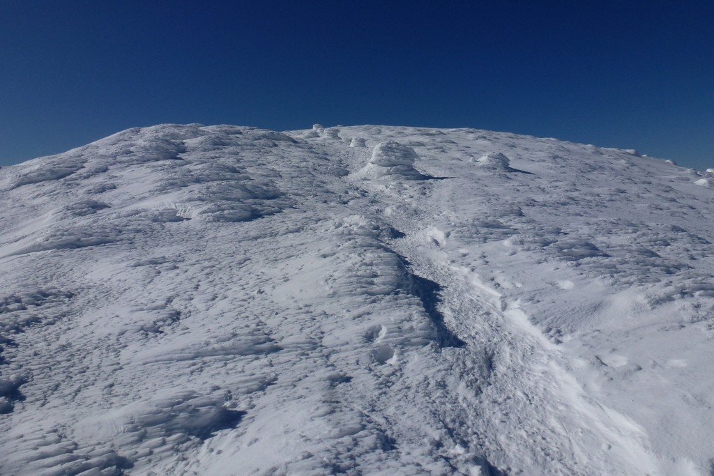
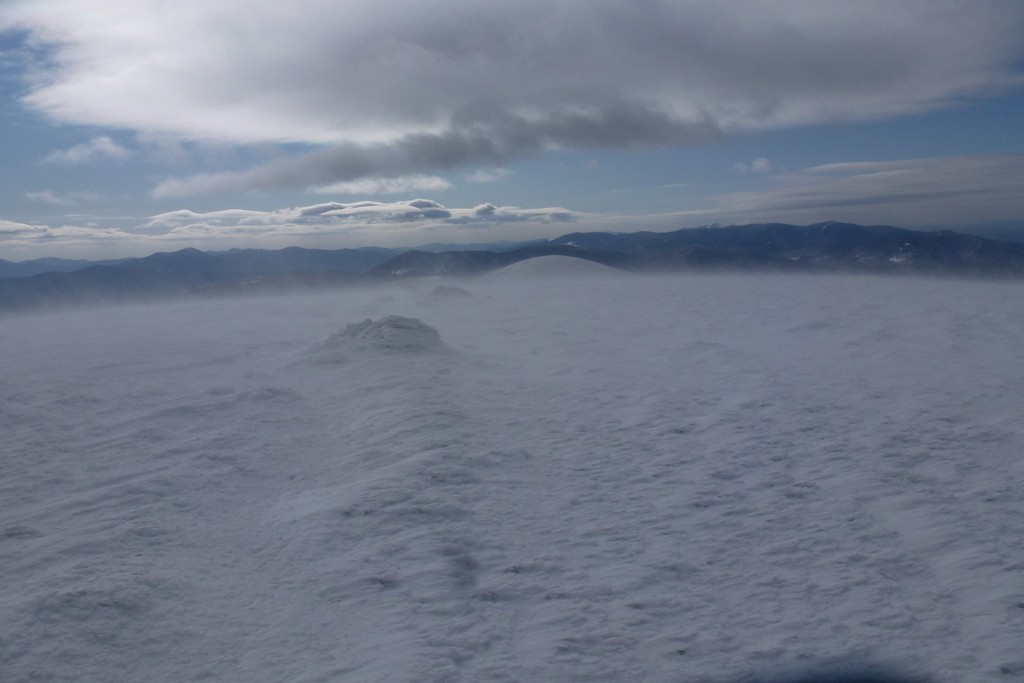
It took about two more hours to pick myself across those two miles to Mount Monroe. They trail kept disappearing and I was just trying to pick the easiest way across the ridge heading as close as possible in a straight line to the summit. Occasionally I would pick up the trail only to have it disappear again. It was slow going. The good thing was I figure I could follow my own bootprints back to Eisenhower.
|
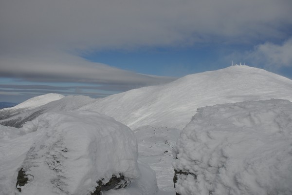
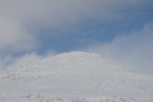
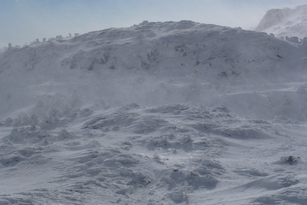
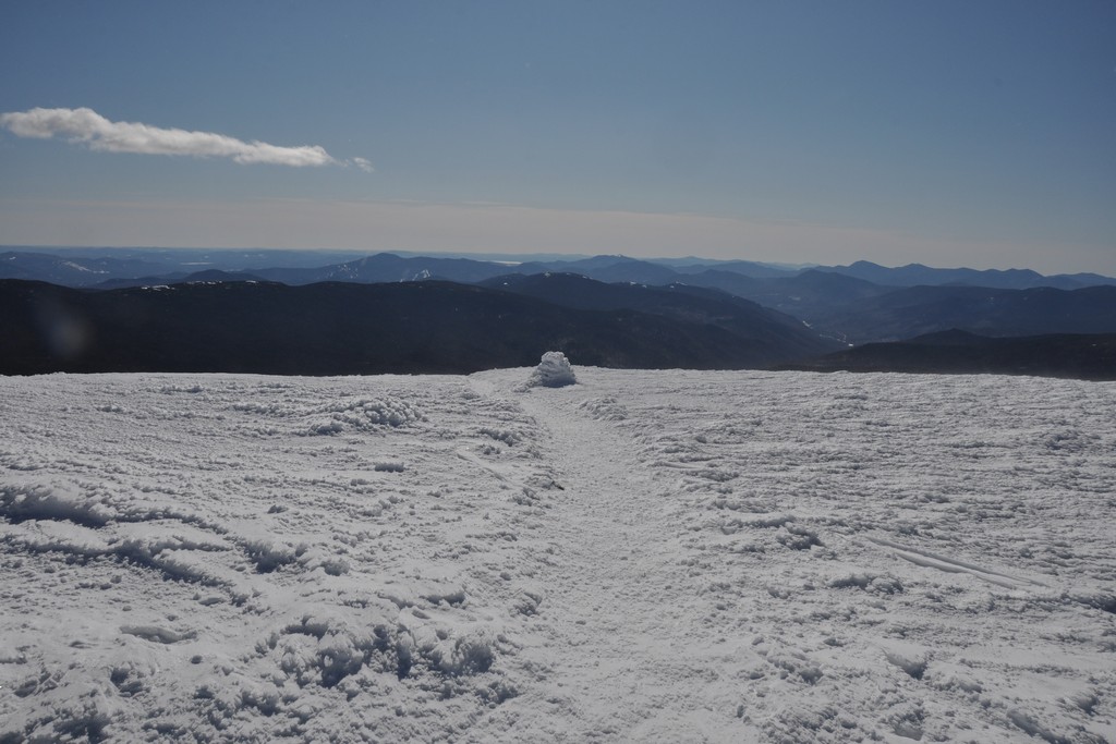
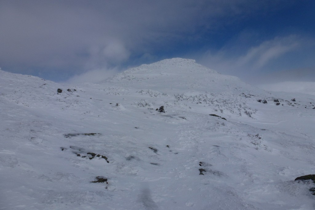
The wind and the blowing snow just got more and more intense the closer I got to Mount Monroe. I headed for the high point, which I assumed was the summit, but when I got there and took out my GPS to confirm it said the real summit was still 100 yards west of me. I don't know what was up with this but I started heading west, which was definitely downslope. After traveling a short ways I took the GPS out again and now it was telling me to go east. I went back up to where I was and now it said I was on the summit. I've never had any problems with this thing before but it sure was acting flakey up here.
|
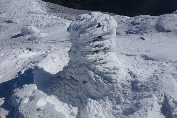
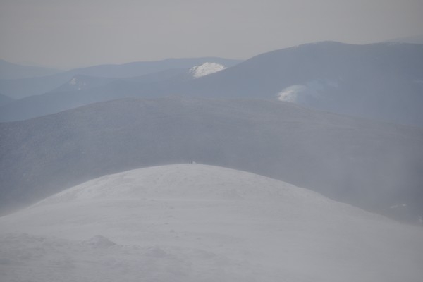
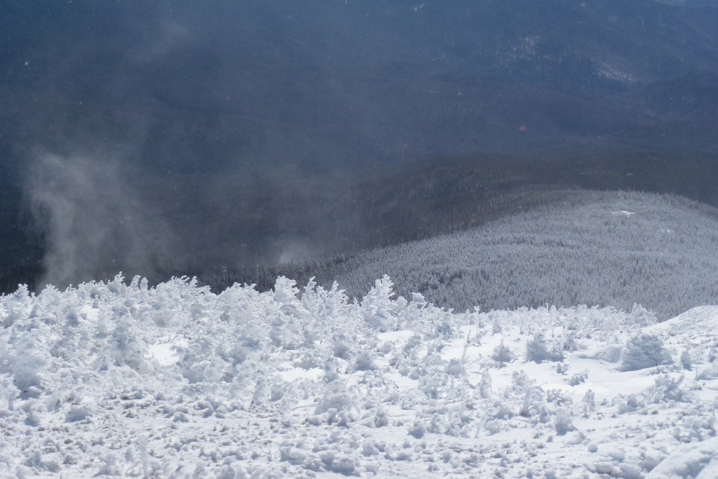
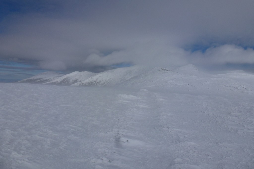
Looking back towards Eisenhower was scary as now there was lots of snow blowing across the ridge and also off the top of Eisenhower. I knew I didn't have to go back up there and was planning to take the trail around the back side to return to the Webster Cliff Trail. I was almost blown over several times on the way back but somehow manage to stay up. The wind was so string it was pushing my backpack partiall around and off of the center of my back. I had a little gap betwen my snow goggle and the balaclava and ended up getting some windburn in there. It wasn't just the wind, it was the snow and/or ice pellets that were being driven by the wind. And the winds had to be at least gale force at this point.
I gained a new respct for the winter weather up there there in the Presidential Range. This was a sunny day and not really that cold apart for the wind chill. I could only imagine what it would be like during bad weather and knew I would never want to experience that first hand. I had met some hikers coming the other way when I was heading to Monroe and the said they had been trapped and hunkered down in an igloo for two days because there had just been continuous wind and white-out conditions.
I never did see any of my own tracks going back the other way, the wind and the blowing snow had aleady erased any sign of my passage. In spite of the conditions it took less than one hour to go back the other way. A trip that had taken almost two hours on the way to Mount Monroe??? I don't understand that either.
|
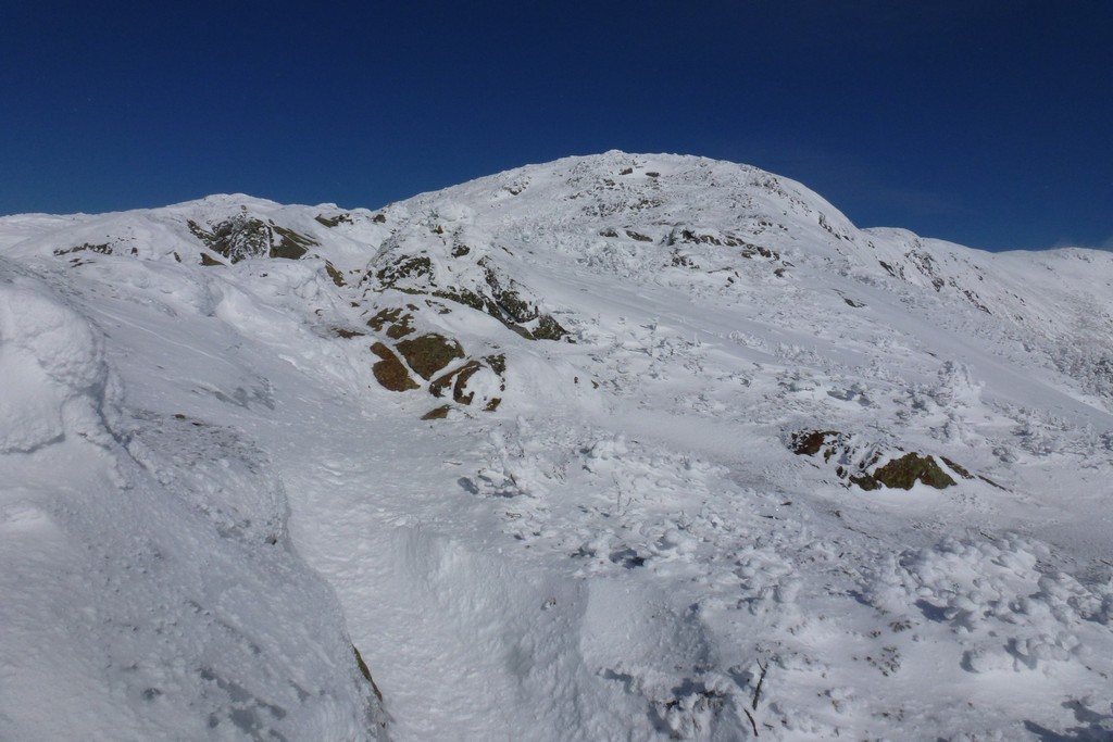
I finally made my way back to Eisenhower and found the split for the trail going around the back side. I followed it for a short distance and then it got to a cliff ede and just disappeared. I could see ir winding its way through the tress some distance away but had absolutely no idea how to get there. I knew it could not go over the edge wghere it ended. There were just tress and deep snow down there with no sign of any path. I backtracked and looked around and just could not find anything else. I gave up and started back towards the trail that went over Eisenhower. I was not intending to go back over Eisenhower and was just looking for another way to get where I could see the rest of the trail around the back. After crossing over a couple of deep drifts I finally found the trail and proceeded around the back. I was out of the wind here and it was sunny and actually quite pleasant. The snow was deep in places but passaable. I lost probabably 15-20 minutes trying to find the trail but it was still better than going back over the summit.
|
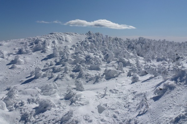
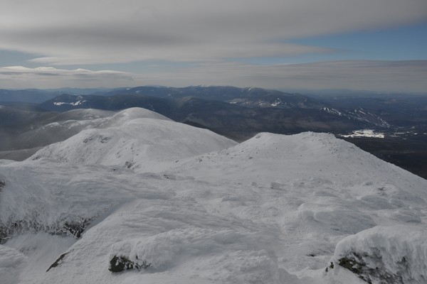
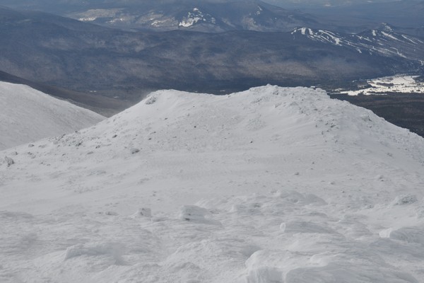
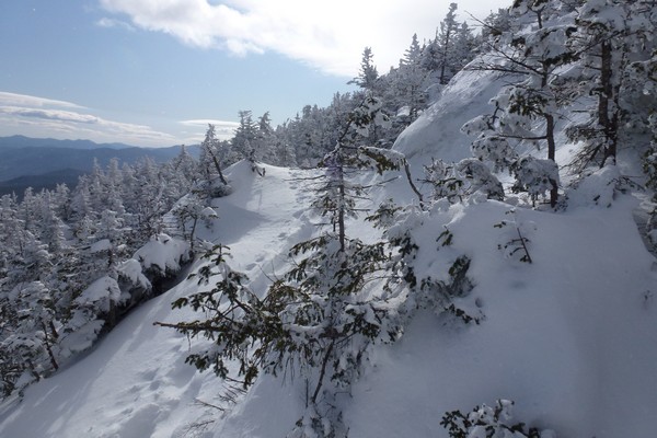
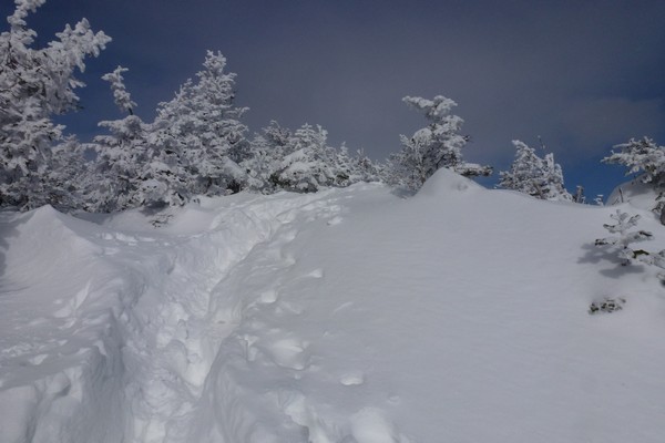
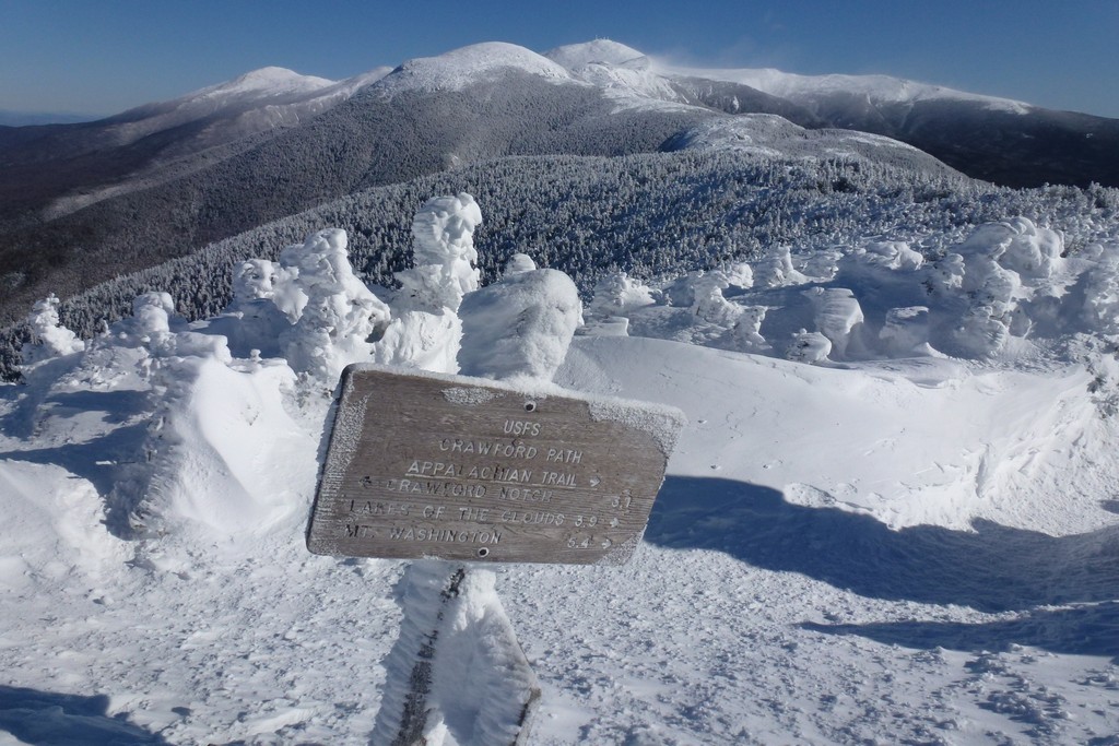
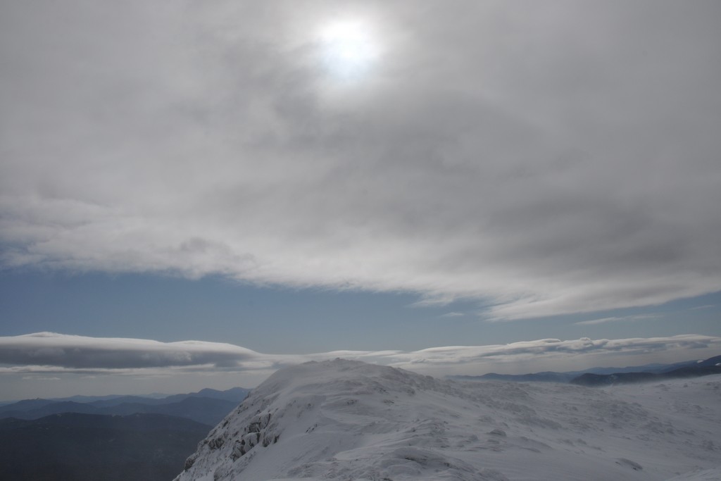
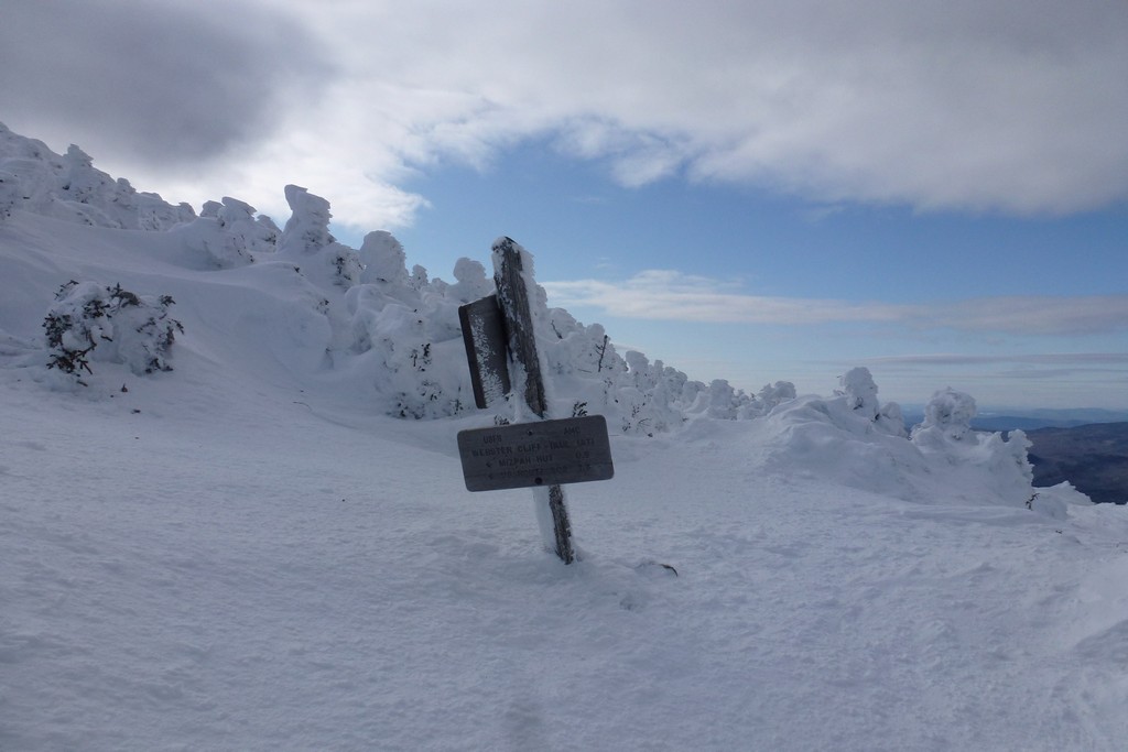
Once I got back to the southern junction with the Eisenhower Loop Trail it did not take long at all to get to back to the Webester Cliff Trail and it was only about 10 minutes from there to the summit of Mount Pierce. The wind along this section was a lot less intense and there was no blowing snow mixed in with it. Clouds had started to move in during the afternoon though and they were now starting to thinkig up, obscuring the sun and making it feel colder.
It was already after 3:00 and I had pretty much already given up on the idea of getting to Mount Jackson as well. Jackson was a hope but I knew there was an easy bail-out point from here as I could just go back down the Crawford Path to Crawford Notch. Mount Jackson was still two miles away and then it would still be another 2½ miles from there back to Crawford Notch. I could probably make Jackson before the sun set but it would likely be dark before I got back to the notch. I was already tied and in no mood for it. Mount Jackson would wait for another day and would be a pretty easy solo hike.
|
I still hadn't had my lunch yet so I got out my PB&J sandwich and are that and contiued to torment myself with thoughts of doing Jackson as well, going back and forth, forth and back. It was now closing in on 3:30 and still doable. My feet were feeling a little better after the rest but... I still decided to bail out.
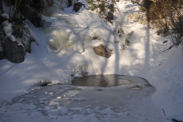
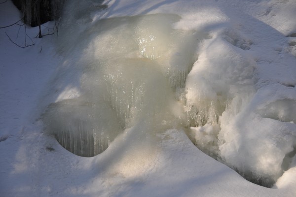
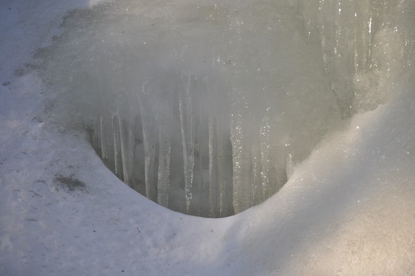
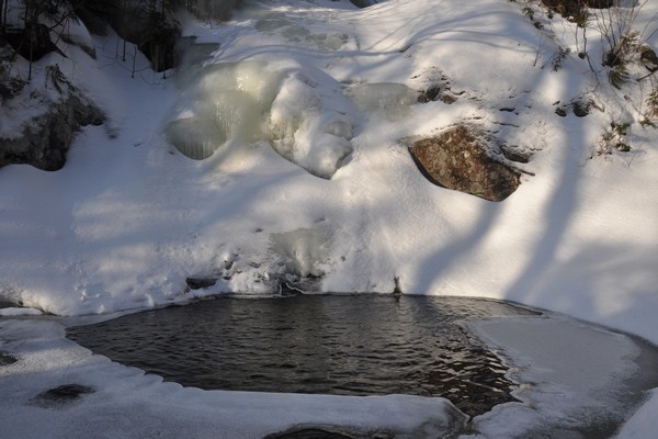
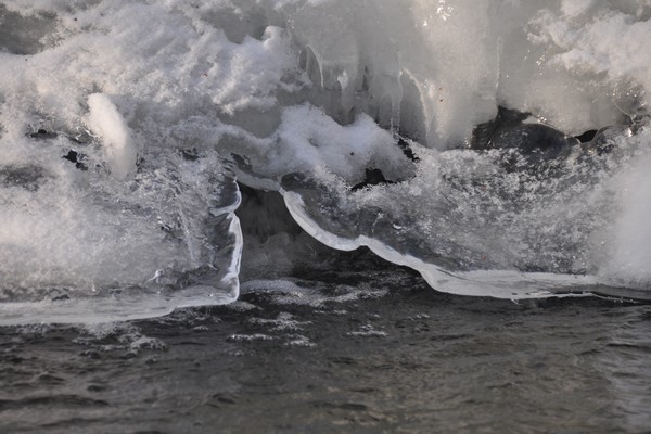
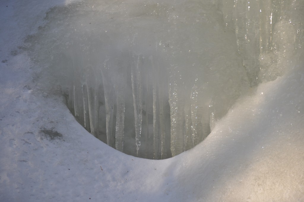
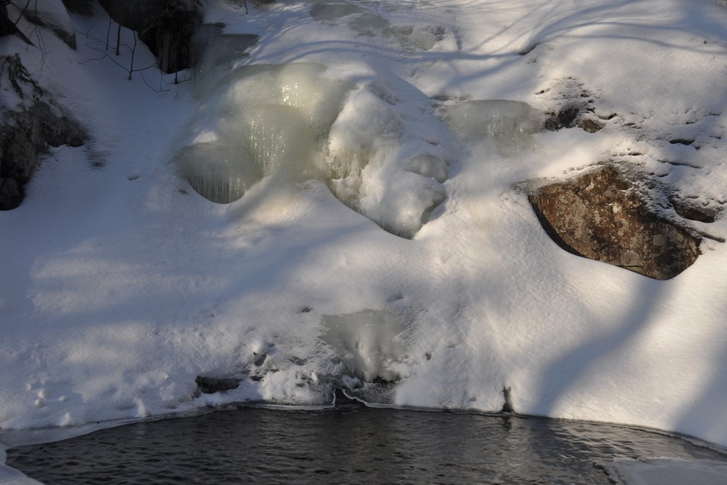
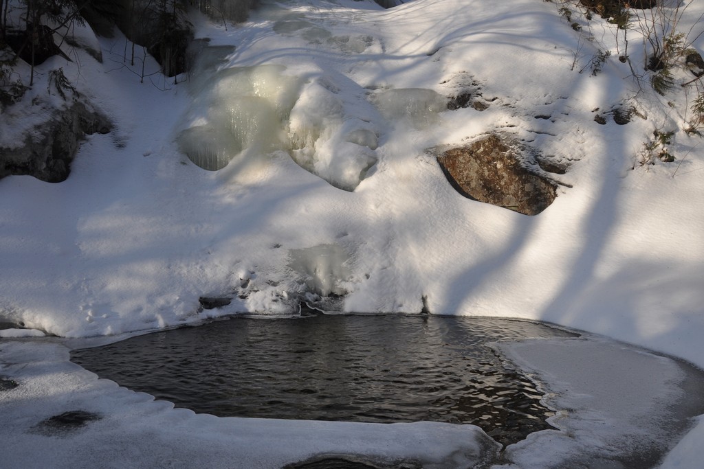
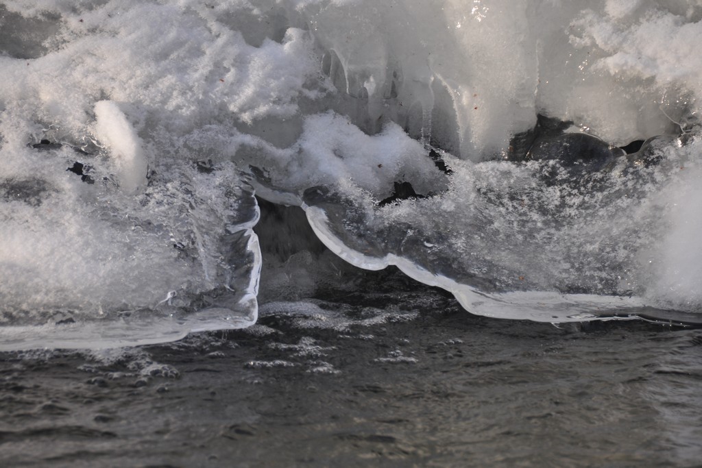
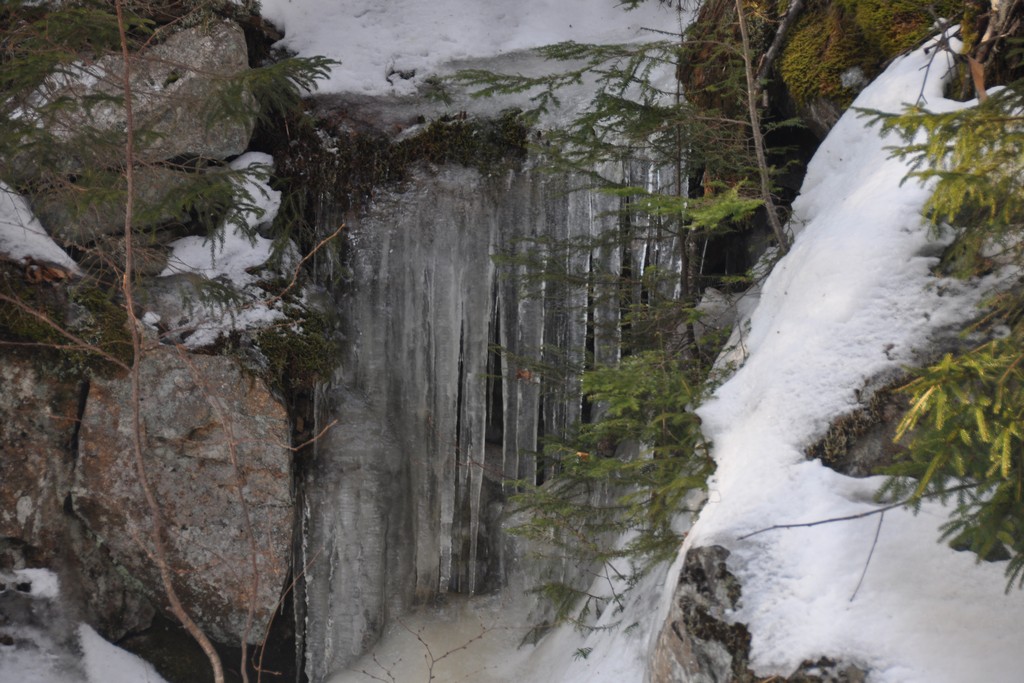
The descent down the Crawford Path was just as quick as some of the other descents I had made this winter and before I knew it I was back at Gibbs Falls. It had only taken about an hour to come down what had taken two to go up. The frozen waterfall had been in shadows when I was there in the morning but now it was catching the last rays of the late afternoon sun. It was simply beautiful and I knew I would have missed this had I gone on to Mount Jackson. I felt lucky. The sun finally set behind the ridge on the other side of the notch while I was there and the frozen falls went back into the shadows. I was very lucky to have made it there just in time to see this.
|
It was only about 10 minutes from Gibbs Falls to the trailhead of the Crawford Path and then another 10 minutes from there to the car. It felt very strange being back at the Crawford Notch railway depot again after just ending another hike there two days prior. Ir was a definite deja vu moment.
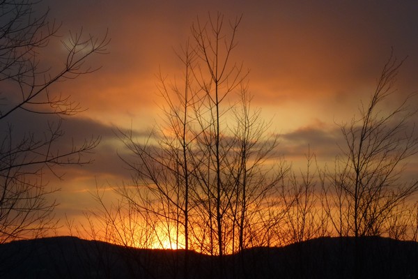
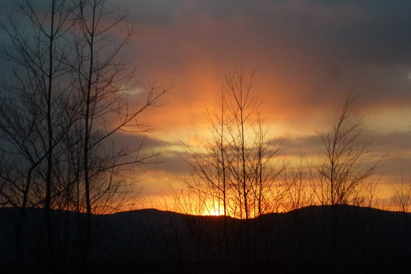
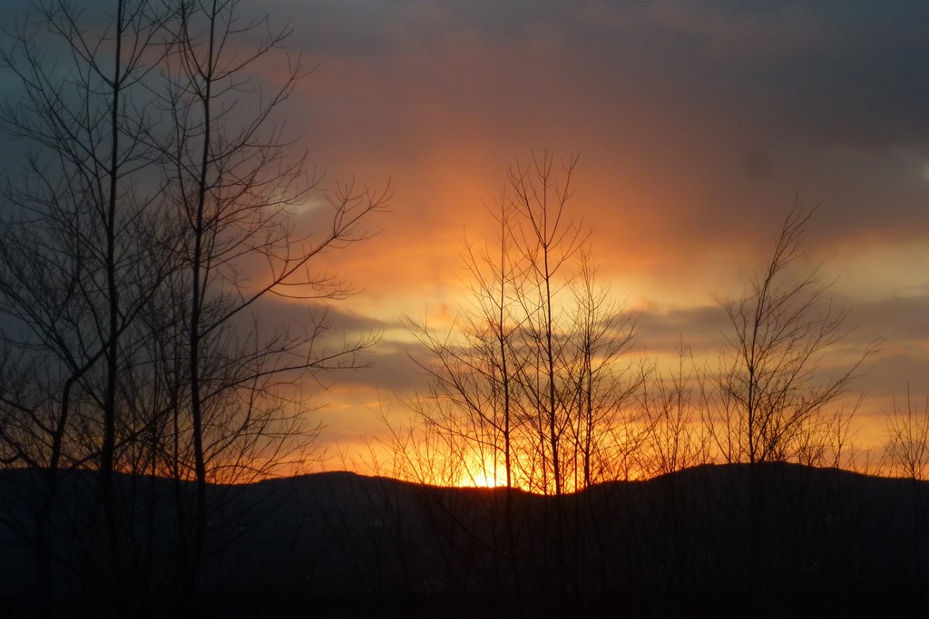
I was treated to a magnificent sunset on the way back towards Franconia Notch and that was the perfect ending to an almost perfect day.
|
|
|
|---|
|
|---|


