|
TOPO! Interactive Maps On CD-ROM by Wildflower Productions |
|---|
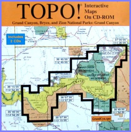
Grand Canyon, Bryce and Zion National ParksThe 2 CD set contains detailed topographical maps for all three parks as well as Lake Mead and the Las Vegas vicinity.TOPO! uses detailed USGS (United Status Geological Survey) topographical maps which are further enhanced by the addtional of millions of DEM (Digital Elevation Model) data points.
Navigate in Three Dimensions
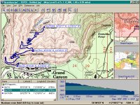
Instant Elevation ProfilingElevation profiling is quick and easy. Simply use Route Tool to draw a line (route or trail) anywhere on the map, then right click on the line to activate the pop-up menu and select Build Profile. TOPO! walks the route for you and instantly displays the elevation gains/losses in an elevation profile graph.
Customize Your Own MapsYou can trace existing trails on the maps, or add your own routes. You may also add your own text, symbols and GPS waypoints. Maps may be printed in full color or black and white.
Other Features
Target AudienceHikers, backpackers and climbers.
Minimum Recommended Hardware/Software Requirements
|
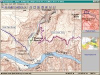
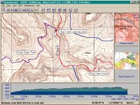
Sample Screen Shots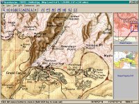
Grand Canyon Village - 1 : 24,000
|
Price: $49 plus shipping
TOP!GPS upgrade is $39
To order your copy, call 1-415-558-8700
Wildflower Productions
375 Alabama Street, Suite 400,
San Francisco, California 94110
Visit the TOPO! web site at http://www.topo.com
|
|
|---|
|
|---|